MyTopo
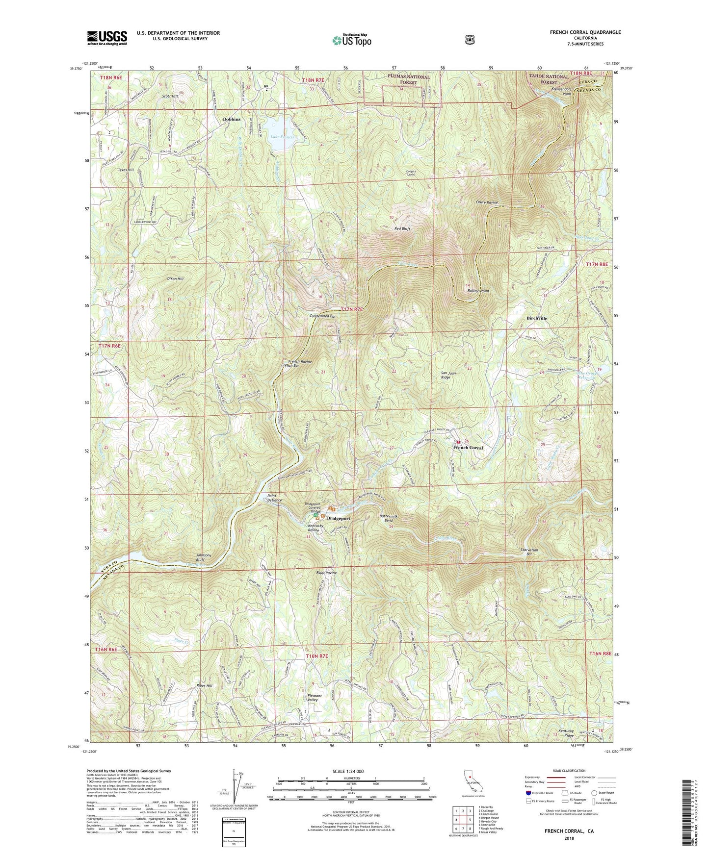
French Corral California US Topo Map
Couldn't load pickup availability
Also explore the French Corral Forest Service Topo of this same quad for updated USFS data
2022 topographic map quadrangle French Corral in the state of California. Scale: 1:24000. Based on the newly updated USGS 7.5' US Topo map series, this map is in the following counties: Yuba, Nevada. The map contains contour data, water features, and other items you are used to seeing on USGS maps, but also has updated roads and other features. This is the next generation of topographic maps. Printed on high-quality waterproof paper with UV fade-resistant inks.
Quads adjacent to this one:
West: Oregon House
Northwest: Rackerby
North: Challenge
Northeast: Camptonville
East: Nevada City
Southeast: Grass Valley
South: Rough And Ready
Southwest: Smartsville
This map covers the same area as the classic USGS quad with code o39121c2.
Contains the following named places: Allisons Ranch, Birchville, Bridgeport, Bridgeport Covered Bridge, Buttermilk Bend, Chute Ravine, Colgate Powerhouse, Colgate Tunnel, Condemned Bar, Dixon Hill, Dobbins, Dobbins Census Designated Place, Dobbins Creek, Dobbins Elementary School, Dobbins Post Office, Dobbins Sacred Heart Catholic Cemetery, French Bar, French Corral, French Corral Cemetery, French Corral Creek, French Ravine, Frenches Ravine, Johnsons Bluff, Kentucky Ranch, Kentucky Ravine, Klensendorf Point, Kneebone Cemetery, Lake Francis, Lake Francis 1034-009 Dam, Little Shady Creek, McKittrick Ranch, Middle Yuba River, North San Juan Fire Protection District Station 2, North Yuba River, Owl Creek, Pine Grove 2003 Dam, Pine Grove Reservoir, Piper Creek, Piper Hill, Pleasant Valley, Pleasant Valley Cemetery, Pleasant Valley Elementary School, Point Defiance, Rapp Ravine, Red Bluff, Rice Crossing, Richards Ranch, Ridge Rock Quarry, Rolleys Point, Ruths Ranch, San Juan Mine, Schwartz Ranch, Scott Hill, South Pleasant Valley Cemetery, South Yuba River State Park, Starvation Bar, Sweetland Creek, Texas Hill, West Branch Dobbins Creek