MyTopo
Oregon House California US Topo Map
Couldn't load pickup availability
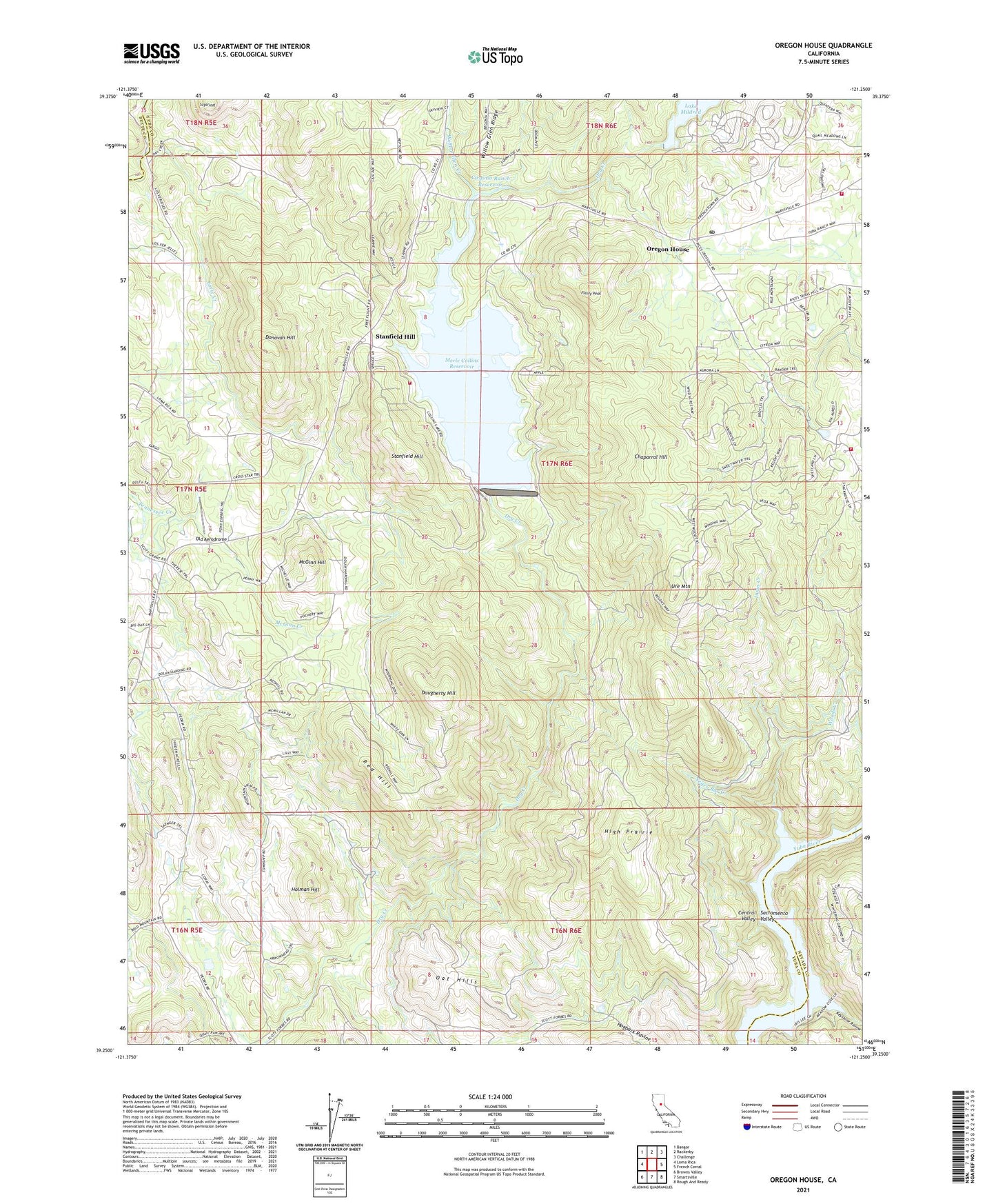
2021 topographic map quadrangle Oregon House in the state of California. Scale: 1:24000. Based on the newly updated USGS 7.5' US Topo map series, this map is in the following counties: Yuba, Nevada, Butte. The map contains contour data, water features, and other items you are used to seeing on USGS maps, but also has updated roads and other features. This is the next generation of topographic maps. Printed on high-quality waterproof paper with UV fade-resistant inks.
Quads adjacent to this one:
West: Loma Rica
Northwest: Bangor
North: Rackerby
Northeast: Challenge
East: French Corral
Southeast: Rough And Ready
South: Smartsville
Southwest: Browns Valley
This map covers the same area as the classic USGS quad with code o39121c3.
Contains the following named places: Browns Valley Ditch, Carmichael Ranch, Chaparral Hill, Collins Lake Recreation Area, Daugherty Hill, Dobbins - Oregon House Fire Protection District, Donovan Hill, Double Tree Farm Airport, Flanly Peak, High Prairie, Holman Hill, Injun Creek, Keystone Ravine, Lake Mildred, Los Verjeles Dam, McGinn Creek, McGinn Hill, Merle Collins Reservoir, Negro Bar Creek, Oak Grove, Oat Hills, Old Aerodrome, Oregon House, Oregon House Post Office, Oregon House School, Pal O Mine Ranch, Peoria School, Rancho Loma Rica, Red Hill, Stanfield Hill, Sugarloaf, Thousand Trails Campground, Ure Mountain, Virginia Ranch, Virginia Ranch 1021 Dam, Virginia Ranch Reservoir, Willow Glen Creek, Woods Creek, Yuba County, ZIP Codes: 95918, 95962