MyTopo
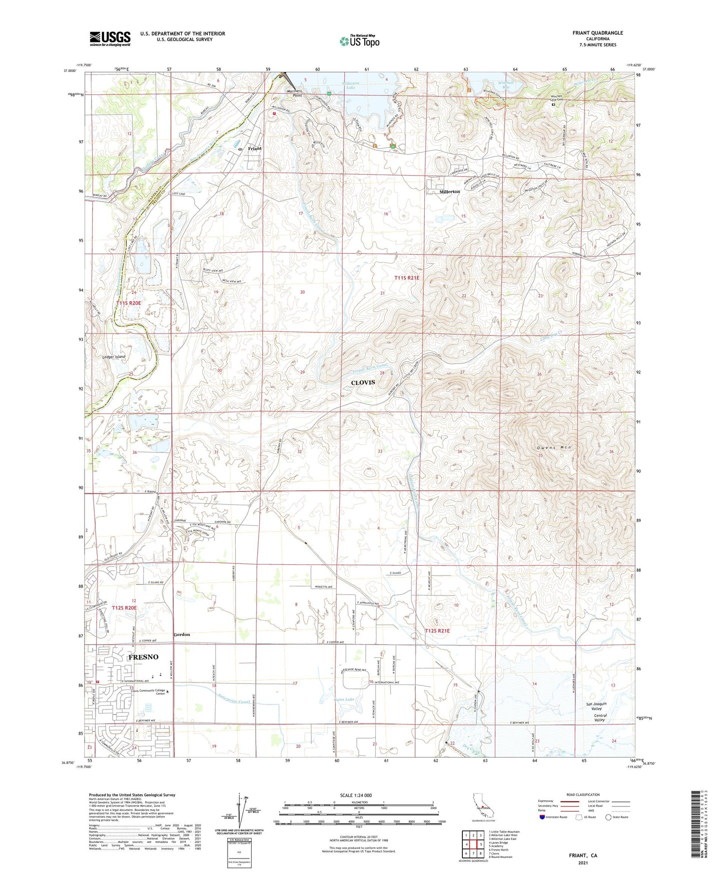
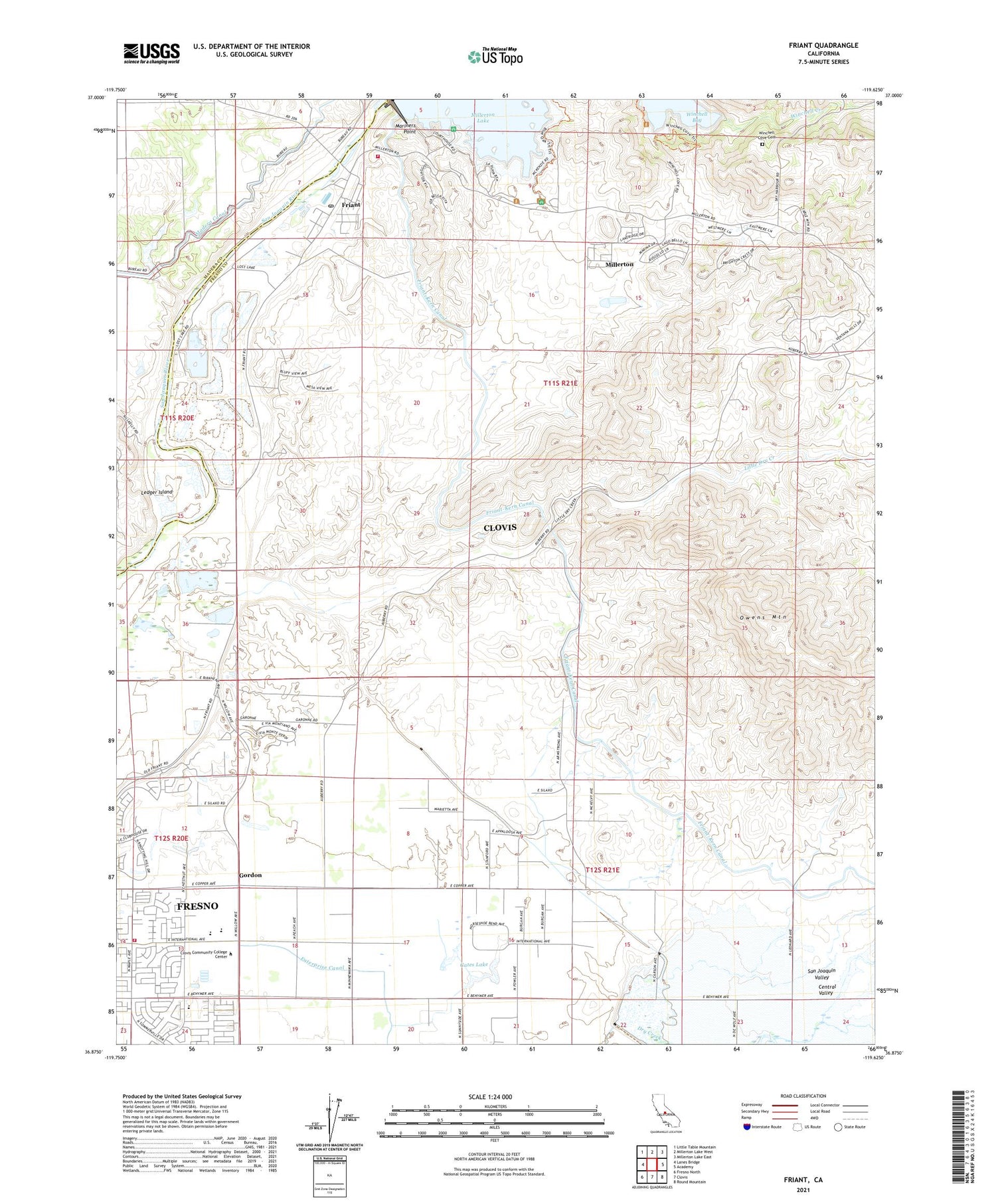
Friant California US Topo Map
Couldn't load pickup availability
2021 topographic map quadrangle Friant in the state of California. Scale: 1:24000. Based on the newly updated USGS 7.5' US Topo map series, this map is in the following counties: Fresno, Madera. The map contains contour data, water features, and other items you are used to seeing on USGS maps, but also has updated roads and other features. This is the next generation of topographic maps. Printed on high-quality waterproof paper with UV fade-resistant inks.
Quads adjacent to this one:
West: Lanes Bridge
Northwest: Little Table Mountain
North: Millerton Lake West
Northeast: Millerton Lake East
East: Academy
Southeast: Round Mountain
South: Clovis
Southwest: Fresno North
This map covers the same area as the classic USGS quad with code o36119h6.
Contains the following named places: Blue Oak Picnic Area, Copper Substation, Cottonwood Creek, El Prado, Fresno City Fire Department Station 17, Fresno Copper Mine, Fresno County Fire Protection District Millerton Station 72, Friant, Friant Census Designated Place, Friant Elementary School, Friant Post Office, Gates Lake, Gordon, Grange Grove Picnic Area, KFIG-FM (Fresno), La Playa Picnic Area, Ledger Island, Lost Lake, Lost Lake Recreation Area, Mariners Point, Millerton, Millerton Census Designated Place, Millerton Courthouse Museum, Millerton Lake Fire Control Station, Millerton Lake State Recreation Area Headquarters, Millerton School, Owens Mountain, Pollasky School, Pontoon Bridge, Shipp, South Bay Picnic Area, Table Mountain Rancheria, Winchell Cove Campground, Winchell Cove Cemetery, Winchell Creek, ZIP Code: 93730