MyTopo
Fruto California US Topo Map
Couldn't load pickup availability
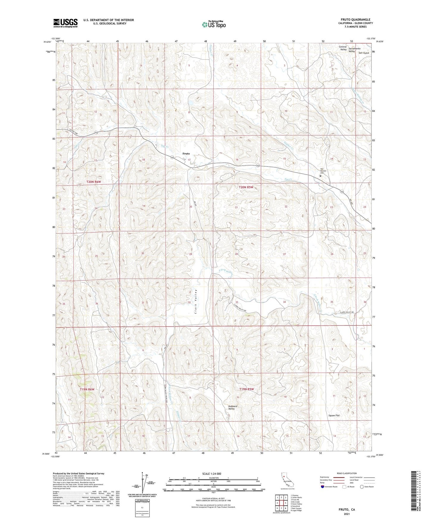
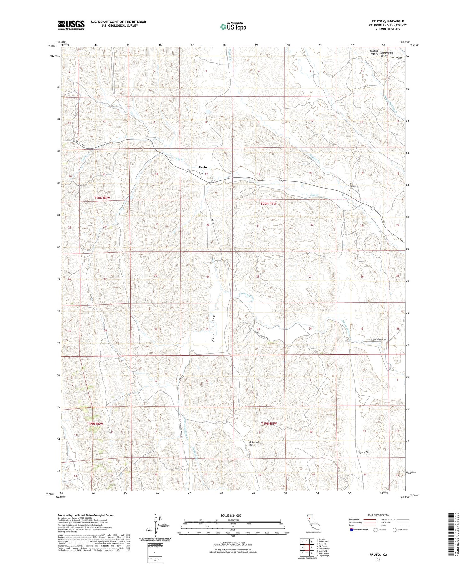
2023 topographic map quadrangle Fruto in the state of California. Scale: 1:24000. Based on the newly updated USGS 7.5' US Topo map series, this map is in the following counties: Glenn. The map contains contour data, water features, and other items you are used to seeing on USGS maps, but also has updated roads and other features. This is the next generation of topographic maps. Printed on high-quality waterproof paper with UV fade-resistant inks.
Quads adjacent to this one:
West: Elk Creek
Northwest: Chrome
North: Julian Rocks
Northeast: Fruto NE
East: Stone Valley
Southeast: Logan Ridge
South: Rail Canyon
Southwest: Stonyford
This map covers the same area as the classic USGS quad with code o39122e4.
Contains the following named places: Bunnell Ranch, Clark Valley, Fillippi Creek, Fruto, Glenn County, Gopher Creek, Hubbard Valley, Nye Pioneer Cemetery, Squaw Flat