MyTopo
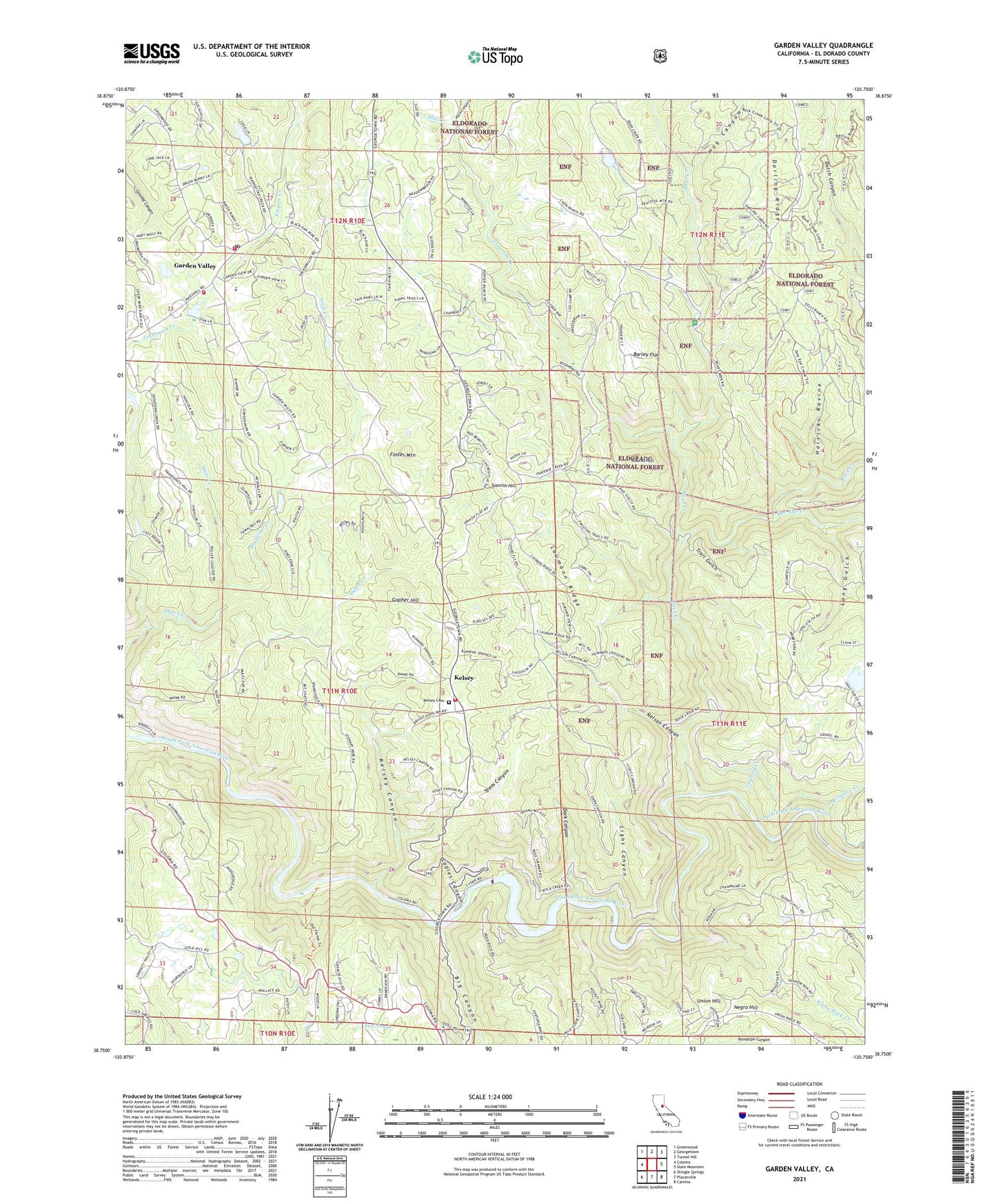
Garden Valley California US Topo Map
Couldn't load pickup availability
Also explore the Garden Valley Forest Service Topo of this same quad for updated USFS data
2021 topographic map quadrangle Garden Valley in the state of California. Scale: 1:24000. Based on the newly updated USGS 7.5' US Topo map series, this map is in the following counties: El Dorado. The map contains contour data, water features, and other items you are used to seeing on USGS maps, but also has updated roads and other features. This is the next generation of topographic maps. Printed on high-quality waterproof paper with UV fade-resistant inks.
Quads adjacent to this one:
West: Coloma
Northwest: Greenwood
North: Georgetown
Northeast: Tunnel Hill
East: Slate Mountain
Southeast: Camino
South: Placerville
Southwest: Shingle Springs
This map covers the same area as the classic USGS quad with code o38120g7.
Contains the following named places: Alhambra Mine, American Flat, American River Powerhouse, Barley Flat, Bear Creek, Bear Creek Picnic Area, Big Canyon, Big Sailor Creek, Black Oak Mine, Chili Bar, Chili Bar Reservoir, Creekside Elementary School, Dark Canyon, Department of Forestry and Fire Protection Station 50 Garden Valley, Divide High School, Dubey Airport, Empire Creek, Finnon Lake 1-034 Dam, Finnon Lake Campground, Finnon Lake Picnic Area, Foster Mountain, Garden Valley, Garden Valley California Division of Forestry Station, Garden Valley Fire Protection District Station 51, Garden Valley Fire Protection District Station 52, Garden Valley Post Office, Garden Valley School, Gold Hill Nursery, Gold Hill School, Gold Trail Elementary School, Gold Trail Park, Golden Sierra High School, Gopher Hill, Granite Hills Vineyards, Harricks Ravine, Hog Canyon, Irish Creek, J W Marshall Shop, Jaybird Creek, Jodar Vineyard and Winery, Kelsey, Kelsey Canyon, Kelsey Cemetery, Kelsey P O, Kelsey School, KTLL-AM (Placerville), Ladies Canyon, Laumann Ridge, Light Canyon, Little Sailor Creek, Long Gulch, Manhattan Creek, Manhattan Creek 2461 Dam, Meadow Brook, Mosquito Camp, Mosquito Creek, Mosquito Trail, Nancy Lee Mine, Negro Hill, Nelson Canyon, North Placerville, North Star Tree Farm, Oma 6 300 Reservoir, One Eye Creek, Rock Canyon, Rock Creek, Round Hill, Slat Creek, Slate Creek, Slate Mine, Spanish Flat, Spanish Hill, Taylor Mine, Teal Pond, Texas Canyon, Trail Gulch, Traverse Creek, Union Hill, Union School, White Rock Creek, White Rock Power House, ZIP Code: 95633