MyTopo
Gerber California US Topo Map
Couldn't load pickup availability
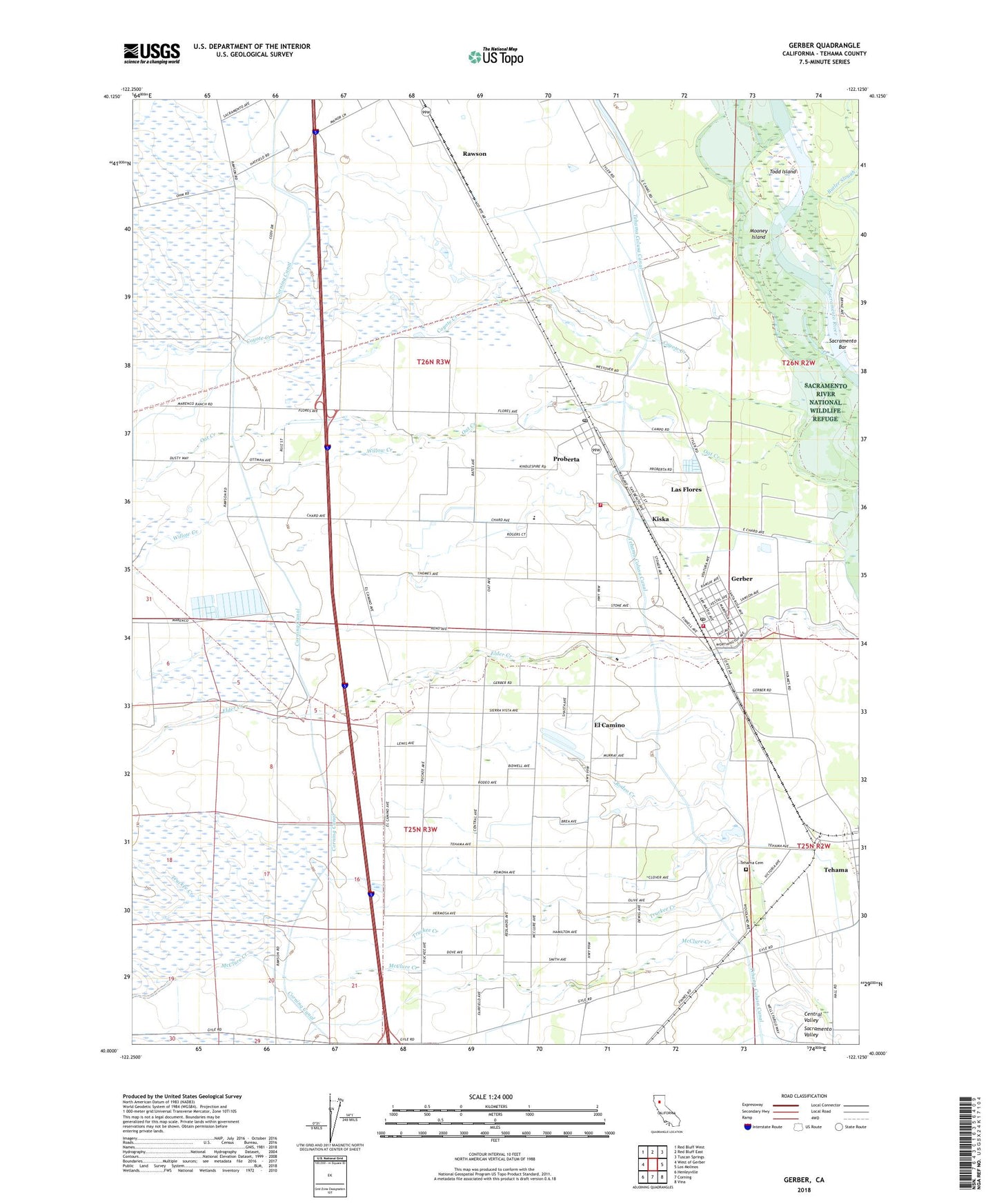
2022 topographic map quadrangle Gerber in the state of California. Scale: 1:24000. Based on the newly updated USGS 7.5' US Topo map series, this map is in the following counties: Tehama. The map contains contour data, water features, and other items you are used to seeing on USGS maps, but also has updated roads and other features. This is the next generation of topographic maps. Printed on high-quality waterproof paper with UV fade-resistant inks.
Quads adjacent to this one:
West: West of Gerber
Northwest: Red Bluff West
North: Red Bluff East
Northeast: Tuscan Springs
East: Los Molinos
Southeast: Vina
South: Corning
Southwest: Henleyville
This map covers the same area as the classic USGS quad with code o40122a2.
Contains the following named places: Butler Slough, City of Tehama, Corning Canal, Coyote Creek, El Camino, El Camino Grange, Gerber, Gerber Census Designated Place, Gerber Elementary School, Gerber Fire Department, Gerber Post Office, Gerber-Las Flores Census Designated Place, Haleakala Ranch, Kiska, La Barranca Colorada, Las Flores, Las Flores Census Designated Place, Mooney Island, Proberta, Proberta Census Designated Place, Proberta Post Office, Rawson, Red Bluff Omni Radio Range Station, Rodeo Creek, Sacramento Bar, Sacramento River National Wildlife Refuge, Saucos, Tehama Cemetery, Tehama County Fire Department Station 9 El Camino, Todd Island, Truckee Creek, Willow Creek, ZIP Codes: 96035, 96090