MyTopo
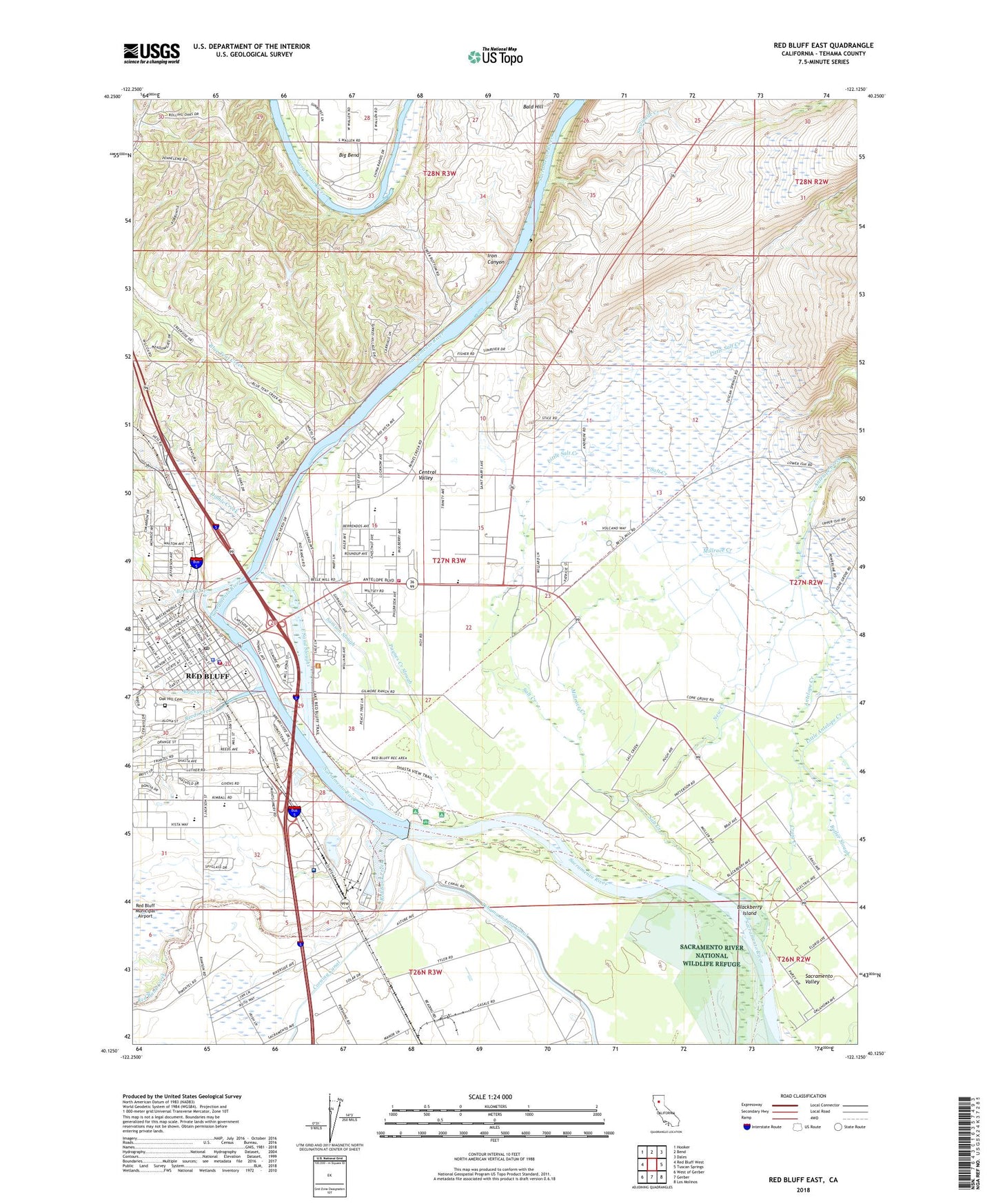
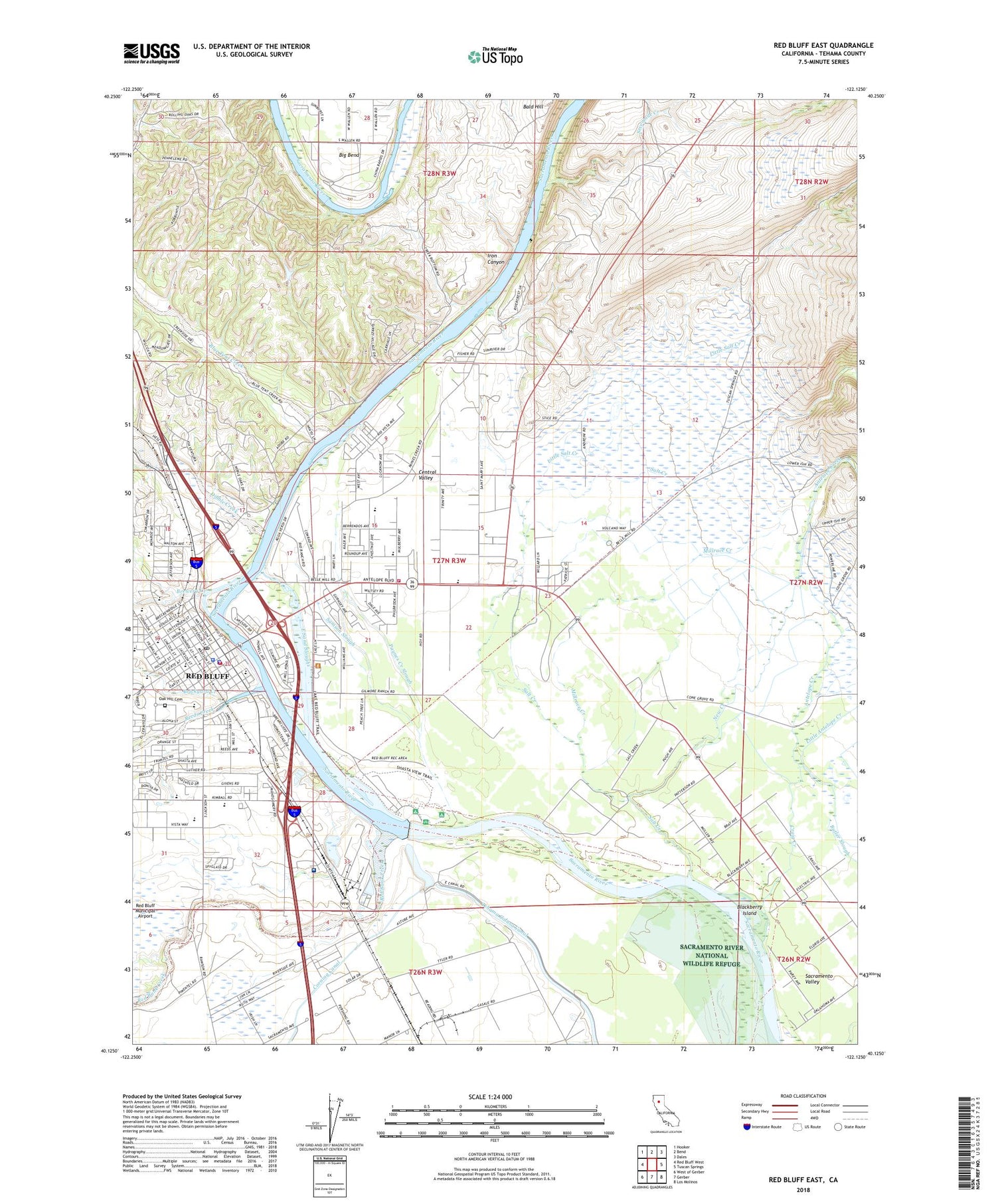
Red Bluff East California US Topo Map
Couldn't load pickup availability
2022 topographic map quadrangle Red Bluff East in the state of California. Scale: 1:24000. Based on the newly updated USGS 7.5' US Topo map series, this map is in the following counties: Tehama. The map contains contour data, water features, and other items you are used to seeing on USGS maps, but also has updated roads and other features. This is the next generation of topographic maps. Printed on high-quality waterproof paper with UV fade-resistant inks.
Quads adjacent to this one:
West: Red Bluff West
Northwest: Hooker
North: Bend
Northeast: Dales
East: Tuscan Springs
Southeast: Los Molinos
South: Gerber
Southwest: West of Gerber
This map covers the same area as the classic USGS quad with code o40122b2.
Contains the following named places: Academy of Our Lady of Mercy, Antelope Elementary School, Ayer Park, Berrendos Middle School, Bidwell Elementary School, Big Bend, Blackberry Island, Blue Tent Creek, Brewery Creek, Brickyard Creek, California Highway Patrol Red Bluff, Calvary Temple, Central Valley, Church of God, Church of the Nazarene, City of Red Bluff, Craig Creek, Diamond Park, Dibble Creek, East Sand Slough, First Baptist Church, First Christian Church, First Church of Christ Scientist, First Methodist Church, First Presbyterian Church, Forward Park, Fry Field, Gospel Church, Herbert Kraft Free Library, Iron Canyon, Jackson Heights Elementary School, KBLF-AM (Red Bluff), Lincoln Street Independent Elementary School, Little Antelope Creek, Little Salt Creek, Mercy High School, Millrace Creek, New Creek, Oak Creek Golf Course, Oak Hill Cemetery, Orchard Park School, Paynes Creek Slough, Red Bank Creek, Red Bluff, Red Bluff City Hall, Red Bluff City Park, Red Bluff Diversion Dam, Red Bluff Diverson Dam Recreation Area, Red Bluff Fire Department, Red Bluff High School, Red Bluff Police Department, Red Bluff Post Office, Reeds Creek, Sacred Heart Parish School, Sacred Heart Roman Catholic Church, Saint Elizabeth Community Hospital, Saint Pauls Lutheran Church, Saint Peters Episcopal Church, Salt Creek, Samson Slough, Sevenmile Creek, South Log Pond 268 Dam, Tehama County, Tehama County Courthouse, Tehama County Fairgrounds, Tehama County Fire Department Station 1 Red Bluff Headquarters, Tehama County Sheriff's Office, Veterans Memorial Building, Vista Middle School, William B. Ide Adobe State Historic Park, William M Metteer Elementary School


