MyTopo
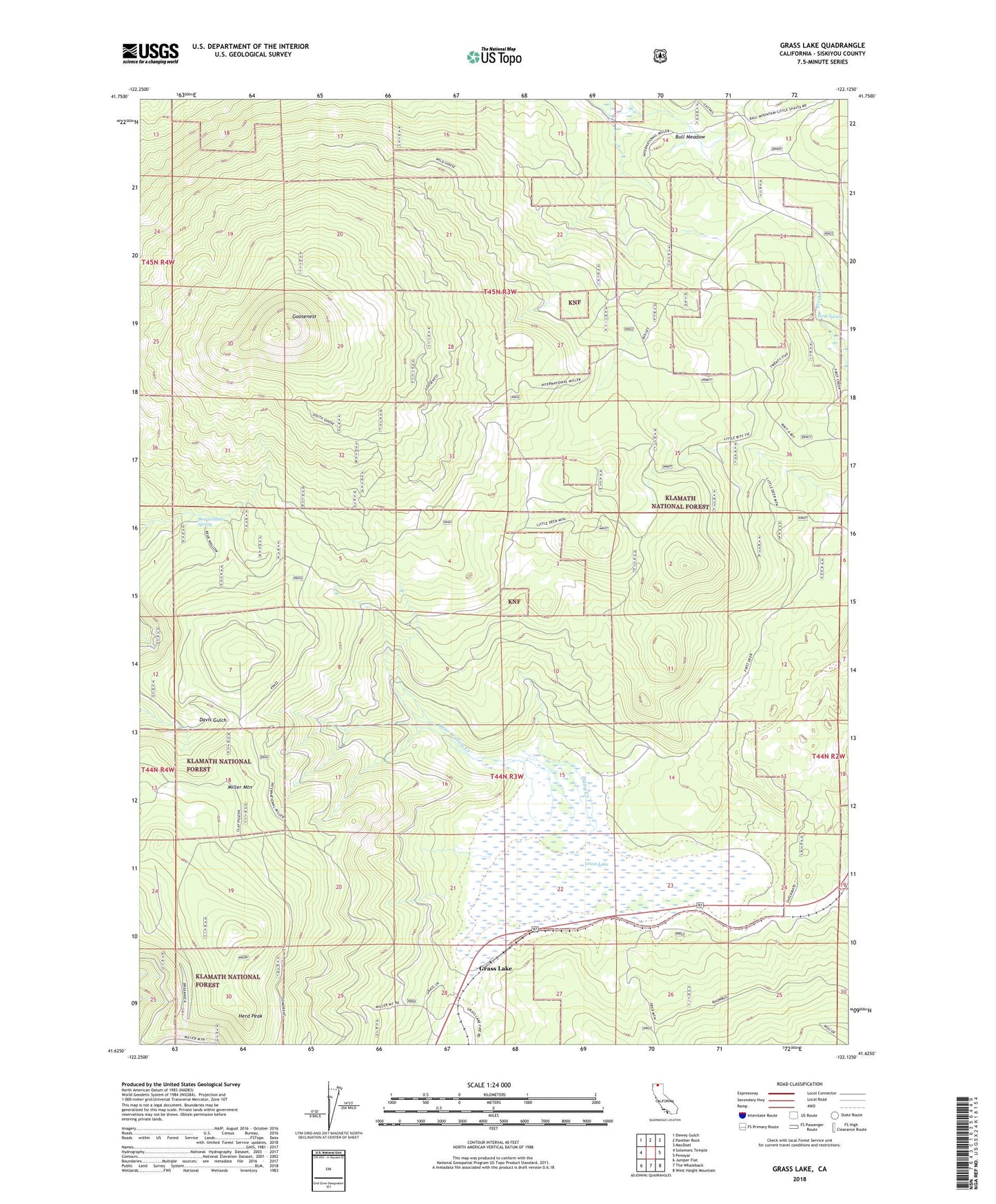
Grass Lake California US Topo Map
Couldn't load pickup availability
Also explore the Grass Lake Forest Service Topo of this same quad for updated USFS data
2021 topographic map quadrangle Grass Lake in the state of California. Scale: 1:24000. Based on the newly updated USGS 7.5' US Topo map series, this map is in the following counties: Siskiyou. The map contains contour data, water features, and other items you are used to seeing on USGS maps, but also has updated roads and other features. This is the next generation of topographic maps. Printed on high-quality waterproof paper with UV fade-resistant inks.
Quads adjacent to this one:
West: Solomons Temple
Northwest: Dewey Gulch
North: Panther Rock
Northeast: MacDoel
East: Penoyar
Southeast: West Haight Mountain
South: The Whaleback
Southwest: Juniper Flat
This map covers the same area as the classic USGS quad with code o41122f2.
Contains the following named places: Bear Wallow Creek, Bearwallow Spring, Bull Meadow, Dairy Creek, Davis Cabin, First Spring, Goosenest, Goosenest Trail, Grass Lake, Grass Lake Forest Service Station, Herd Peak, Miller Mountain