MyTopo
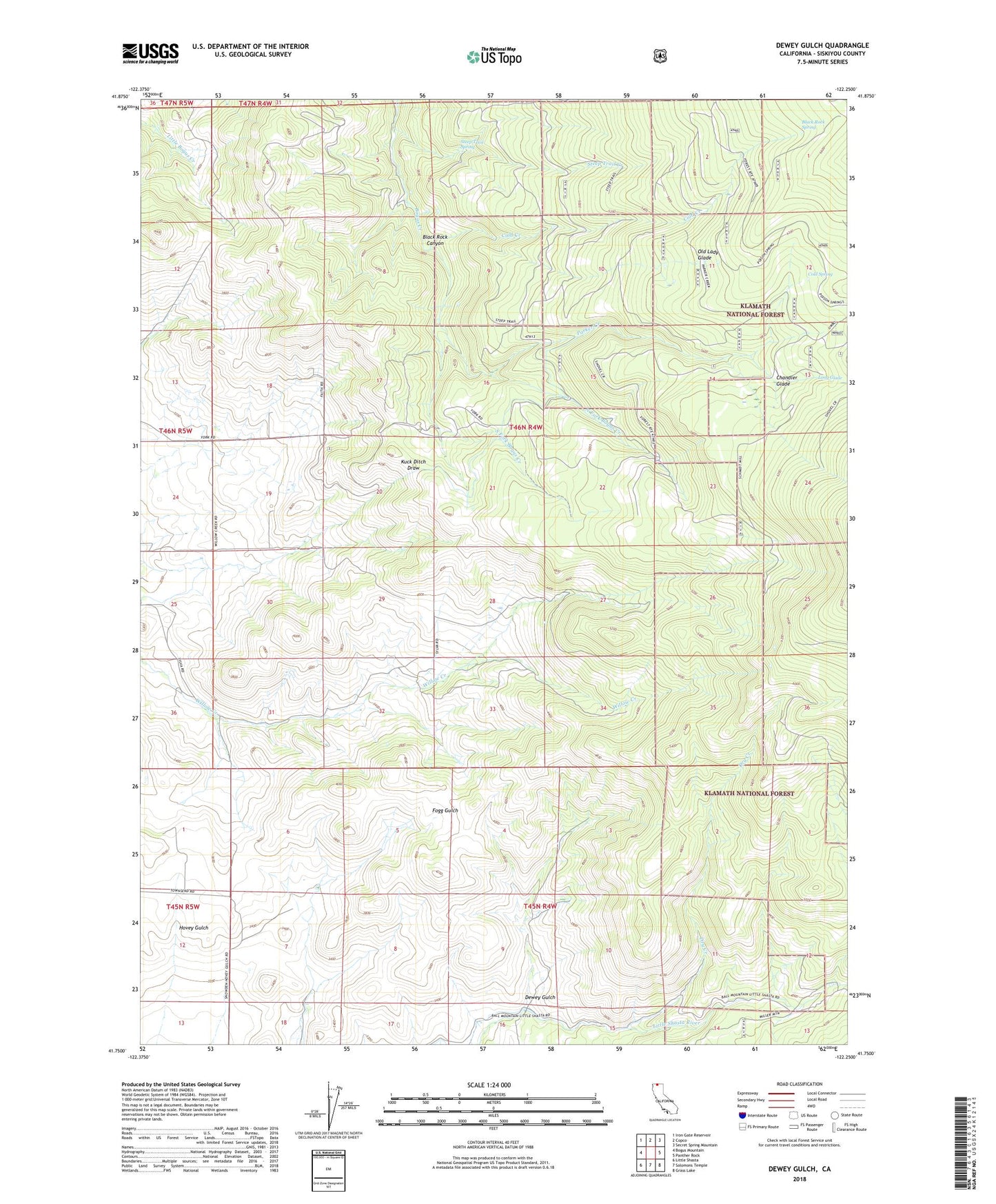
Dewey Gulch California US Topo Map
Couldn't load pickup availability
Also explore the Dewey Gulch Forest Service Topo of this same quad for updated USFS data
2021 topographic map quadrangle Dewey Gulch in the state of California. Scale: 1:24000. Based on the newly updated USGS 7.5' US Topo map series, this map is in the following counties: Siskiyou. The map contains contour data, water features, and other items you are used to seeing on USGS maps, but also has updated roads and other features. This is the next generation of topographic maps. Printed on high-quality waterproof paper with UV fade-resistant inks.
Quads adjacent to this one:
West: Bogus Mountain
Northwest: Iron Gate Reservoir
North: Copco
Northeast: Secret Spring Mountain
East: Panther Rock
Southeast: Grass Lake
South: Solomons Temple
Southwest: Little Shasta
This map covers the same area as the classic USGS quad with code o41122g3.
Contains the following named places: Barba, Black Rock Canyon, Black Rock Spring, Buckley, Chandler Glade, Cold Creek, Cold Spring, Dewey Gulch, Dry Creek, Kuck Ditch, Long Glade, Montague Division, North Fork Bogus Creek, Old Lady Glade, Old Schmidt Sawmill, Old White Mill, Parker Cabin, Parker Camp, Parker Camp Trail, Parker Creek, Smith Mine, Smith Sawmill, South Fork Bogus Creek, Steep Trail Creek, Steep Trail Spring, Sylva Brothers, York, ZIP Code: 96064