MyTopo
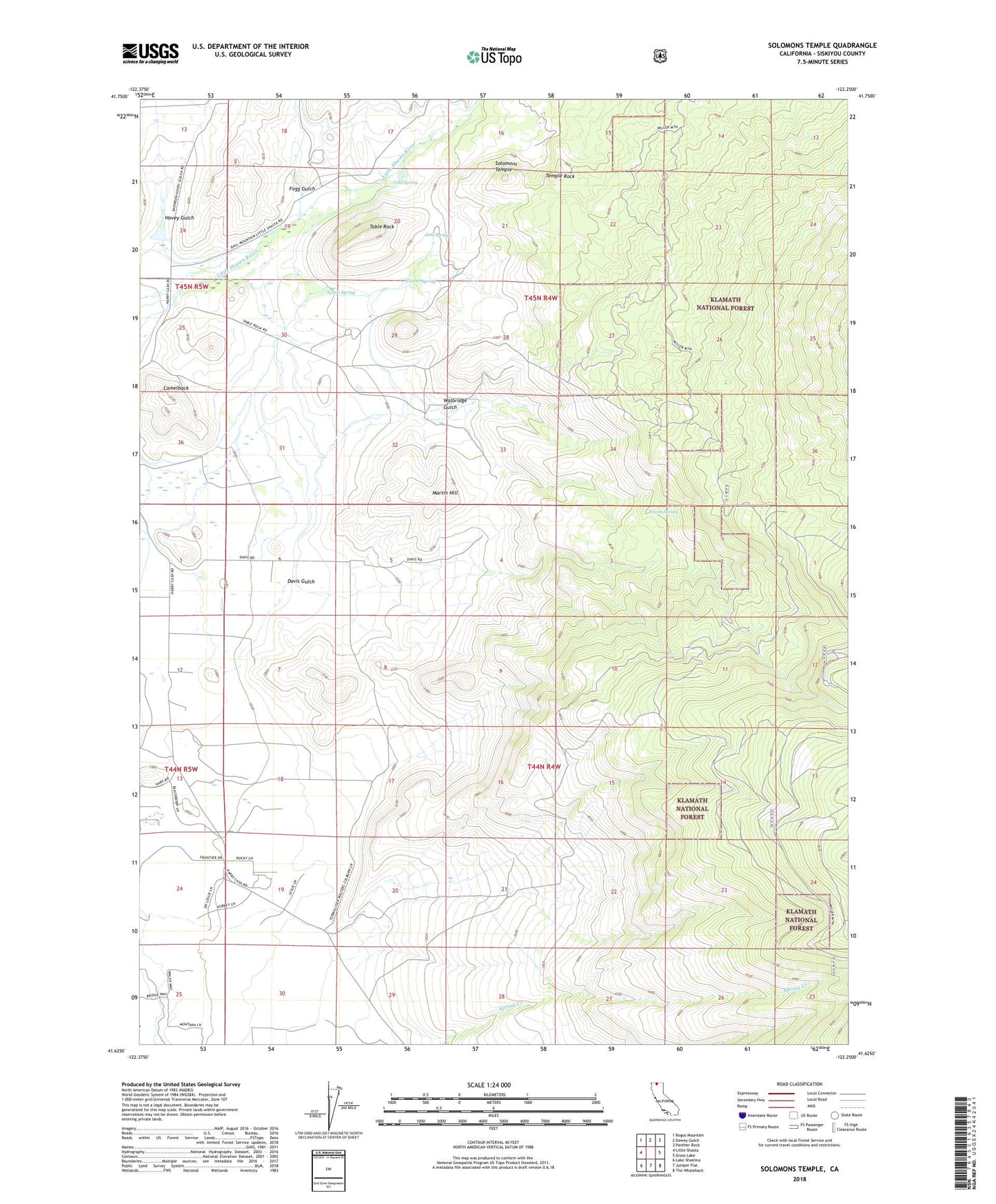
Solomons Temple California US Topo Map
Couldn't load pickup availability
Also explore the Solomons Temple Forest Service Topo of this same quad for updated USFS data
2021 topographic map quadrangle Solomons Temple in the state of California. Scale: 1:24000. Based on the newly updated USGS 7.5' US Topo map series, this map is in the following counties: Siskiyou. The map contains contour data, water features, and other items you are used to seeing on USGS maps, but also has updated roads and other features. This is the next generation of topographic maps. Printed on high-quality waterproof paper with UV fade-resistant inks.
Quads adjacent to this one:
West: Little Shasta
Northwest: Bogus Mountain
North: Dewey Gulch
Northeast: Panther Rock
East: Grass Lake
Southeast: The Whaleback
South: Juniper Flat
Southwest: Lake Shastina
This map covers the same area as the classic USGS quad with code o41122f3.
Contains the following named places: Camelback, Cold Spring, Davis, Davis Gulch, Evans Spring, Fogg Gulch, Hart, Hovey Gulch, Hovey Gulch School, Jims Springs, Kegg, Lema, Martin, Martin Hill, Ray Soule Reservoir 182 Dam, Solomons Temple, Spring Creek, Table Rock, Temple Rock, Terwilliger Walters, Tunnel Spring, Walbridge Gulch, Warm Spring, Williams