MyTopo
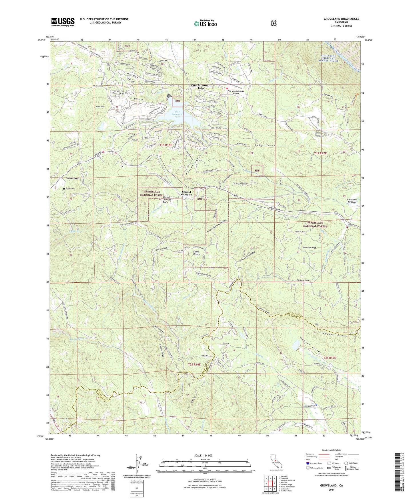
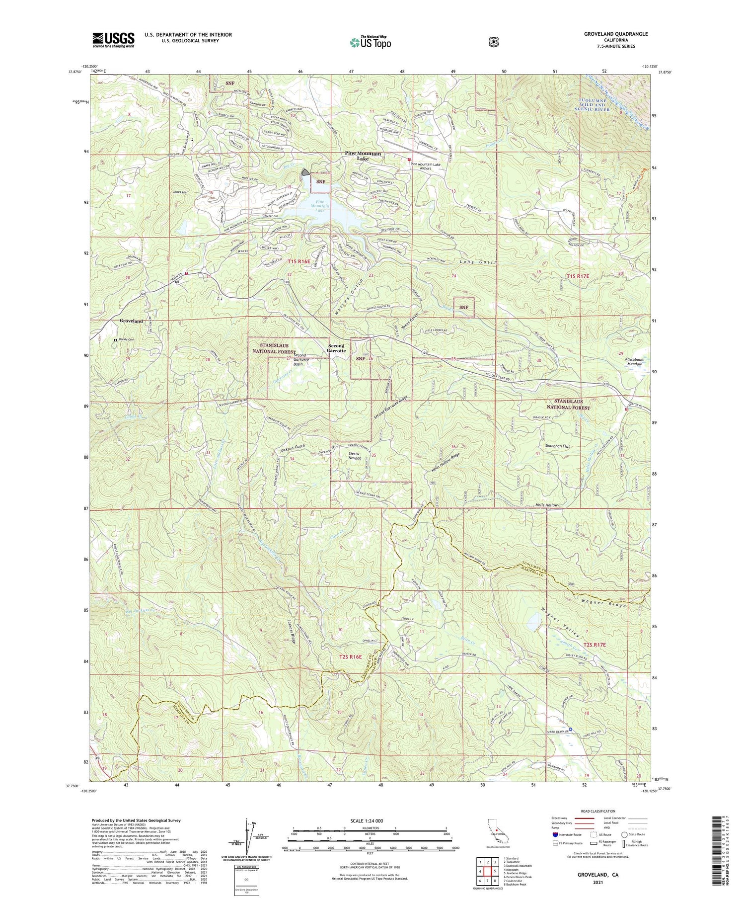
Groveland California US Topo Map
Couldn't load pickup availability
Also explore the Groveland Forest Service Topo of this same quad for updated USFS data
2021 topographic map quadrangle Groveland in the state of California. Scale: 1:24000. Based on the newly updated USGS 7.5' US Topo map series, this map is in the following counties: Tuolumne, Mariposa. The map contains contour data, water features, and other items you are used to seeing on USGS maps, but also has updated roads and other features. This is the next generation of topographic maps. Printed on high-quality waterproof paper with UV fade-resistant inks.
Quads adjacent to this one:
West: Moccasin
Northwest: Standard
North: Tuolumne
Northeast: Duckwall Mountain
East: Jawbone Ridge
Southeast: Buckhorn Peak
South: Coulterville
Southwest: Penon Blanco Peak
This map covers the same area as the classic USGS quad with code o37120g2.
Contains the following named places: Big Creek 557 Dam, Bret Harte Cabin, Cline Creek, Crook Ranch, Divide Cemetery, Elmore Temporary School, Foothills Community Church, Garrotte Creek, Graham Ranch, Green Valley 673 Dam, Groveland, Groveland California Division of Forestry Station, Groveland Census Designated Place, Groveland Community Services District Fire Department Station 3, Groveland CSD Fire Department, Groveland District Ranger Office, Groveland Landfill, Groveland Post Office, Groveland Wayside Park, Groveland-Big Oak Flat Census Designated Place, Hells Hollow, Hells Hollow Creek, Hells Hollow Ridge, Jackass Ridge, Jackson Gulch, Jones Hill, Kanaka Mine, Kassabaum Meadow, Little Jackass Creek, Long Gulch, Mariposa County Sheriff's Office, Pine Mountain Lake, Pine Mountain Lake Airport, Pine Mountain Lake Census Designated Place, Pine Mountain Lake Country Club, Ponderosa Way, Second Garrotte, Second Garrotte Basin, Second Garrotte Ridge, Servaes Temporary School, Shanahan Flat, Tenaya Elementary School, Tenaya School, Texas Gulch, Tuolumne County Ambulance Service Station 41, Tuolumne County Fire Department Station 63 Smith, Wagner Ridge, Whites Gulch