MyTopo
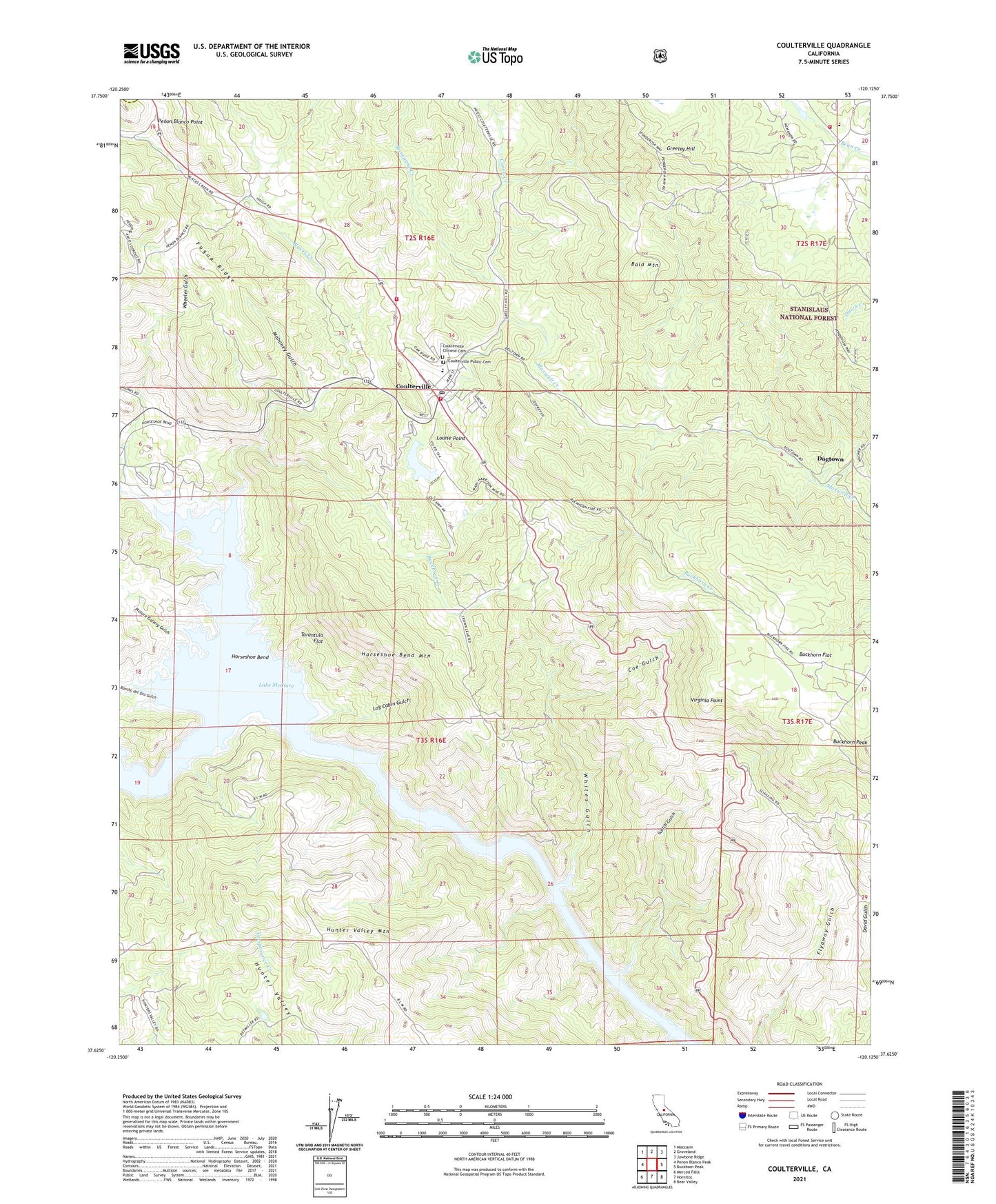
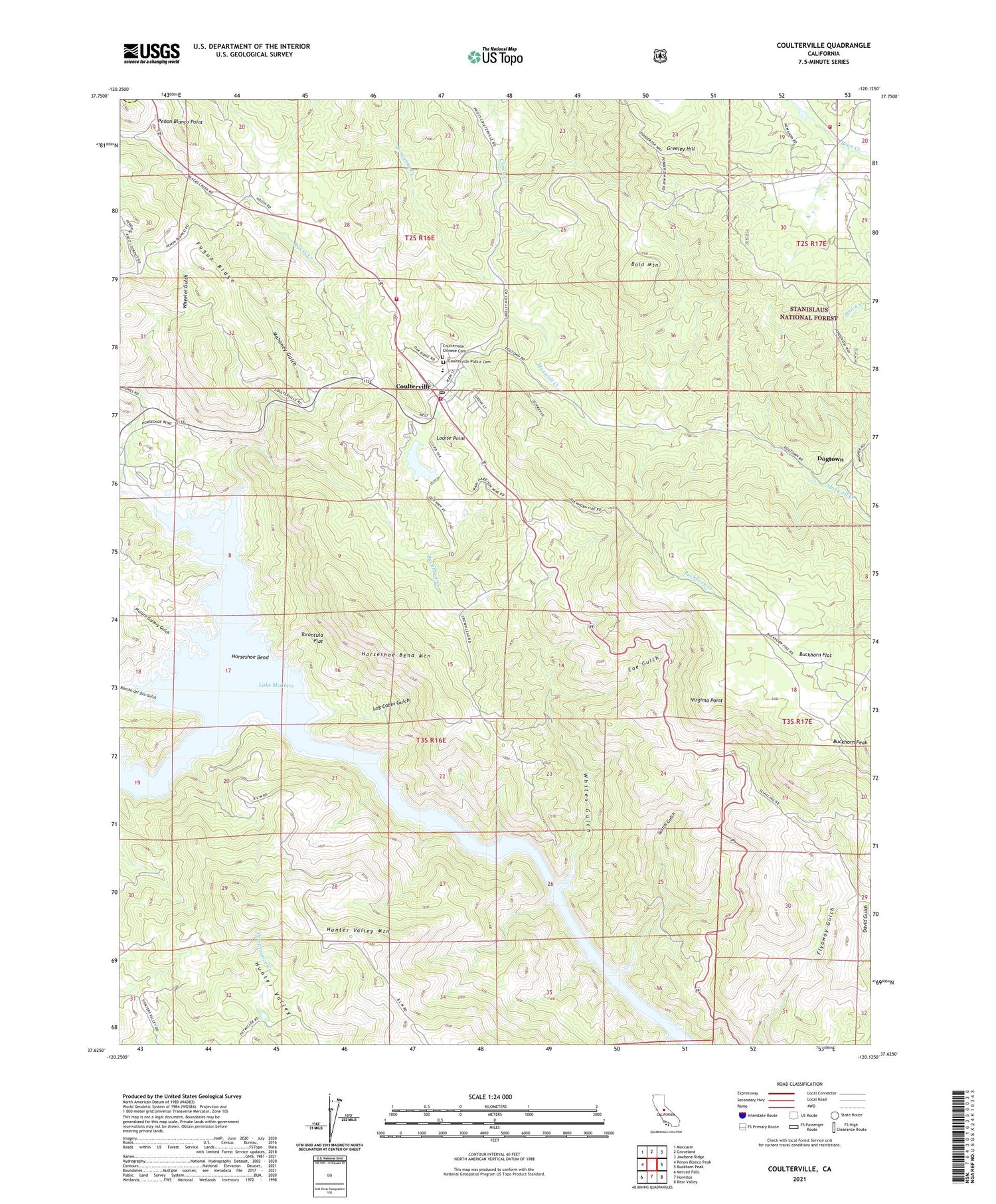
Coulterville California US Topo Map
Couldn't load pickup availability
Also explore the Coulterville Forest Service Topo of this same quad for updated USFS data
2021 topographic map quadrangle Coulterville in the state of California. Scale: 1:24000. Based on the newly updated USGS 7.5' US Topo map series, this map is in the following counties: Mariposa, Tuolumne. The map contains contour data, water features, and other items you are used to seeing on USGS maps, but also has updated roads and other features. This is the next generation of topographic maps. Printed on high-quality waterproof paper with UV fade-resistant inks.
Quads adjacent to this one:
West: Penon Blanco Peak
Northwest: Moccasin
North: Groveland
Northeast: Jawbone Ridge
East: Buckhorn Peak
Southeast: Bear Valley
South: Hornitos
Southwest: Merced Falls
This map covers the same area as the classic USGS quad with code o37120f2.
Contains the following named places: Adelaide Mine, Bald Mountain, Black Spider Prospect, Blacks Creek, Boneyard Creek, Buckhorn Creek, Buckhorn Flat, Champion Mine, Coe Gulch, Coulterville, Coulterville - Greeley Elementary School, Coulterville Census Designated Place, Coulterville Chinese Cemetery, Coulterville Community Club House, Coulterville High School, Coulterville Main Street Historic District, Coulterville Park, Coulterville Post Office, Coulterville Public Cemetery, Cuneo Creek, Department of Forestry and Fire Protection Coulterville Fire Station, Dogtown, Four Jacks Mine, Fugua Ridge, Gold Coin Mine, Greeley Hill, Greeley Hill Community Club, Greeley School, Green Dragon Mine, Hayes Camp, Horseshoe Bend, Horseshoe Bend Mine, Horseshoe Bend Mountain, Horseshoe Bend Recreation Area, Hunter Valley, Hunter Valley Mountain, Hunters Valley Point Recreation Area, Log Cabin Gulch, Louise Point, Mahoney Gulch, Malvina Mine, Mariposa County Fire Department - Greeley Hill Company 31, Mariposa County Fire Department Company 26 Coulterville, Mary Harrison Mine, Maxwell Creek, McMahon 674 Dam, Ming Prospect, Newtown, Oriental Deposit, Oro Rico Mine, Penon Blanco Point, Picture Gallery Gulch, Rancho del Oro Gulch, Red Ball Prospect, Red Banks Placer Mine, Riverside Chrome Mine, Rolfe Ranch, Scotch Gulch, Sonora Marble Agregates Quarry, Split Rock Ferry, Tarantula Flat, Virginia Mine, Virginia Point, Wheeler Gulch, Wheeler Gulch Mine, Whites Gulch, Wildwood Community Church, Willow Creek, Yang Prospect