
MyTopo
Standard California US Topo Map
Couldn't load pickup availability
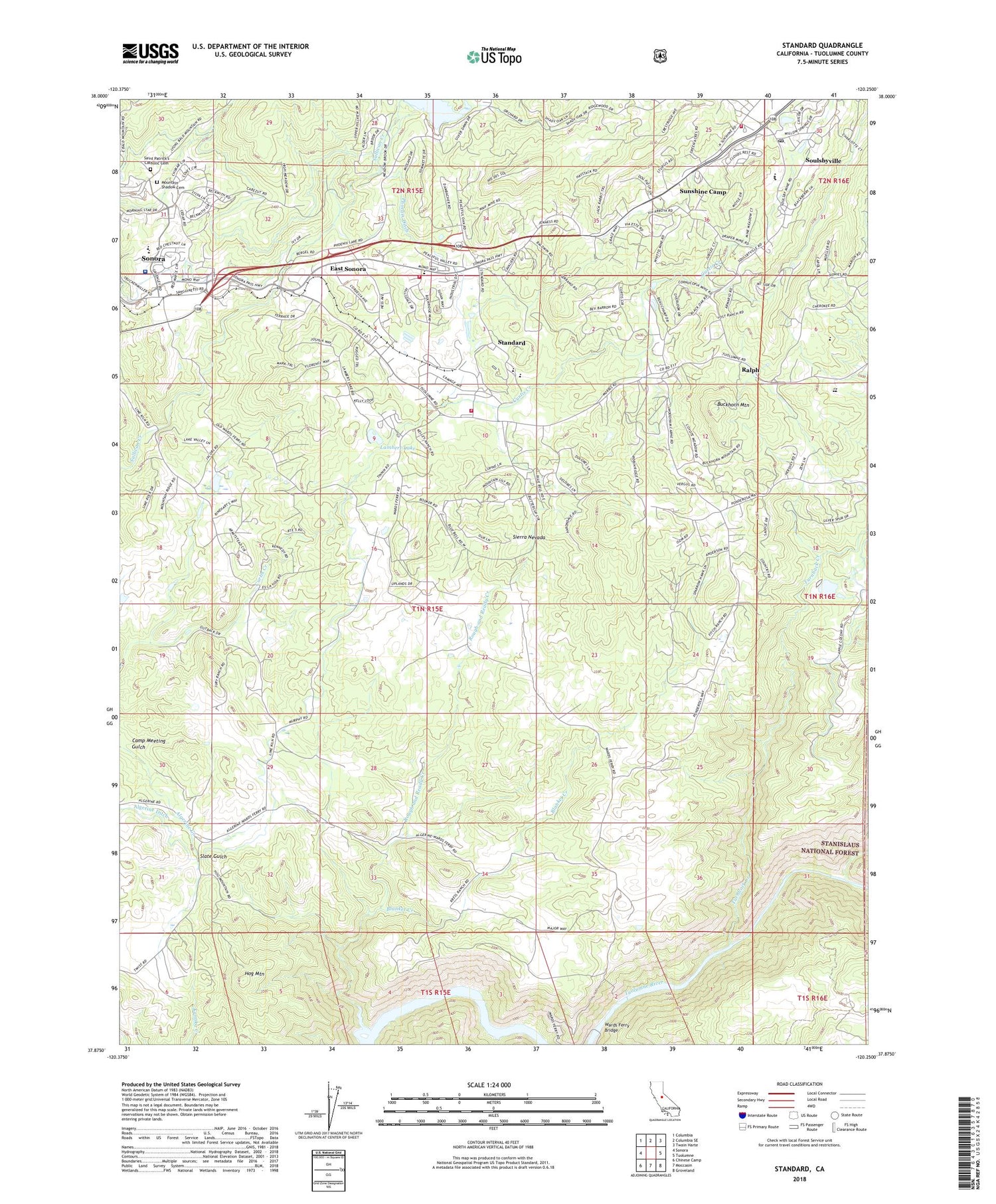
2021 topographic map quadrangle Standard in the state of California. Scale: 1:24000. Based on the newly updated USGS 7.5' US Topo map series, this map is in the following counties: Tuolumne. The map contains contour data, water features, and other items you are used to seeing on USGS maps, but also has updated roads and other features. This is the next generation of topographic maps. Printed on high-quality waterproof paper with UV fade-resistant inks.
Quads adjacent to this one:
West: Sonora
Northwest: Columbia
North: Columbia SE
Northeast: Twain Harte
East: Tuolumne
Southeast: Groveland
South: Moccasin
Southwest: Chinese Camp
This map covers the same area as the classic USGS quad with code o37120h3.
Contains the following named places: Algerine Ditch, Algerine School, Baker Ranch, Barron Ranch, Black Oak Mine, Blanket Creek, Buckhorn Estates, Buckhorn Mountain, Chickenfeed Mine, Curtis Creek Elementary School, Curtis Creek Ranch, Diamond Bar B Ranch, East Sonora, East Sonora Census Designated Place, East Sonora-Phoenix Lake Division, Eastman Ranch, Emerson Ranch, Gandolfo Ranch, Greenley Oaks, Grinding Rock 2018 Dam, Hawkins Ranch, Hog Mountain, Junction Mine, Kincaid 97-072 Dam, Kress Ranch, Lambert Lake, Lambert Lake Estates, McNutt Ranch, Merlo Field Sports Complex, Mono Village, Mono Vista, Monte Grande Heights, Morgan Chapel, Morgan Chapel Cemetery, Mountain Shadow Cemetery, Mountain View Cemetery, North Fork Tuolumne River, Oak Gardens Estates, Oak Hill Presbyterian Church, Peaceful Valley, Phoenix 97-078 Dam, Phoenix Ditch, Quail Hollow, Quail Ridge Ranch, Ralph, Rancho Poquitos, Richards Ranch, Rough and Ready Creek, Russell Telegraph Mine, Scenic Brook, Scenic View, Slate Gulch, Sonora Elementary School, Sonora Hills, Sonora Ranchettes, Sonora Regional Medical Center, Soulsby Mine, Soulsbyville, Soulsbyville Census Designated Place, Soulsbyville Elementary School, Soulsbyville Post Office, Soulsbyville United Methodist Church, Standard, Sudall Ranch, Summerville High School, Sunnyside Mine, Sunshine Camp, Tuolumne County Ambulance Service Station 10, Tuolumne County Ambulance Service Station 11, Tuolumne County Ambulance Service Station 20, Tuolumne County Fire Department Standard Station, Tuolumne County Fire Department Station 51 Mono Village, Tuolumne County Fire Department Station 56 Mono Vista, Tuolumne County Free Library, Tuolumne Junction Shopping Center, Turnback Creek, United States Forest Service Stanislaus National Forest, Wards Ferry Bridge, Wards Ferry School, Willow Springs, ZIP Codes: 95370, 95372


