MyTopo
Hernandez Reservoir California US Topo Map
Couldn't load pickup availability
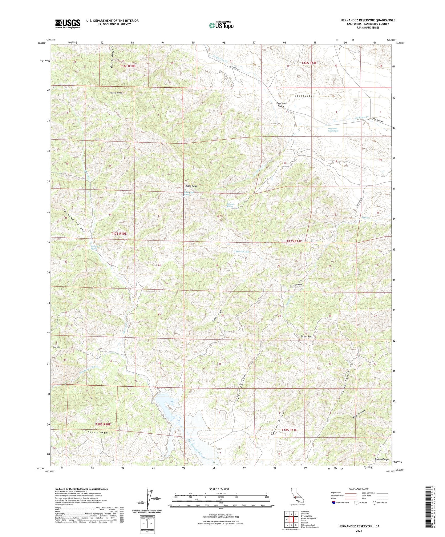
2021 topographic map quadrangle Hernandez Reservoir in the state of California. Scale: 1:24000. Based on the newly updated USGS 7.5' US Topo map series, this map is in the following counties: San Benito. The map contains contour data, water features, and other items you are used to seeing on USGS maps, but also has updated roads and other features. This is the next generation of topographic maps. Printed on high-quality waterproof paper with UV fade-resistant inks.
Quads adjacent to this one:
West: Rock Spring Peak
Northwest: Llanada
North: Panoche
Northeast: Tumey Hills
East: Idria
Southeast: San Benito Mountain
South: Hepsedam Peak
Southwest: Lonoak
This map covers the same area as the classic USGS quad with code o36120d7.
Contains the following named places: Ashurst Spring, Baker Canyon, Black Mountain, Bucks Peak, Bucks Peak Spring, Cane Canyon, Castle Rock, Dogwood Lateral Six, Eugene Well, Harrison Cabin, Hernandez 1025-002 Dam, Hernandez Reservoir, Johnson Canyon, Laguna Creek, McCoy Creek, Merrill Lake, Post Canyon, Red Corral, Red Corral Spring, Red Mountain, Syncline Divide, The Adobe, Tucker Mountain