MyTopo
Hepsedam Peak California US Topo Map
Couldn't load pickup availability
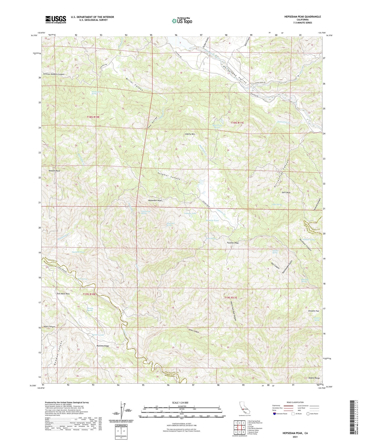
2021 topographic map quadrangle Hepsedam Peak in the state of California. Scale: 1:24000. Based on the newly updated USGS 7.5' US Topo map series, this map is in the following counties: San Benito, Monterey. The map contains contour data, water features, and other items you are used to seeing on USGS maps, but also has updated roads and other features. This is the next generation of topographic maps. Printed on high-quality waterproof paper with UV fade-resistant inks.
Quads adjacent to this one:
West: Lonoak
Northwest: Rock Spring Peak
North: Hernandez Reservoir
Northeast: Idria
East: San Benito Mountain
Southeast: Priest Valley
South: Monarch Peak
Southwest: Nattrass Valley
This map covers the same area as the classic USGS quad with code o36120c7.
Contains the following named places: Abelardo Cabin, Airstrip Pond, Augustine Creek, Badlands, Bar B Ranch, Bootleg Spring, Byles Canyon, Calhoon Cabin, Cedar Spring, Clear Creek, Cottonwood Springs, Dry Lake, Dunham Spring, Garcia Creek, Gull Neck Rock, Hepsedam Creek, Hepsedam Peak, Hepsedam Ranch, Hepsedam Spring, Hernandez School, Hernandez Valley, Hog Hole, Horsethief Canyon, James Canyon, John Cabin, Kenner Lake, Kenneth Cabin, Laguna Lake, Laguna Mountain, Laguna Ranch, Lake Spring, Mail Trail, Mail Trail Pond, Miller Canyon, North Fork Oak Canyon, Orejano Flat, Orejano Spring, Panther Peak, Rattlesnake Gulch, Spanish Flats, Split Oak Spring, Split Rock, Sulphur Canyon, Sulphur Spring, Susie Spring, Sweetwater Spring, The Gorge, Tucker Gulch, Vasquez Crossing, Vasquez Rock