MyTopo
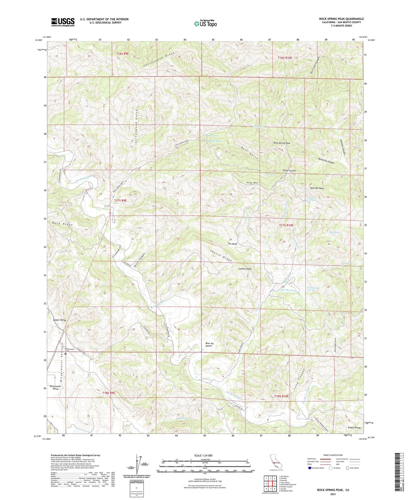
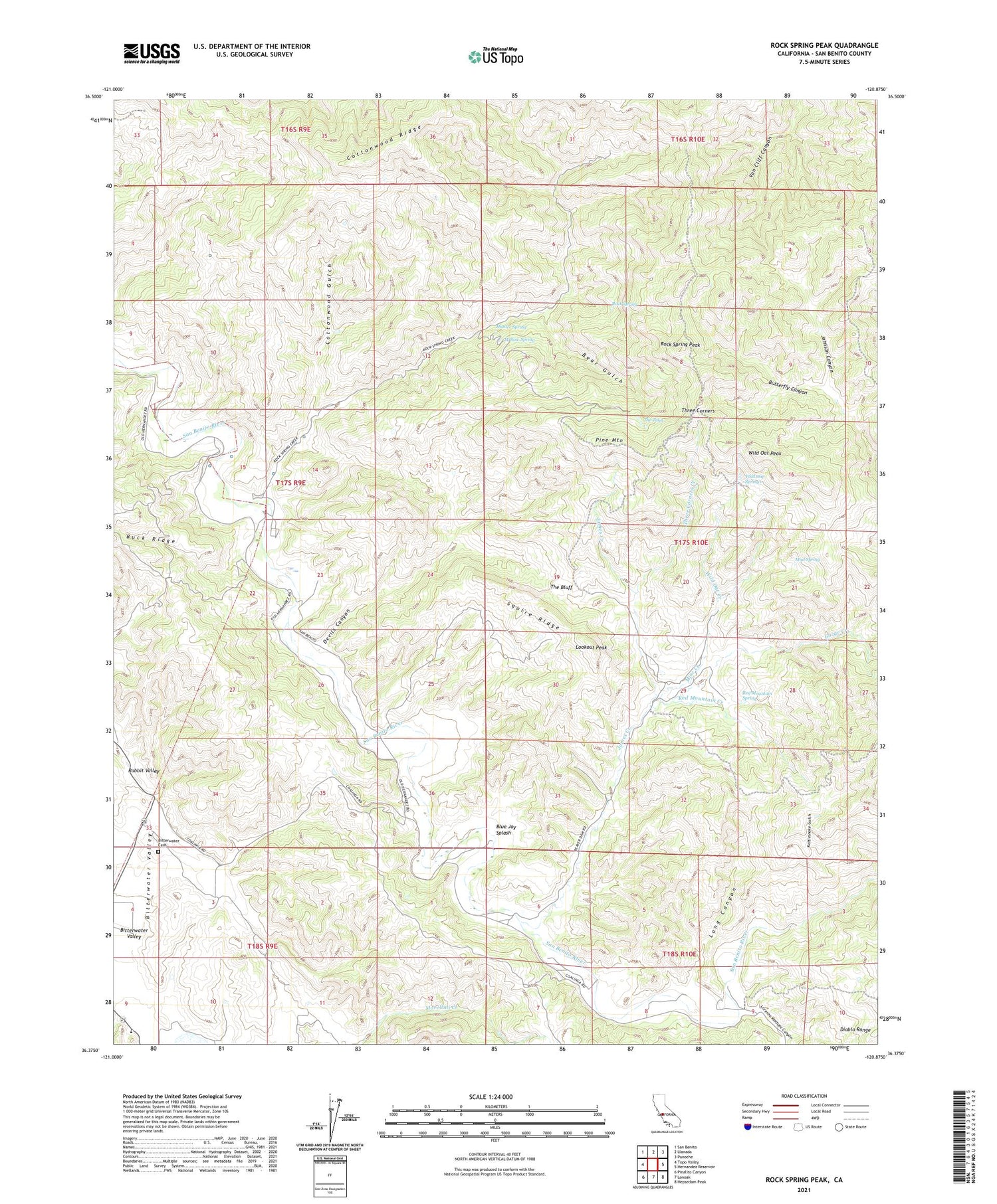
Rock Spring Peak California US Topo Map
Couldn't load pickup availability
2021 topographic map quadrangle Rock Spring Peak in the state of California. Scale: 1:24000. Based on the newly updated USGS 7.5' US Topo map series, this map is in the following counties: San Benito. The map contains contour data, water features, and other items you are used to seeing on USGS maps, but also has updated roads and other features. This is the next generation of topographic maps. Printed on high-quality waterproof paper with UV fade-resistant inks.
Quads adjacent to this one:
West: Topo Valley
Northwest: San Benito
North: Llanada
Northeast: Panoche
East: Hernandez Reservoir
Southeast: Hepsedam Peak
South: Lonoak
Southwest: Pinalito Canyon
This map covers the same area as the classic USGS quad with code o36120d8.
Contains the following named places: Bear Gulch, Beaver Dam Fire Control Station, Bitterwater - Tully Elementary School, Bitterwater Cemetery, Blue Jay Splash, Butterfly Canyon, Cottonwood Gulch, Cottonwood Ridge, Devils Canyon, Fireflex Mine, Gorge Creek, Hunter Spring, James Creek, Lew Smith Ranch, Long Canyon, Lookout Peak, Lorenzo Vasquez Canyon, Mine Creek, Mud Spring, Pine Mountain, Rattlesnake Gulch, Red Mountain Creek, Red Mountain Spring, Rock Spring, Rock Spring Peak, Rock Springs Creek, Squire Ridge, The Bluff, The Tules, Three Corners, Three Corners Creek, Three Corners Dam, Wild Oat Creek, Wild Oat Dam, Wild Oat Peak, Wild Oat Springs, Willow Spring