MyTopo
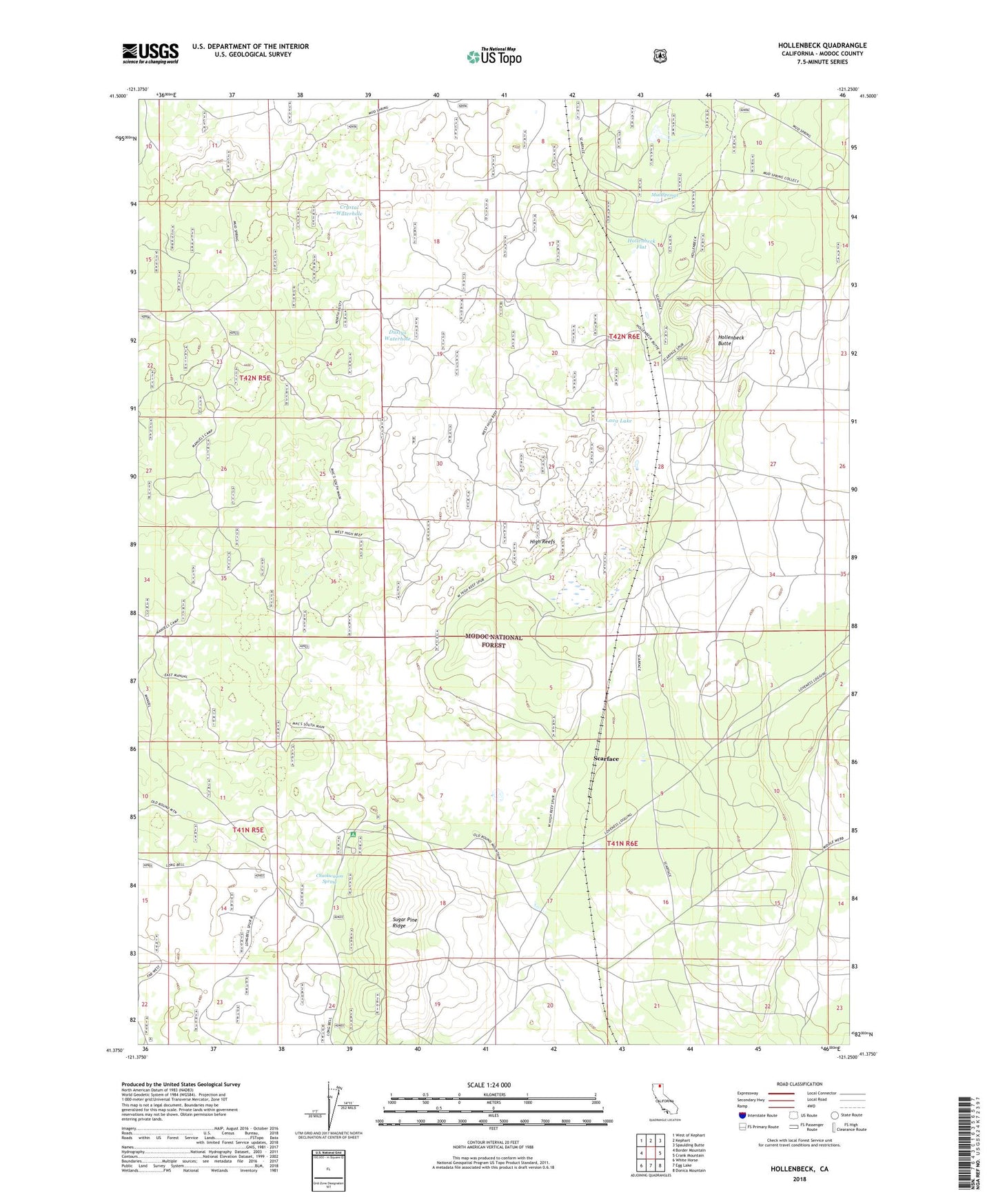
Hollenbeck California US Topo Map
Couldn't load pickup availability
Also explore the Hollenbeck Forest Service Topo of this same quad for updated USFS data
2022 topographic map quadrangle Hollenbeck in the state of California. Scale: 1:24000. Based on the newly updated USGS 7.5' US Topo map series, this map is in the following counties: Modoc. The map contains contour data, water features, and other items you are used to seeing on USGS maps, but also has updated roads and other features. This is the next generation of topographic maps. Printed on high-quality waterproof paper with UV fade-resistant inks.
Quads adjacent to this one:
West: Border Mountain
Northwest: West of Kephart
North: Kephart
Northeast: Spaulding Butte
East: Crank Mountain
Southeast: Donica Mountain
South: Egg Lake
Southwest: White Horse
This map covers the same area as the classic USGS quad with code o41121d3.
Contains the following named places: Big Waterhole, Crystal Waterhole, Dustys Waterhole, High Reefs, Hollenbeck, Hollenbeck Butte, Hollenbeck Flat, Lava Campground, Lava Lake, Long Bell State Game Refuge 1N, Manuels Camp, Mud Springs, Scarface, Sugar Pine Ridge