MyTopo
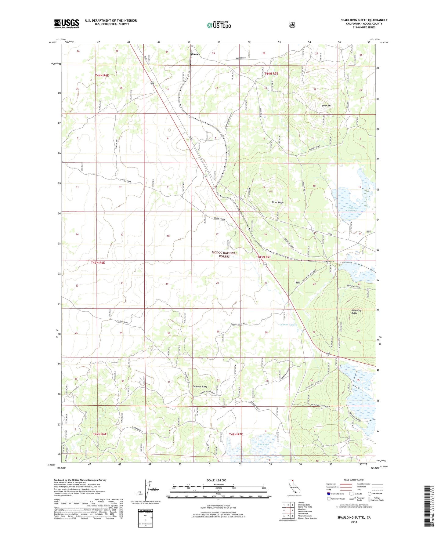
Spaulding Butte California US Topo Map
Couldn't load pickup availability
Also explore the Spaulding Butte Forest Service Topo of this same quad for updated USFS data
2022 topographic map quadrangle Spaulding Butte in the state of California. Scale: 1:24000. Based on the newly updated USGS 7.5' US Topo map series, this map is in the following counties: Modoc. The map contains contour data, water features, and other items you are used to seeing on USGS maps, but also has updated roads and other features. This is the next generation of topographic maps. Printed on high-quality waterproof paper with UV fade-resistant inks.
Quads adjacent to this one:
West: Kephart
Northwest: Perez
North: Rimrock Lake
Northeast: Lone Pine Butte
East: Knobcone Butte
Southeast: Happy Camp Mountain
South: Crank Mountain
Southwest: Hollenbeck
This map covers the same area as the classic USGS quad with code o41121e2.
Contains the following named places: Cannon Tank, Damons Butte, Deer Hill, Hackamore Reservoir, Hackamore Reservoir Dam, Henski Reservoir, Meares, Plum Ridge, Spaulding 3 Dam, Spaulding Butte, Spaulding Reservoir, Upper Mud Lake, Whitney Reservoir