MyTopo
Holtville NE California US Topo Map
Couldn't load pickup availability
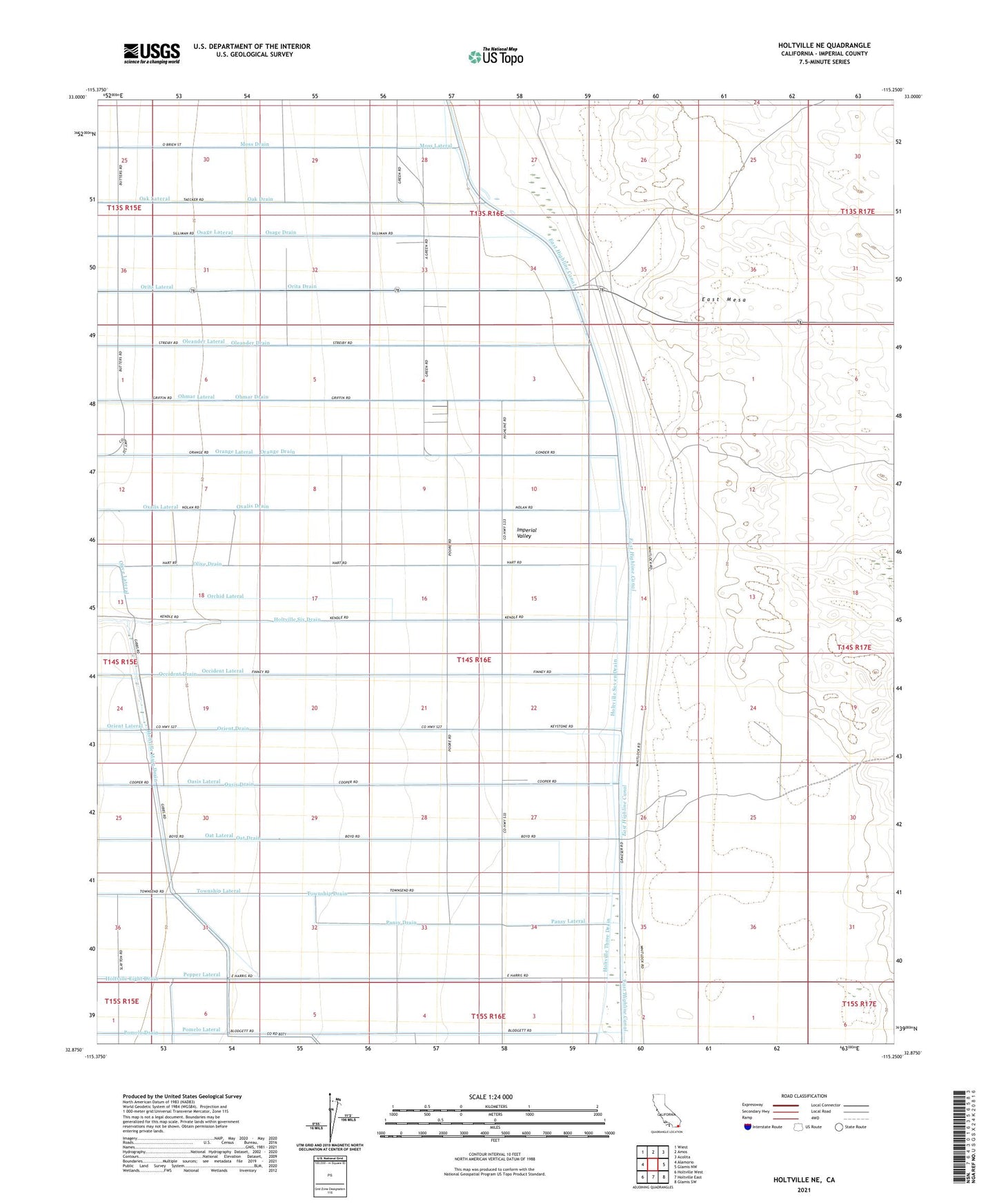
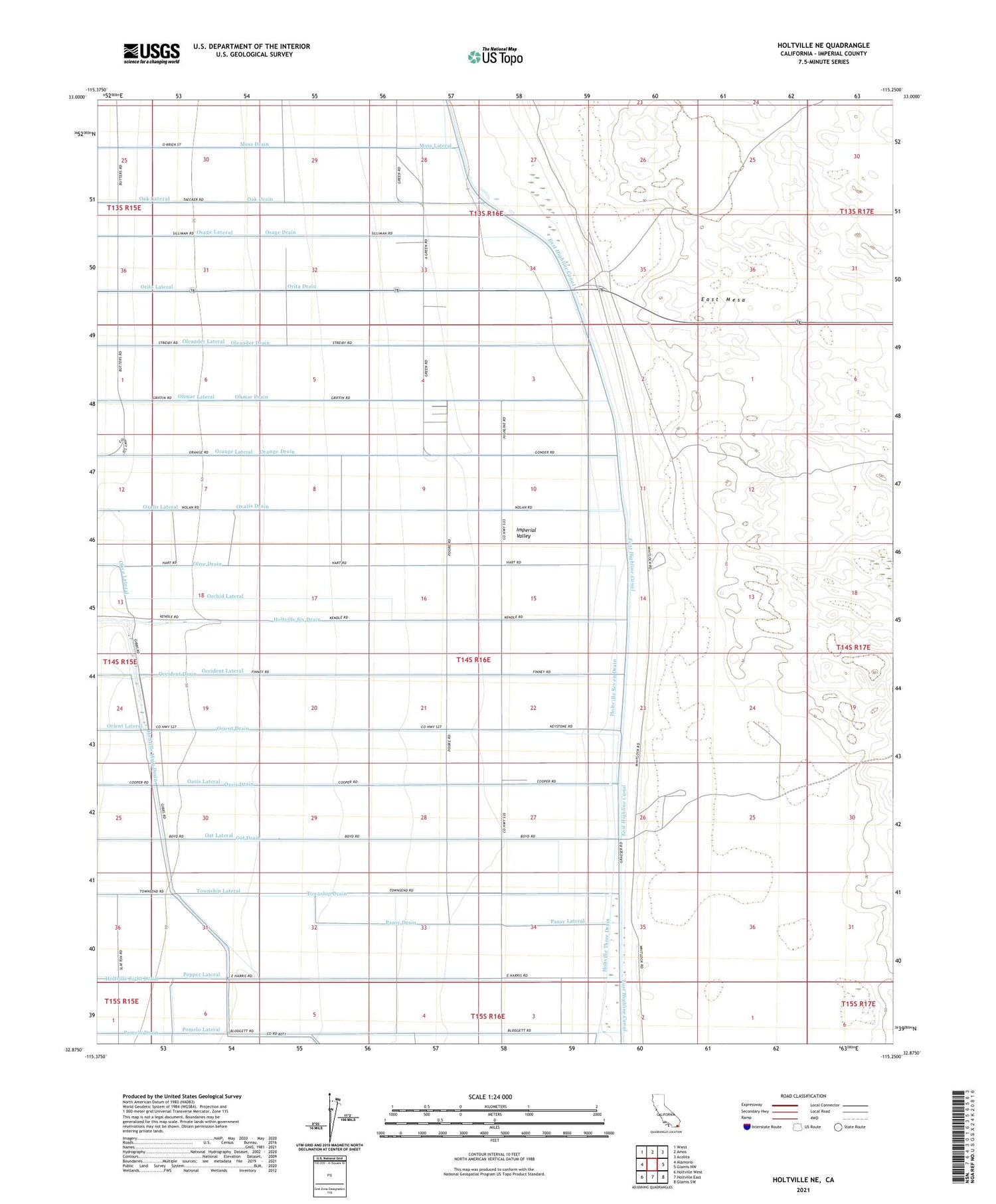
2021 topographic map quadrangle Holtville NE in the state of California. Scale: 1:24000. Based on the newly updated USGS 7.5' US Topo map series, this map is in the following counties: Imperial. The map contains contour data, water features, and other items you are used to seeing on USGS maps, but also has updated roads and other features. This is the next generation of topographic maps. Printed on high-quality waterproof paper with UV fade-resistant inks.
Quads adjacent to this one:
West: Alamorio
Northwest: Wiest
North: Amos
Northeast: Acolita
East: Glamis NW
Southeast: Glamis SW
South: Holtville East
Southwest: Holtville West
This map covers the same area as the classic USGS quad with code o32115h3.
Contains the following named places: Highline School, Holtville Eight Drain, Holtville Main Drain, Holtville Seven Drain, Holtville Six Drain, Holtville Three Drain, Oak Drain, Oak Lateral, Oasis Drain, Oasis Lateral, Oat Drain, Oat Lateral, Occident Drain, Occident Lateral, Ohmar Drain, Ohmar Lateral, Oleander Drain, Oleander Lateral, Olive Drain, Orange Drain, Orange Lateral, Orchid Lateral, Orient Drain, Orient Lateral, Orita Drain, Orita Lateral, Osage Drain, Osage Lateral, Oxalis Drain, Oxalis Lateral, Pansy Drain, Pansy Lateral, Pepper Drain, Pepper Lateral, Pomelo Lateral, Township Drain, Township Lateral, ZIP Code: 92227