MyTopo
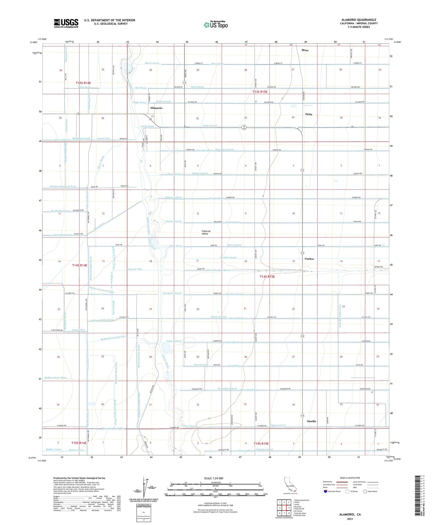
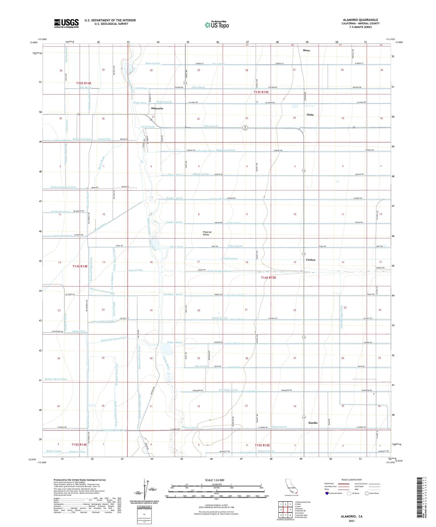
Alamorio California US Topo Map
Couldn't load pickup availability
2021 topographic map quadrangle Alamorio in the state of California. Scale: 1:24000. Based on the newly updated USGS 7.5' US Topo map series, this map is in the following counties: Imperial. The map contains contour data, water features, and other items you are used to seeing on USGS maps, but also has updated roads and other features. This is the next generation of topographic maps. Printed on high-quality waterproof paper with UV fade-resistant inks.
Quads adjacent to this one:
West: Brawley
Northwest: Westmorland East
North: Wiest
Northeast: Amos
East: Holtville NE
Southeast: Holtville East
South: Holtville West
Southwest: El Centro
This map covers the same area as the classic USGS quad with code o32115h4.
Contains the following named places: Alamorio, Brawley Division, Bryant Drain, Bryant Drain One, Curlew, De Moulin Drain, Lateral Eight, Lateral Eight-A, Lateral Five, Lateral Nine, Lateral One, Lateral Six, Lateral Two, Magnolia Union Elementary School, Mesquite Drain, Mesquite Drain One, Mesquite Drain Two, Moss, Moss Drain, Moss Lateral, Olive Lateral, Orita, Pine Elementary School, Pomelo Drain, Redwood Eight Drain, Redwood Five Drain, Redwood Four Drain, Redwood Lateral Eight, Redwood Lateral Five, Redwood Lateral Four, Redwood Lateral Three, Redwood Nine Drain, Redwood Nine-A Drain, Rockwood Lateral Four, Rose Mesquite School, Rose Outlet, Rubber Canal, Rubber Drain Three, Rubber Drain Two, Rubber Lateral, Sandia, Stevens Drain, Sunset Springs School, Wills Drain, Wills Drain One, Wills Drain Two, Wores Drain