MyTopo
Inwood California US Topo Map
Couldn't load pickup availability
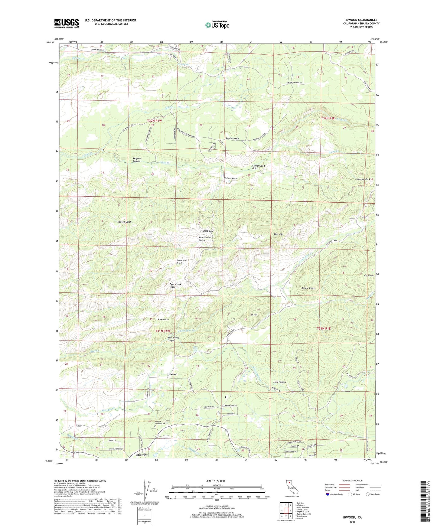
2022 topographic map quadrangle Inwood in the state of California. Scale: 1:24000. Based on the newly updated USGS 7.5' US Topo map series, this map is in the following counties: Shasta. The map contains contour data, water features, and other items you are used to seeing on USGS maps, but also has updated roads and other features. This is the next generation of topographic maps. Printed on high-quality waterproof paper with UV fade-resistant inks.
Quads adjacent to this one:
West: Clough Gulch
Northwest: Oak Run
North: Whitmore
Northeast: Miller Mountain
East: Hagaman Gulch
Southeast: Manton
South: Shingletown
Southwest: Tuscan Buttes NE
This map covers the same area as the classic USGS quad with code o40121e8.
Contains the following named places: Alamine Peak, Bear Creek Falls, Bear Creek Ridge, Black Butte Elementary School, Blue Mountain, Bonnie Craigs, Clover Creek School, Cottonwood Gulch, Di Hill, Fern Spring, Fluhart Basin, Fluhart Gap, Hamp Creek, Inwood, Inwood School, Long Hollow, Midway, Mill Creek, Mill Creek School, North Fork Bear Creek, Ogburn Inwood Cemetery, Pine Basin, Redwoods, Snow Creek, South Fork Bear Creek, Whitmore Census Designated Place, Witherow Ranch, ZIP Code: 96088