MyTopo
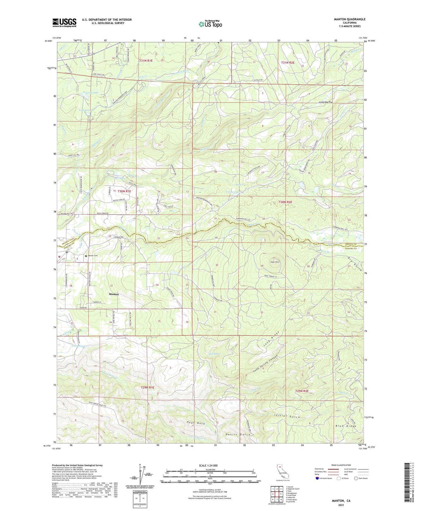
Manton California US Topo Map
Couldn't load pickup availability
Also explore the Manton Forest Service Topo of this same quad for updated USFS data
2023 topographic map quadrangle Manton in the state of California. Scale: 1:24000. Based on the newly updated USGS 7.5' US Topo map series, this map is in the following counties: Shasta, Tehama. The map contains contour data, water features, and other items you are used to seeing on USGS maps, but also has updated roads and other features. This is the next generation of topographic maps. Printed on high-quality waterproof paper with UV fade-resistant inks.
Quads adjacent to this one:
West: Shingletown
Northwest: Inwood
North: Hagaman Gulch
Northeast: Viola
East: Grays Peak
Southeast: Lyonsville
South: Finley Butte
Southwest: Inskip Hill
This map covers the same area as the classic USGS quad with code o40121d7.
Contains the following named places: Bailey Creek, Berry Creek, Bluff Springs, Brush Creek, Camp Digger Butte, Canyon Creek, Carobe Lake, Cross Country Ditch, Devils Gulch, Digger Butte, Dry Gulch, Grace Lake, Hogs Back, Keswick Ditch, Long Hay Flat, Long Ridge, Love Branch, Manton, Manton Cemetery, Manton Census Designated Place, Manton Elementary School, Manton Fire Control Station, Manton Post Office, Nora Lake, Null 1221 Dam, Rock Creek, Rockland School, Sand Spring Canyon, Sierra School, Soap Creek, Spring Creek, Tehama County Fire Department Station 18 Manton, The Burn, Union Canal, Volta Powerhouse, ZIP Code: 96059