MyTopo
Whitmore California US Topo Map
Couldn't load pickup availability
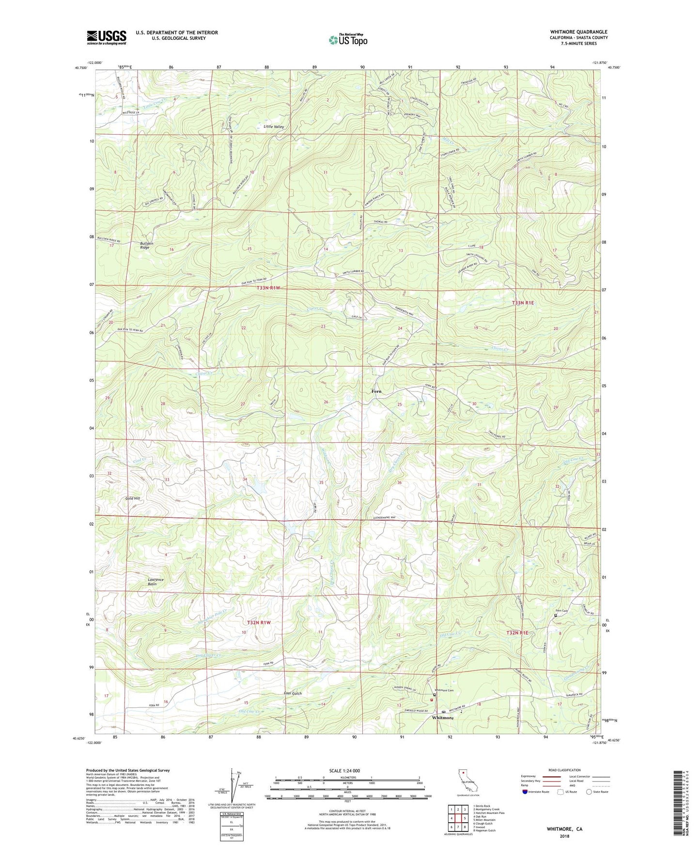
2022 topographic map quadrangle Whitmore in the state of California. Scale: 1:24000. Based on the newly updated USGS 7.5' US Topo map series, this map is in the following counties: Shasta. The map contains contour data, water features, and other items you are used to seeing on USGS maps, but also has updated roads and other features. This is the next generation of topographic maps. Printed on high-quality waterproof paper with UV fade-resistant inks.
Quads adjacent to this one:
West: Oak Run
Northwest: Devils Rock
North: Montgomery Creek
Northeast: Hatchet Mountain Pass
East: Miller Mountain
Southeast: Hagaman Gulch
South: Inwood
Southwest: Clough Gulch
This map covers the same area as the classic USGS quad with code o40121f8.
Contains the following named places: 2 S Ranch 3220 Dam, Buckhorn Forest Fire Station, Bullskin Ridge, Central Shasta Division, Coal Gulch, Fern, Fern Cemetery, Glendenning Creek, Gold Hill, Junge Number 2 2225 Dam, Junge Number 3 2225-002 Dam, Kilarc Powerhouse, Lawrence Basin, Little Valley, Phillips School, Silver Creek, Slaughter Pole Creek, Twin Valley School, Whitmore, Whitmore Cemetery, Whitmore Elementary School, Whitmore Forest Fire Station, Whitmore Post Office, Whitmore Volunteer Fire Company Station 31, Wildcat Creek