MyTopo
Inyokern SE California US Topo Map
Couldn't load pickup availability
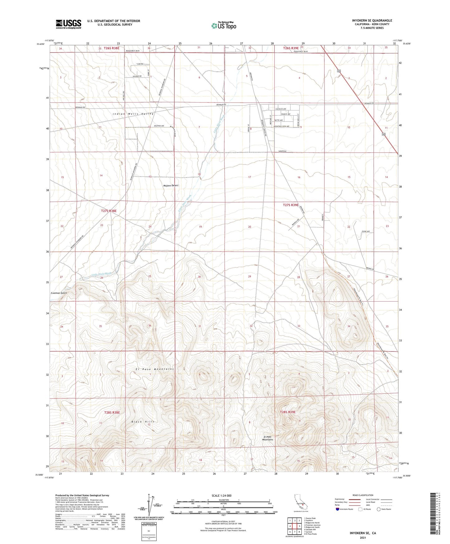
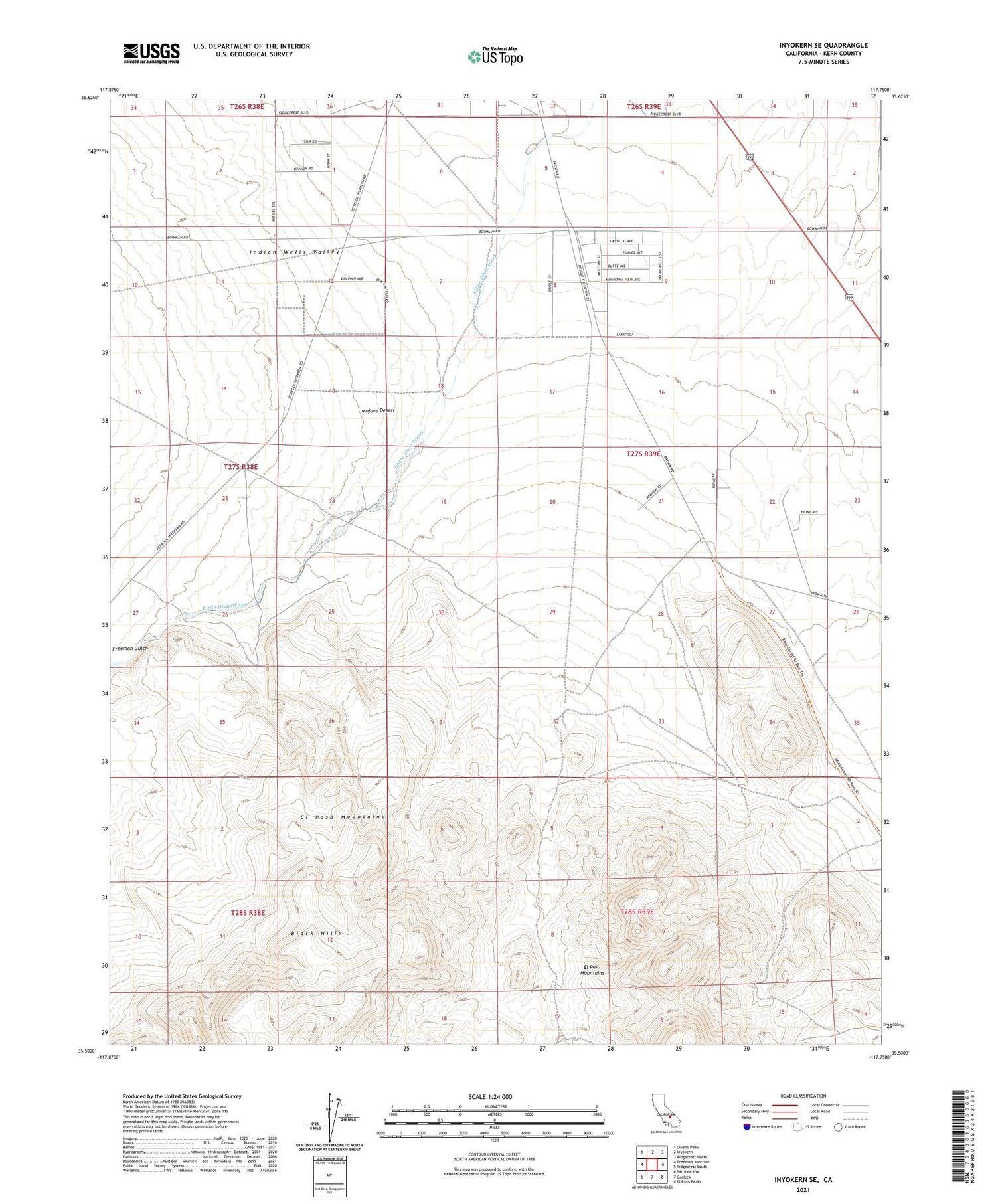
2021 topographic map quadrangle Inyokern SE in the state of California. Scale: 1:24000. Based on the newly updated USGS 7.5' US Topo map series, this map is in the following counties: Kern. The map contains contour data, water features, and other items you are used to seeing on USGS maps, but also has updated roads and other features. This is the next generation of topographic maps. Printed on high-quality waterproof paper with UV fade-resistant inks.
Quads adjacent to this one:
West: Freeman Junction
Northwest: Owens Peak
North: Inyokern
Northeast: Ridgecrest North
East: Ridgecrest South
Southeast: El Paso Peaks
South: Garlock
Southwest: Saltdale NW
This map covers the same area as the classic USGS quad with code o35117e7.
Contains the following named places: El Paso Mountains Wilderness, Inyo Well, Inyokern Cinder Pit, Terese