
MyTopo
Owens Peak California US Topo Map
Couldn't load pickup availability
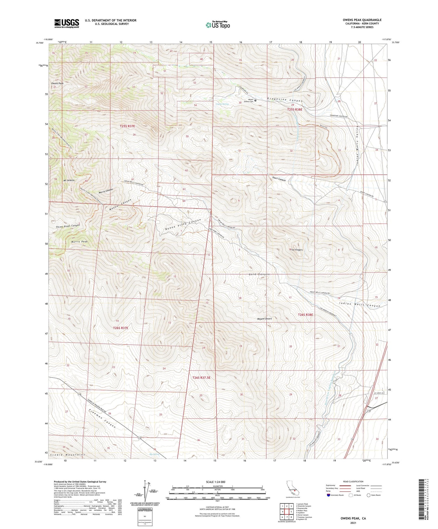
2021 topographic map quadrangle Owens Peak in the state of California. Scale: 1:24000. Based on the newly updated USGS 7.5' US Topo map series, this map is in the following counties: Kern. The map contains contour data, water features, and other items you are used to seeing on USGS maps, but also has updated roads and other features. This is the next generation of topographic maps. Printed on high-quality waterproof paper with UV fade-resistant inks.
Quads adjacent to this one:
West: Walker Pass
Northwest: Lamont Peak
North: Ninemile Canyon
Northeast: Pearsonville
East: Inyokern
Southeast: Inyokern SE
South: Freeman Junction
Southwest: Horse Canyon
This map covers the same area as the classic USGS quad with code o35117f8.
Contains the following named places: Big Spring, Buena Vista Canyon, Coyote Spring, Five Fingers, Gold Canyon, Grapevine Canyon, Los Angeles Aqueduct, Manuel Canyon, Morris Canyon, Morris Peak, Mount Jenkins, Mount Owens Cemetery, Owens Peak, Owens Peak Wilderness, Powers Well, Short Canyon, Tungsten Peak Mine, Walker Well


