
MyTopo
Ivanpah California US Topo Map
Couldn't load pickup availability
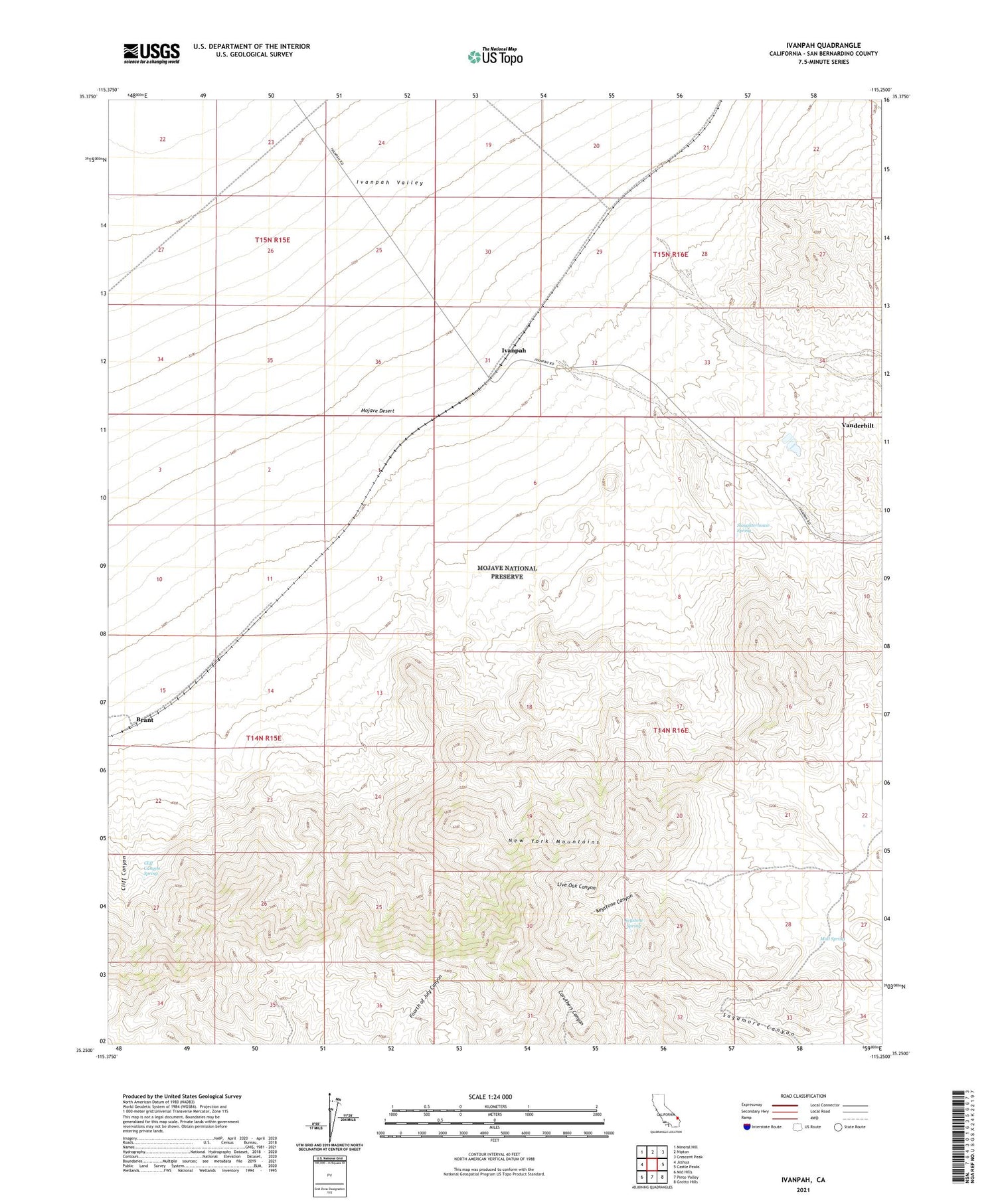
2021 topographic map quadrangle Ivanpah in the state of California. Scale: 1:24000. Based on the newly updated USGS 7.5' US Topo map series, this map is in the following counties: San Bernardino. The map contains contour data, water features, and other items you are used to seeing on USGS maps, but also has updated roads and other features. This is the next generation of topographic maps. Printed on high-quality waterproof paper with UV fade-resistant inks.
Quads adjacent to this one:
West: Joshua
Northwest: Mineral Hill
North: Nipton
Northeast: Crescent Peak
East: Castle Peaks
Southeast: Grotto Hills
South: Pinto Valley
Southwest: Mid Hills
This map covers the same area as the classic USGS quad with code o35115c3.
Contains the following named places: Boomerang Mine, Brant, Cliff Canyon, Cliff Canyon Spring, Fourteenmile Tank, Giant Ledge Mine, Gold Bar Portal, Ivanpah, Keystone Canyon, Keystone Spring, Lecyr Well, Live Oak Canyon, Mail Spring, Sagamore Mine, Slaughterhouse Spring, Trio Mines, Vanderbilt


