MyTopo
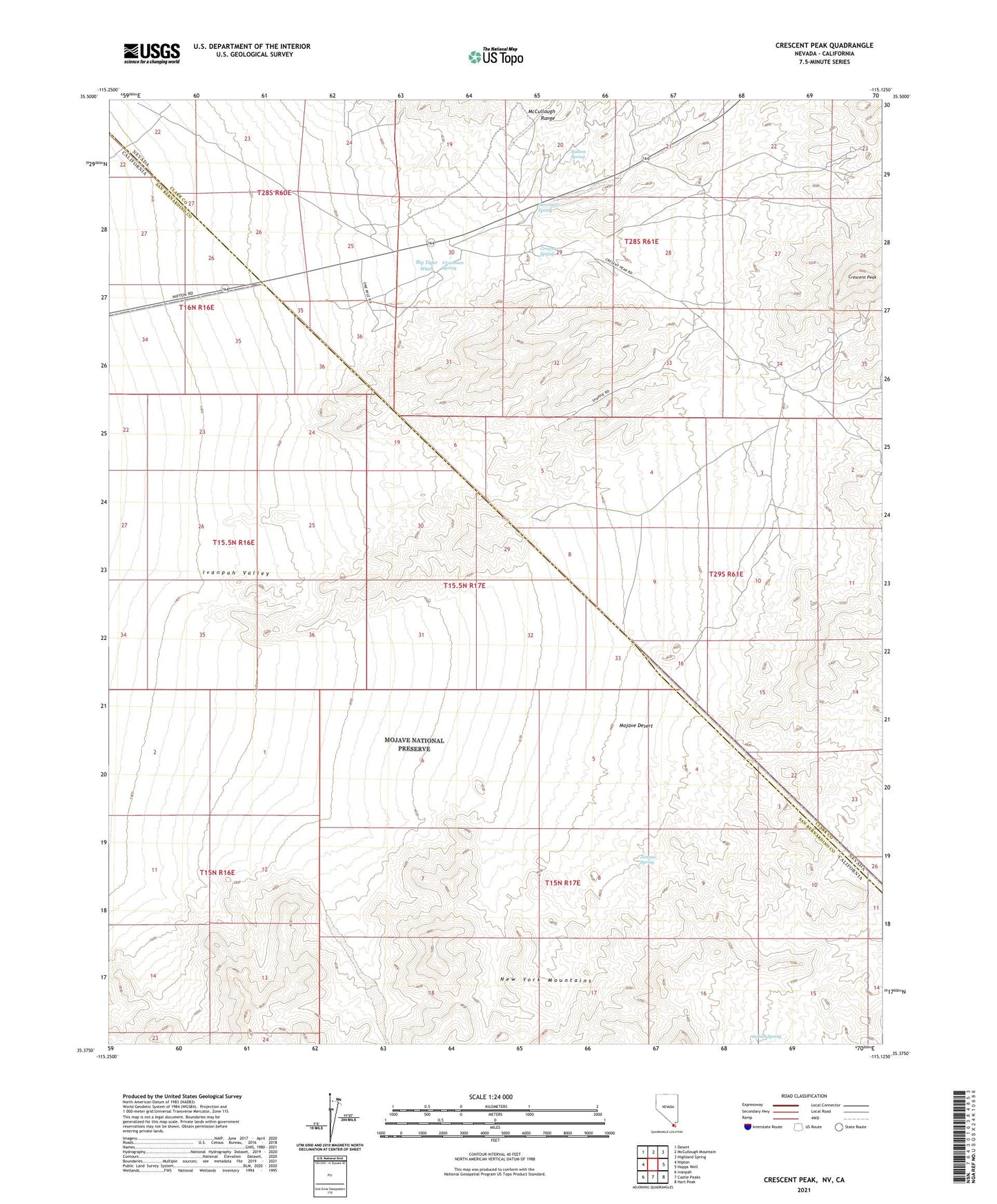
Crescent Peak Nevada US Topo Map
Couldn't load pickup availability
2021 topographic map quadrangle Crescent Peak in the states of California, Nevada. Scale: 1:24000. Based on the newly updated USGS 7.5' US Topo map series, this map is in the following counties: Clark, San Bernardino. The map contains contour data, water features, and other items you are used to seeing on USGS maps, but also has updated roads and other features. This is the next generation of topographic maps. Printed on high-quality waterproof paper with UV fade-resistant inks.
Quads adjacent to this one:
West: Nipton
Northwest: Desert
North: McCullough Mountain
Northeast: Highland Spring
East: Hopps Well
Southeast: Hart Peak
South: Castle Peaks
Southwest: Ivanpah
This map covers the same area as the classic USGS quad with code o35115d2.
Contains the following named places: Big Tiger Wash, Bullion Spring, Castle Peaks, Crescent, Crescent Mine, Crescent Mining District, Crescent Peak, Crescent Post Office, Crescent Spring, Crippled Jack Well, Crossman Spring, Crossman Well, Golden Calf Mine, Indian Spring, Juniper Spring, Morgan Mine, Nippeno Mill, Nippeno Mine, Nu-Lite Insulated Homes Incorporated Mine, Smithson Phillips Mine, Surveyors Spring, Toltec Mine