MyTopo
Jacks Backbone California US Topo Map
Couldn't load pickup availability
Also explore the Jacks Backbone Forest Service Topo of this same quad for updated USFS data
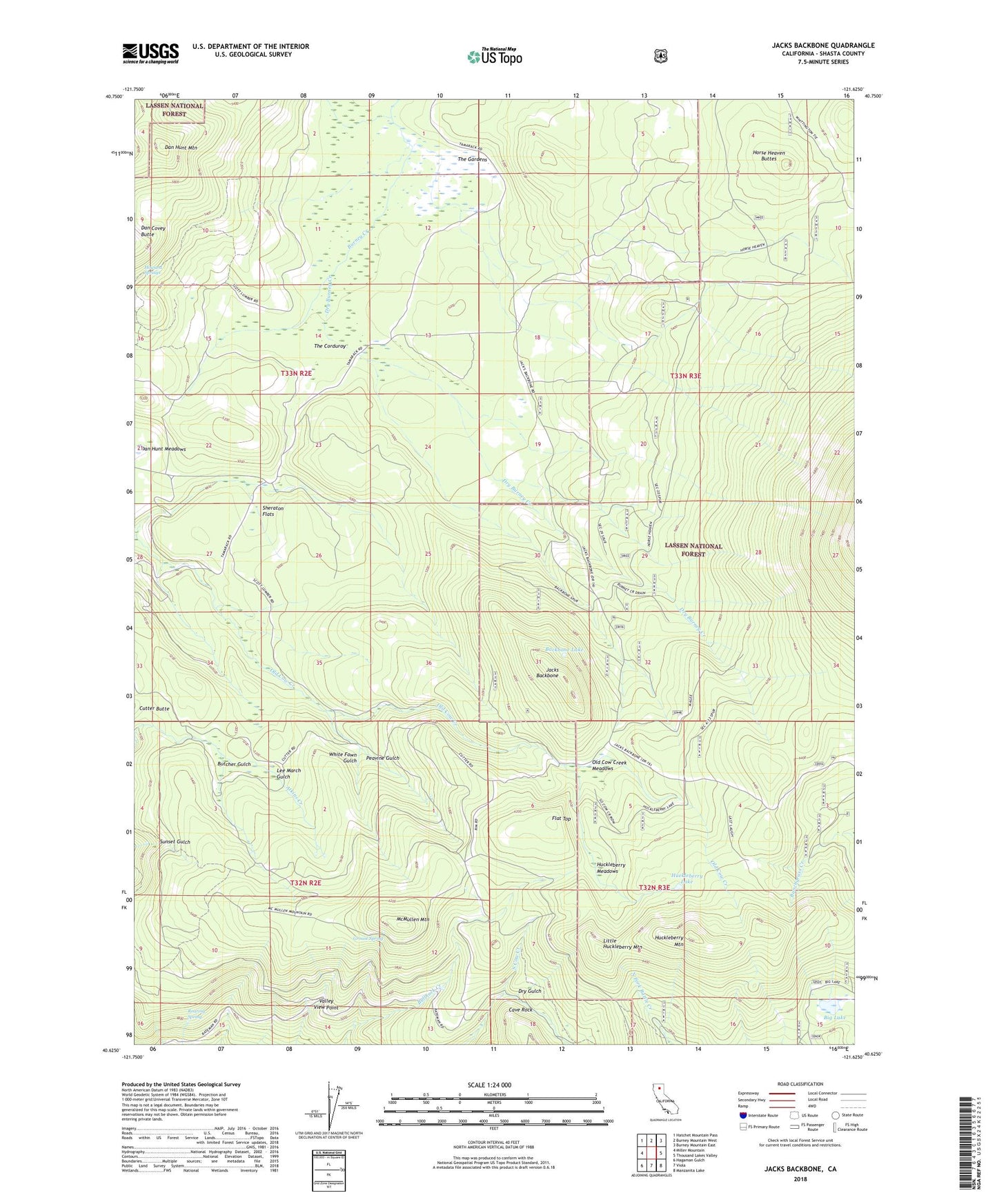
2022 topographic map quadrangle Jacks Backbone in the state of California. Scale: 1:24000. Based on the newly updated USGS 7.5' US Topo map series, this map is in the following counties: Shasta. The map contains contour data, water features, and other items you are used to seeing on USGS maps, but also has updated roads and other features. This is the next generation of topographic maps. Printed on high-quality waterproof paper with UV fade-resistant inks.
Quads adjacent to this one:
West: Miller Mountain
Northwest: Hatchet Mountain Pass
North: Burney Mountain West
Northeast: Burney Mountain East
East: Thousand Lakes Valley
Southeast: Manzanita Lake
South: Viola
Southwest: Hagaman Gulch
This map covers the same area as the classic USGS quad with code o40121f6.
Contains the following named places: Backbone Lake, Beaver Creek, Big Lake, Butcher Gulch, Butcher Gulch Campground, Cave Rock, Cutter Meadows, Cutter Place Campground, Dan Hunt Mountain, Dry Burney Creek, Dry Gulch, Flat Top, Grouse Spring, Horse Heaven Buttes, Howard Springs, Huckleberry Lake, Huckleberry Meadows, Huckleberry Mountain, Jacks Backbone, Latour Demonstration State Forest, Latour Fire Station, Latour Trail, Lee March Gulch, Little Huckleberry Mountain, Lower Plantation, Magee Trailhead, McMullen Mountain, Old Cow Creek Campground, Old Cow Creek Meadows, Peavine Gulch, Roaring Spring, Sheraton Flats, South Cow Creek Meadows, Sunset Loop, The Corduroy, The Gardens, Upper Plantation, Valley View Point, White Fawn Gulch, Whittington Place