MyTopo
Manzanita Lake California US Topo Map
Couldn't load pickup availability
Also explore the Manzanita Lake Forest Service Topo of this same quad for updated USFS data
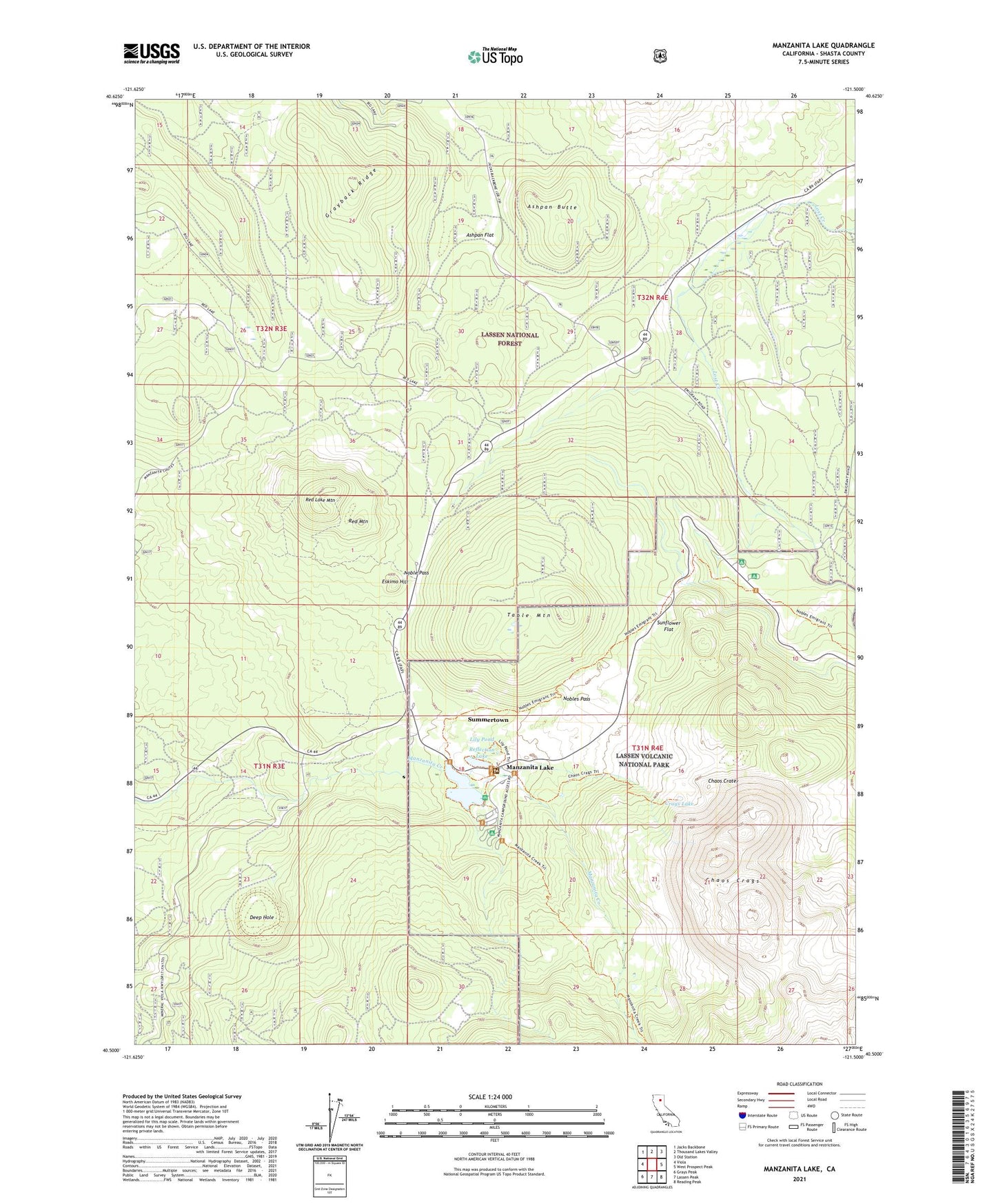
2021 topographic map quadrangle Manzanita Lake in the state of California. Scale: 1:24000. Based on the newly updated USGS 7.5' US Topo map series, this map is in the following counties: Shasta. The map contains contour data, water features, and other items you are used to seeing on USGS maps, but also has updated roads and other features. This is the next generation of topographic maps. Printed on high-quality waterproof paper with UV fade-resistant inks.
Quads adjacent to this one:
West: Viola
Northwest: Jacks Backbone
North: Thousand Lakes Valley
Northeast: Old Station
East: West Prospect Peak
Southeast: Reading Peak
South: Lassen Peak
Southwest: Grays Peak
This map covers the same area as the classic USGS quad with code o40121e5.
Contains the following named places: Ashpan Butte, Ashpan Flat, Ashpan Snowmobile Park, Chaos Crags, Chaos Crags Trail, Chaos Crater, Chaos Jumbles, Crags Campground, Crags Lake, Deep Hole, Dwarf Forest, Eskimo Hill, Grayback Ridge, Interagency Fire and Visitor Center, Lily Pond, Lost Creek Camp, Lost Creek Diversion Flume, Lost Creek Organization Campground, Manzanita Chute, Manzanita Lake, Manzanita Lake Campground, Manzanita Lake Dam, Noble Pass, Nobles Pass, Old Emigrant Trail, Red Lake, Red Lake Mountain, Red Mountain, Reflection Lake, Summertown, Sunflower Flat, Table Mountain, The Plantation