MyTopo
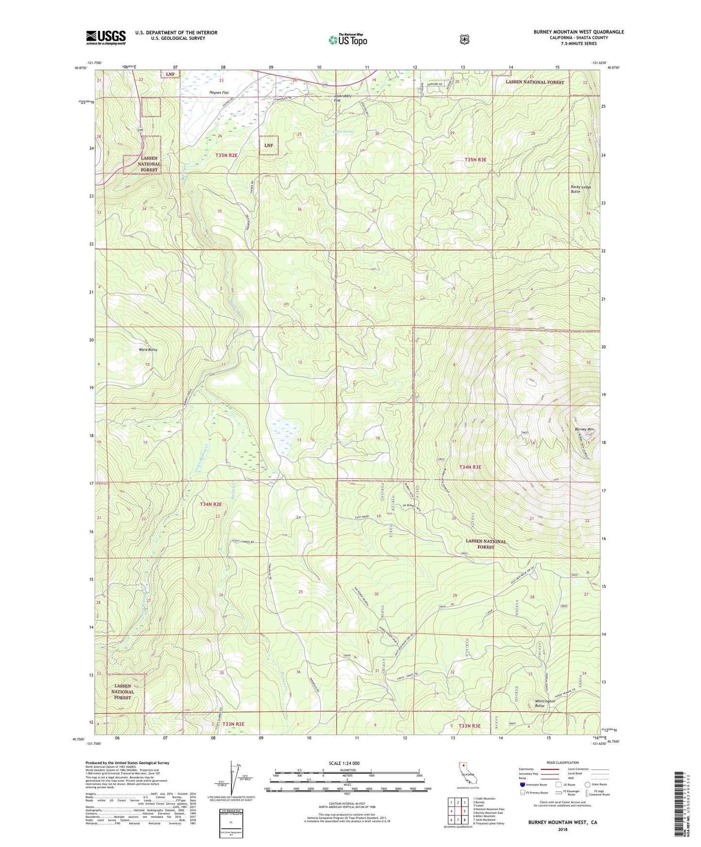
Burney Mountain West California US Topo Map
Couldn't load pickup availability
Also explore the Burney Mountain West Forest Service Topo of this same quad for updated USFS data
2022 topographic map quadrangle Burney Mountain West in the state of California. Scale: 1:24000. Based on the newly updated USGS 7.5' US Topo map series, this map is in the following counties: Shasta. The map contains contour data, water features, and other items you are used to seeing on USGS maps, but also has updated roads and other features. This is the next generation of topographic maps. Printed on high-quality waterproof paper with UV fade-resistant inks.
Quads adjacent to this one:
West: Hatchet Mountain Pass
Northwest: Chalk Mountain
North: Burney
Northeast: Cassel
East: Burney Mountain East
Southeast: Thousand Lakes Valley
South: Jacks Backbone
Southwest: Miller Mountain
This map covers the same area as the classic USGS quad with code o40121g6.
Contains the following named places: Burney Mountain, Dry Lake, Green Burney Creek, Haynes Flat, Indian Spring, Jackrabbit Flat, Old Green Burney Camp, Pit River Trust Land, Rocky Ledge Butte, Ward Butte, Whittington Butte