MyTopo
Keene California US Topo Map
Couldn't load pickup availability
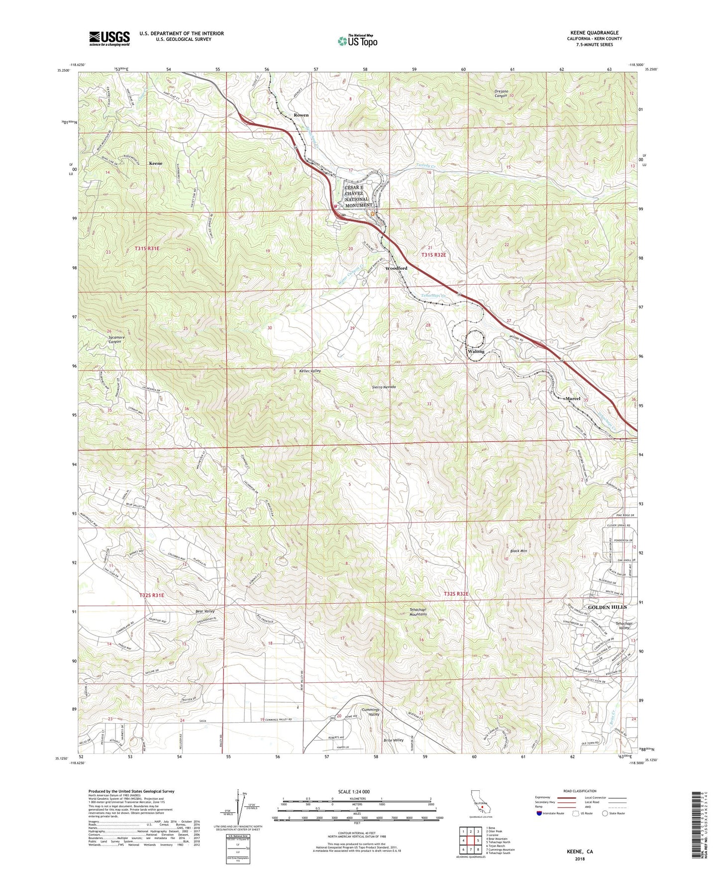
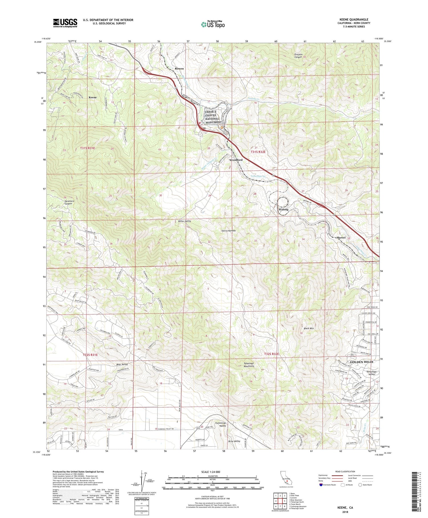
2022 topographic map quadrangle Keene in the state of California. Scale: 1:24000. Based on the newly updated USGS 7.5' US Topo map series, this map is in the following counties: Kern. The map contains contour data, water features, and other items you are used to seeing on USGS maps, but also has updated roads and other features. This is the next generation of topographic maps. Printed on high-quality waterproof paper with UV fade-resistant inks.
Quads adjacent to this one:
West: Bear Mountain
Northwest: Bena
North: Oiler Peak
Northeast: Loraine
East: Tehachapi North
Southeast: Tehachapi South
South: Cummings Mountain
Southwest: Tejon Ranch
This map covers the same area as the classic USGS quad with code o35118b5.
Contains the following named places: Black Mountain, Brite Valley, Cesar E Chavez National Monument, Crofton Ranch, El Rita, Keene, Keene Census Designated Place, Keene Post Office, Keene School, Keller Valley, Kern County Fire Department Station 11 Keene, Kern County Preventorium, Marcel, Rowen, Stonybrook Retreat, Tweedy Creek, Walong, Water Canyon Creek, Woodford, ZIP Code: 93531