MyTopo
Tehachapi South California US Topo Map
Couldn't load pickup availability
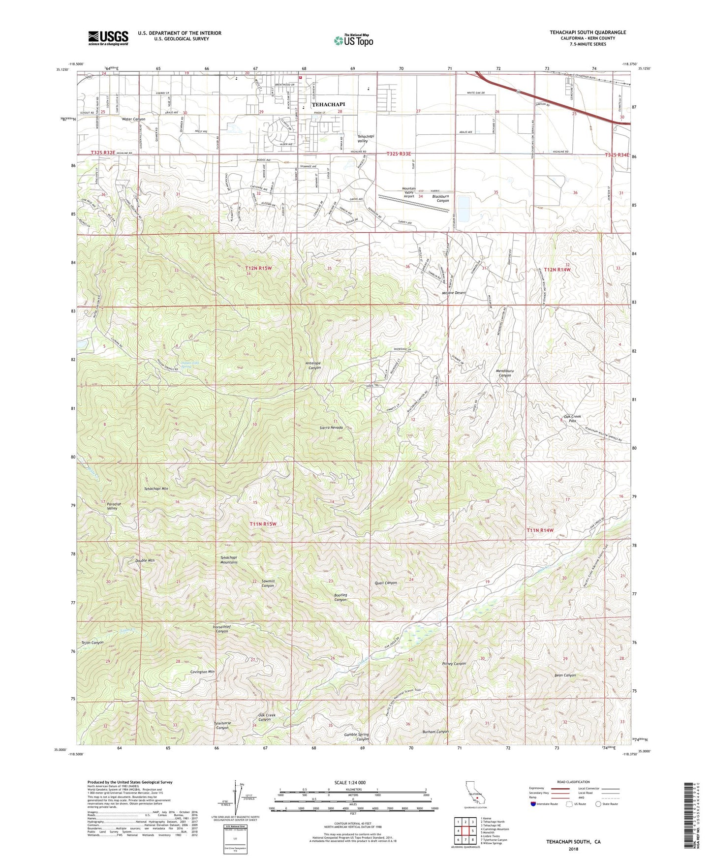
2022 topographic map quadrangle Tehachapi South in the state of California. Scale: 1:24000. Based on the newly updated USGS 7.5' US Topo map series, this map is in the following counties: Kern. The map contains contour data, water features, and other items you are used to seeing on USGS maps, but also has updated roads and other features. This is the next generation of topographic maps. Printed on high-quality waterproof paper with UV fade-resistant inks.
Quads adjacent to this one:
West: Cummings Mountain
Northwest: Keene
North: Tehachapi North
Northeast: Tehachapi NE
East: Monolith
Southeast: Willow Springs
South: Tylerhorse Canyon
Southwest: Liebre Twins
This map covers the same area as the classic USGS quad with code o35118a4.
Contains the following named places: Antelope Canyon, Blackburn Canyon, Bootleg Canyon, Camp Earl-Anna, Church of the Nazarene, Covington Mountain, Double Mountain, Good Samaritan Presbyterian Church, Horsethief Canyon, Indian John Spring, Kern County Fire Department Station 12 Tehachapi, Mendiburu Canyon, Monroe High School, Mountain Meadows, Mountain Meadows Census Designated Place, Mountain Valley Airport, Oak Creek Pass, Overton Ranch, Pitney Canyon, Quail Canyon, Sawmill Canyon, Sherm Chitwood Reservoir, Summit Lime Quarry, Tehachapi Lighthouse United Pentecostal Church, Tehachapi Mountain, Tehachapi Mountain Park, Tompkins Elementary School, Valley Christian Fellowship Church, Water Canyon, ZIP Code: 93561