
MyTopo
Cummings Mountain California US Topo Map
Couldn't load pickup availability
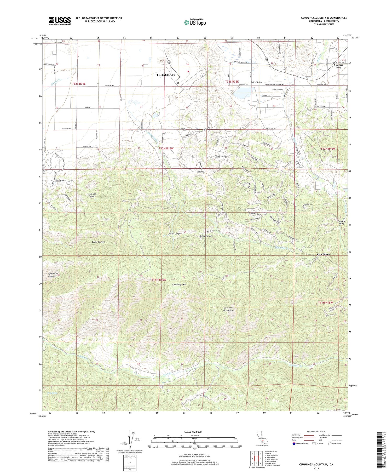
2021 topographic map quadrangle Cummings Mountain in the state of California. Scale: 1:24000. Based on the newly updated USGS 7.5' US Topo map series, this map is in the following counties: Kern. The map contains contour data, water features, and other items you are used to seeing on USGS maps, but also has updated roads and other features. This is the next generation of topographic maps. Printed on high-quality waterproof paper with UV fade-resistant inks.
Quads adjacent to this one:
West: Tejon Ranch
Northwest: Bear Mountain
North: Keene
Northeast: Tehachapi North
East: Tehachapi South
Southeast: Tylerhorse Canyon
South: Liebre Twins
Southwest: Winters Ridge
This map covers the same area as the classic USGS quad with code o35118a5.
Contains the following named places: Brite Valley 1083 Dam, Browning Ranch, California Correctional Institute, California Correctional Institution, California Correctional Institution Fire Department Station 916, Cummings Creek, Cummings Mountain, Cummings Ranch, Cummings Valley School, El Arroyo de los Encinos, Five Points, Grand Oaks Ranch, Indian Hill Ranch, Indian Hill Ranch Campground, Live Oak Canyon, Paradise Valley, PSK Ranch Airport, Spring Valley Farm, Stag Spring, Tehachapi Division, Tejon Canyon School, Water Canyon


