MyTopo
San Joaquin California US Topo Map
Couldn't load pickup availability
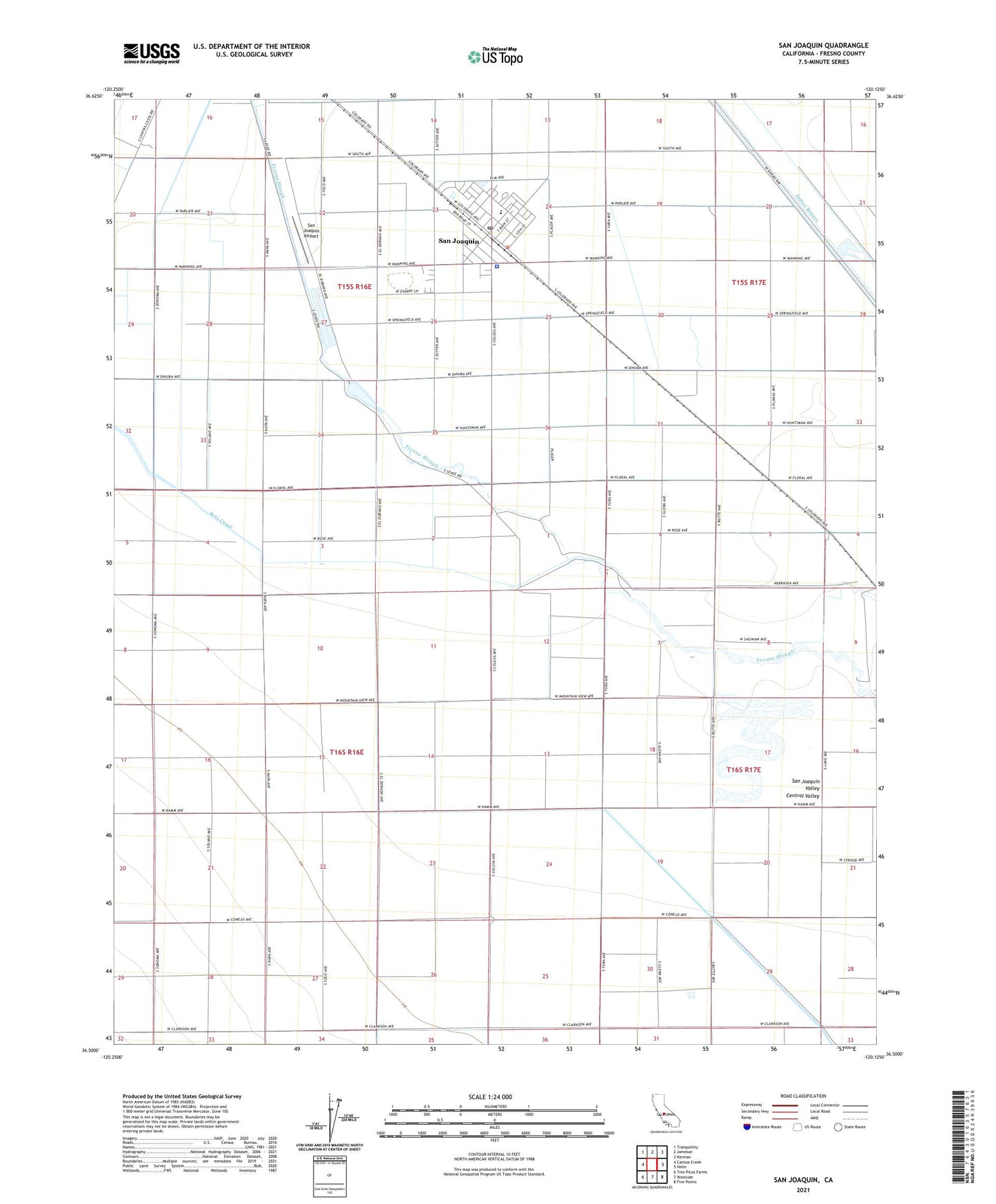
2021 topographic map quadrangle San Joaquin in the state of California. Scale: 1:24000. Based on the newly updated USGS 7.5' US Topo map series, this map is in the following counties: Fresno. The map contains contour data, water features, and other items you are used to seeing on USGS maps, but also has updated roads and other features. This is the next generation of topographic maps. Printed on high-quality waterproof paper with UV fade-resistant inks.
Quads adjacent to this one:
West: Cantua Creek
Northwest: Tranquillity
North: Jamesan
Northeast: Kerman
East: Helm
Southeast: Five Points
South: Westside
Southwest: Tres Picos Farms
This map covers the same area as the classic USGS quad with code o36120e2.
Contains the following named places: Beta Canal, Caldwell, City of San Joaquin, Fresno County Sheriff's Office Substation, Mud 1085 Dam, San Joaquin, San Joaquin Airport, San Joaquin City Hall, San Joaquin City Park, San Joaquin Elementary School, San Joaquin Post Office, San Joaquin Substation, San Joaquin-Tranquillity Division, ZIP Code: 93660