MyTopo
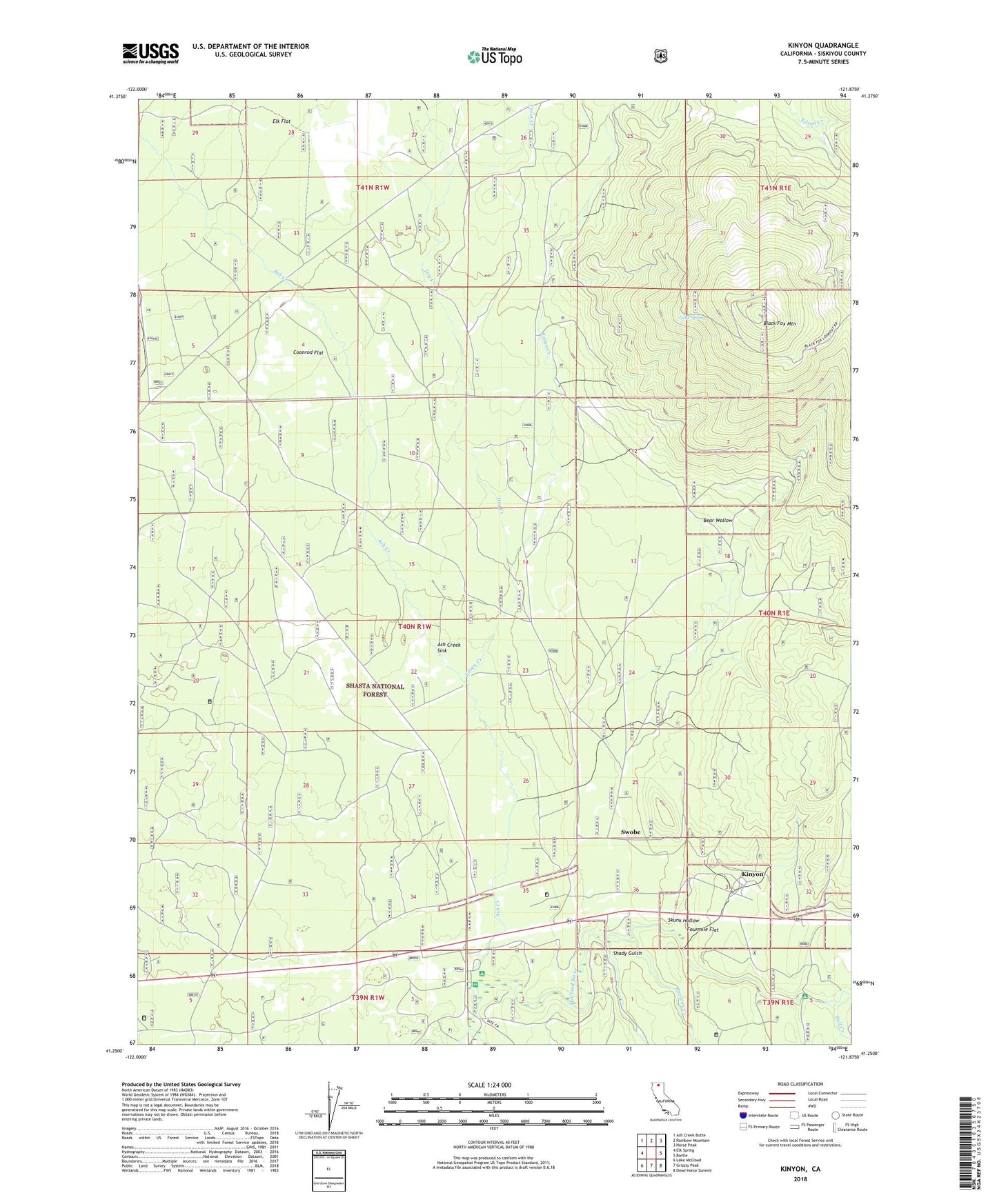
Kinyon California US Topo Map
Couldn't load pickup availability
Also explore the Kinyon Forest Service Topo of this same quad for updated USFS data
2021 topographic map quadrangle Kinyon in the state of California. Scale: 1:24000. Based on the newly updated USGS 7.5' US Topo map series, this map is in the following counties: Siskiyou. The map contains contour data, water features, and other items you are used to seeing on USGS maps, but also has updated roads and other features. This is the next generation of topographic maps. Printed on high-quality waterproof paper with UV fade-resistant inks.
Quads adjacent to this one:
West: Elk Spring
Northwest: Ash Creek Butte
North: Rainbow Mountain
Northeast: Horse Peak
East: Bartle
Southeast: Dead Horse Summit
South: Grizzly Peak
Southwest: Lake McCloud
This map covers the same area as the classic USGS quad with code o41121c8.
Contains the following named places: Algoma, Ash Creek, Ash Creek Forest Service Station, Ash Creek Sink, Ash Creek Station, Bear Wallow, Black Fox Mountain, Bull Creek, Coonrod Flat, Dry Creek, Edson Creek, Elk Flat, Fourmile Flat, Kinyon, Little Spring, Mount Shasta Nursery, Nitwit Camp, Pilgrim Creek Experimental Station, Raccoon Creek, Shady Gulch, Skunk Hollow, Swobe, Tate Creek, Trout Creek, United States Forest Service Ash Creek Forest Service Station, ZIP Code: 96057