MyTopo
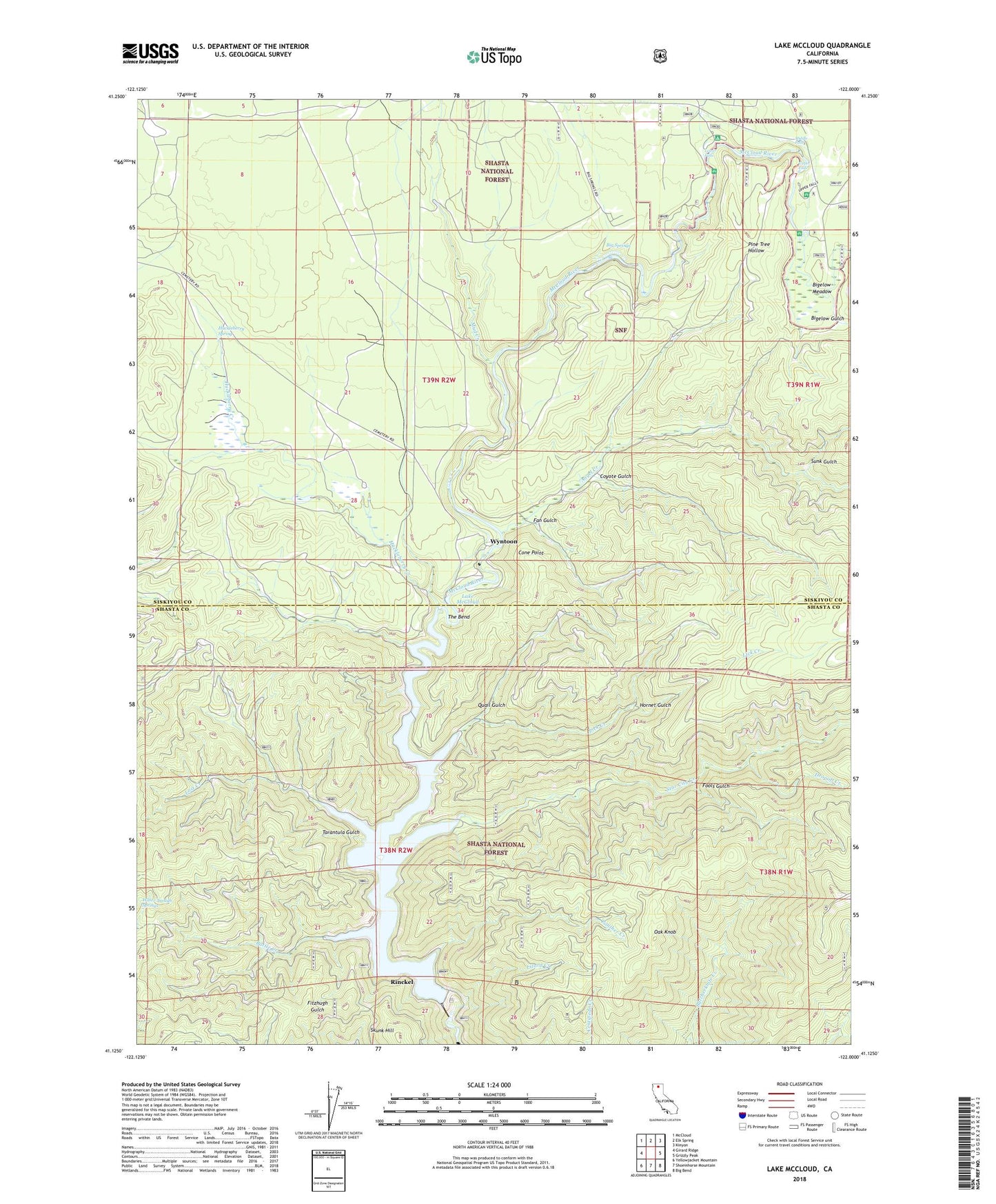
Lake McCloud California US Topo Map
Couldn't load pickup availability
Also explore the Lake McCloud Forest Service Topo of this same quad for updated USFS data
2022 topographic map quadrangle Lake McCloud in the state of California. Scale: 1:24000. Based on the newly updated USGS 7.5' US Topo map series, this map is in the following counties: Siskiyou, Shasta. The map contains contour data, water features, and other items you are used to seeing on USGS maps, but also has updated roads and other features. This is the next generation of topographic maps. Printed on high-quality waterproof paper with UV fade-resistant inks.
Quads adjacent to this one:
West: Girard Ridge
Northwest: McCloud
North: Elk Spring
Northeast: Kinyon
East: Grizzly Peak
Southeast: Big Bend
South: Shoeinhorse Mountain
Southwest: Yellowjacket Mountain
This map covers the same area as the classic USGS quad with code o41122b1.
Contains the following named places: Angel Creek, Battle Creek, Big Springs, Bigelow Gulch, Bigelow Meadow, Cone Point, Coyote Gulch, Dropoff Creek, Fan Gulch, Fools Gulch, Fowlers Campground, Hornet Gulch, Huckleberry Creek, Huckleberry Spring, Lake McCloud, Lake McCloud Boat Launching Ramp, Lakin Dam, Lick Creek, Lizard Creek, Lost Creek, Lower Falls, Lower Falls Picnic Site, McCloud 97-123 Dam, Middle Falls, Mud Creek, Oak Knob, Panther Creek, Pine Tree Hollow, Quail Gulch, Rinckel, Skunk Hill, Star City Creek, Sunk Gulch, Tarantula Gulch, The Bend, Upper Falls, Water Trough Springs, Wyntoon