MyTopo
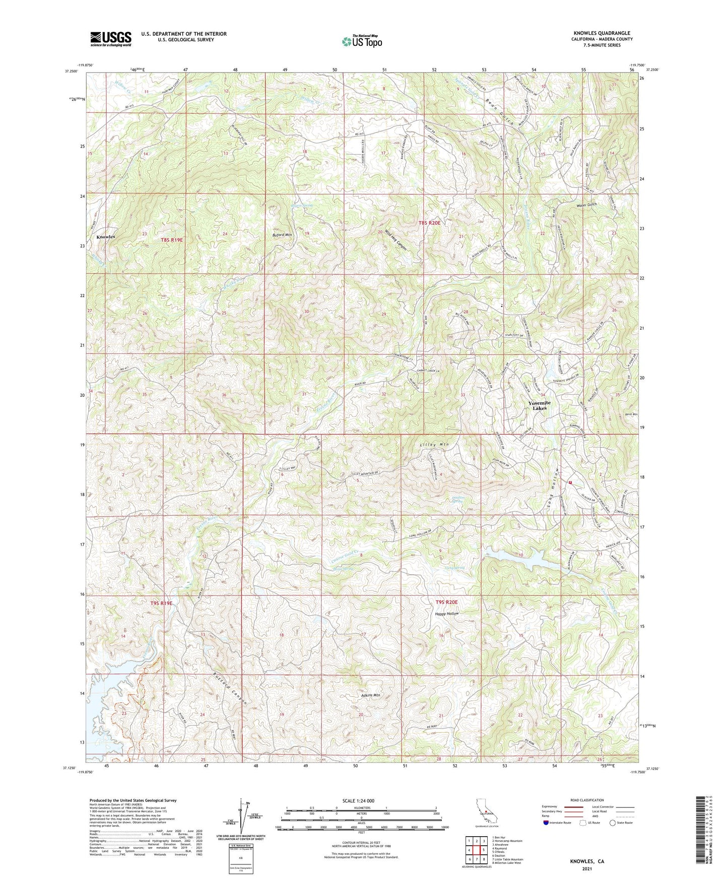
Knowles California US Topo Map
Couldn't load pickup availability
Also explore the Knowles Forest Service Topo of this same quad for updated USFS data
2021 topographic map quadrangle Knowles in the state of California. Scale: 1:24000. Based on the newly updated USGS 7.5' US Topo map series, this map is in the following counties: Madera. The map contains contour data, water features, and other items you are used to seeing on USGS maps, but also has updated roads and other features. This is the next generation of topographic maps. Printed on high-quality waterproof paper with UV fade-resistant inks.
Quads adjacent to this one:
West: Raymond
Northwest: Ben Hur
North: Horsecamp Mountain
Northeast: Ahwahnee
Southeast: Millerton Lake West
South: Little Table Mountain
Southwest: Daulton
This map covers the same area as the classic USGS quad with code o37119b7.
Contains the following named places: Adkins Mountain, Ashbrook Creek, Bean Gulch, Black Hawk 687 Dam, Black Hawk Lake, Buford Mountain, Buzzard Canyon, Coarse Gold Creek, Daulton Spring, Dennis School, Eighteenmile House, Fresno Crossing, Happy Hollow, Knowles, Lilley Mountain, Long Hollow, Madera County, Madera County Fire Department Station 10 Yosemite Lake Park Volunteer Fire Department, Madera Quarry, Middle Lake 1681 Dam, Pecan Spring, Polk School, Raymond Quarry, Red Top Lookout, Rogers Spring, Savage Monument, Spangle Gold Creek, Spring 687-002 Dam, Vichy Spring, Water Gulch, Wild Hog Canyon, Yosemite Lakes, Yosemite Lakes Census Designated Place, Yosemite Lakes Division, Yosemite Lakes Golf Course, Yosemite Lakes Park, Zebra Ranch