MyTopo
Horsecamp Mountain California US Topo Map
Couldn't load pickup availability
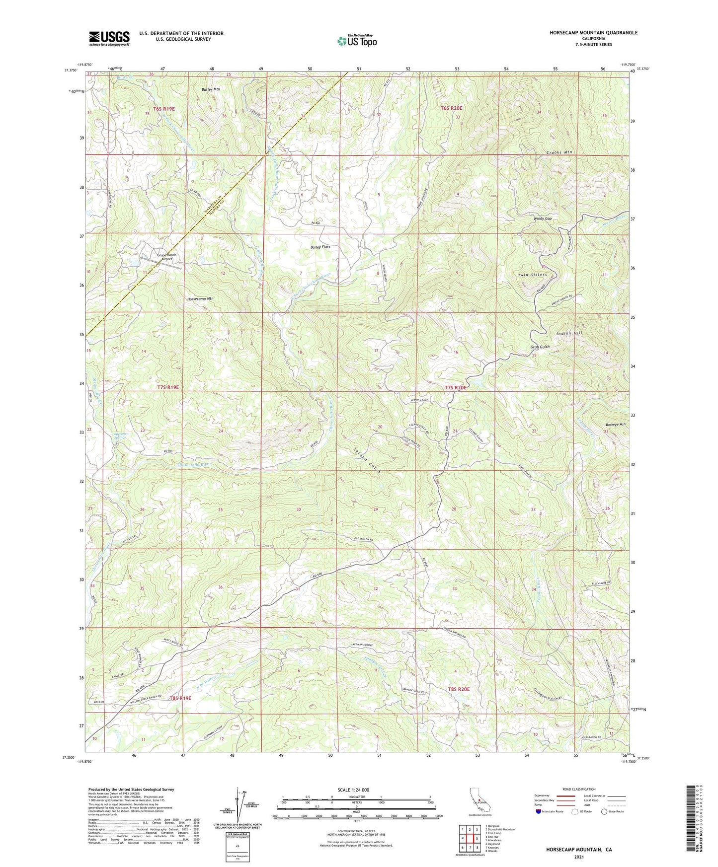
2021 topographic map quadrangle Horsecamp Mountain in the state of California. Scale: 1:24000. Based on the newly updated USGS 7.5' US Topo map series, this map is in the following counties: Madera, Mariposa. The map contains contour data, water features, and other items you are used to seeing on USGS maps, but also has updated roads and other features. This is the next generation of topographic maps. Printed on high-quality waterproof paper with UV fade-resistant inks.
Quads adjacent to this one:
West: Ben Hur
Northwest: Mariposa
North: Stumpfield Mountain
Northeast: Fish Camp
East: Ahwahnee
South: Knowles
Southwest: Raymond
Contains the following named places: Bailey Flat School, Bailey Flats, Blade Creek, Crooks Mountain, East Fork Chowchilla River, Grub Gulch, Grupe Ranch Airport, Horsecamp Mountain, Indian Hill, Leland Gulch, Middle Fork Chowchilla River, North Branch Willow Creek, Specimen Springs, Striped Rock Creek, Summit House, Twin Sisters, West Fork Chowchilla River, Windy Gap