MyTopo
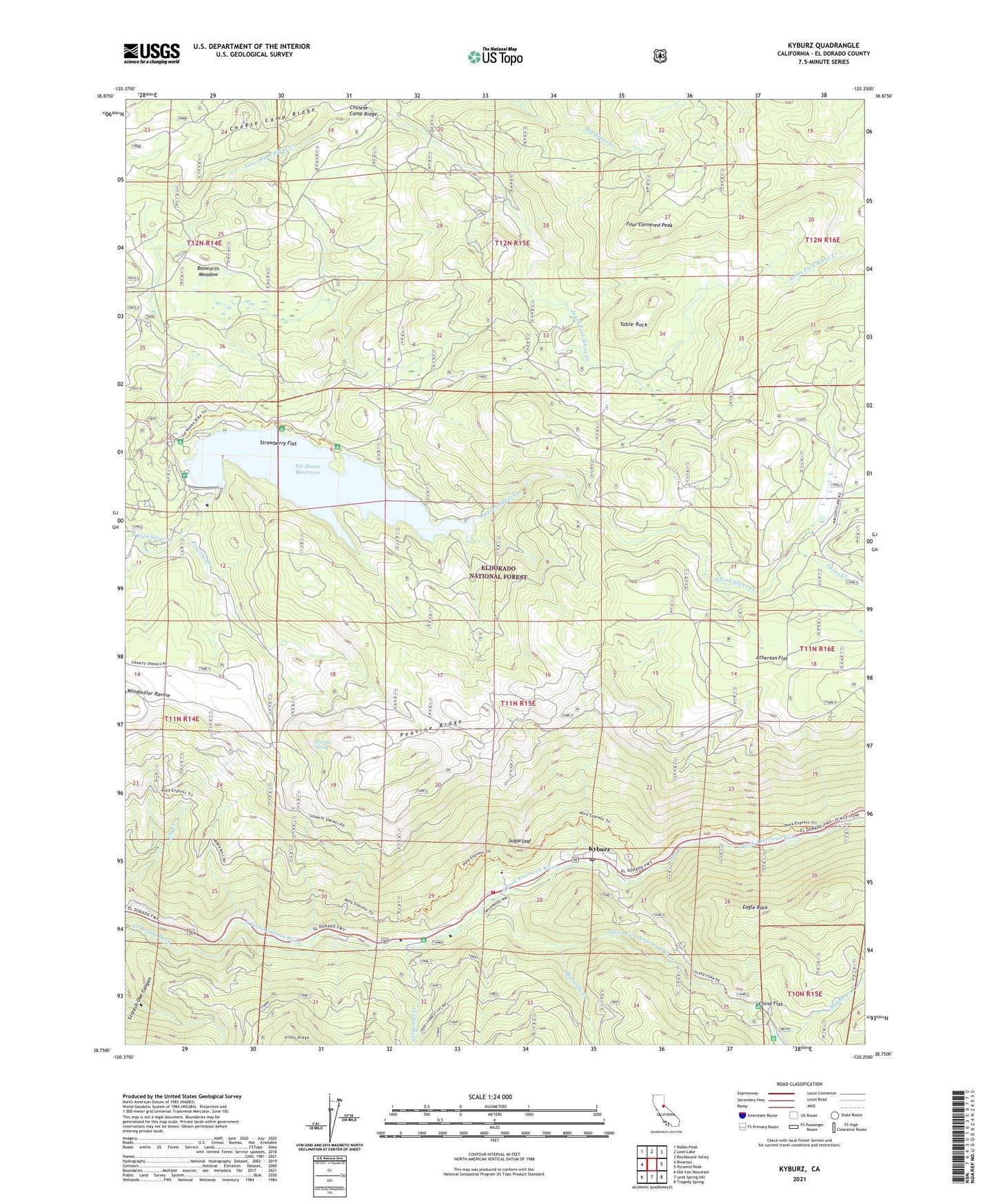
Kyburz California US Topo Map
Couldn't load pickup availability
Also explore the Kyburz Forest Service Topo of this same quad for updated USFS data
2021 topographic map quadrangle Kyburz in the state of California. Scale: 1:24000. Based on the newly updated USGS 7.5' US Topo map series, this map is in the following counties: El Dorado. The map contains contour data, water features, and other items you are used to seeing on USGS maps, but also has updated roads and other features. This is the next generation of topographic maps. Printed on high-quality waterproof paper with UV fade-resistant inks.
Quads adjacent to this one:
West: Riverton
Northwest: Robbs Peak
North: Loon Lake
Northeast: Rockbound Valley
East: Pyramid Peak
Southeast: Tragedy Spring
South: Leek Spring Hill
Southwest: Old Iron Mountain
This map covers the same area as the classic USGS quad with code o38120g3.
Contains the following named places: Atherton Flat, Beanville Creek, Bosworth Meadow, Cal Aggie Camp, Carpenter Creek, Cheese Camp Ridge, China Flat, China Flat Campground, Chinese Camp Ridge, Crystal Basin Station, Digger Indian Spring Campground, Ditch Camp One, Eagle Rock, Eagle Rock Campground, El Dorado County Fire Protection District Station 16, Eldorado National Forest, Four Cornered Peak, Fry Creek, Granite Spring, Ice House, Ice House 1009 Dam, Ice House Campgound, Ice House Reservoir, Ice House Vista, Jones Place, Kyburz, Kyburz Post Office, Lyons Creek, Middle Creek, Peavine Creek, Sand Flat Campground, Screech Owl Canyon, Silver Fork American River, Silver Fork Elementary School, Strawberry Flat, Sugarloaf, Sugarloaf Organ Camp, Table Rock, Twentynine Mile Guard Station, Wilson Ranch, Windmiller Cabin, Windmiller Trail