MyTopo
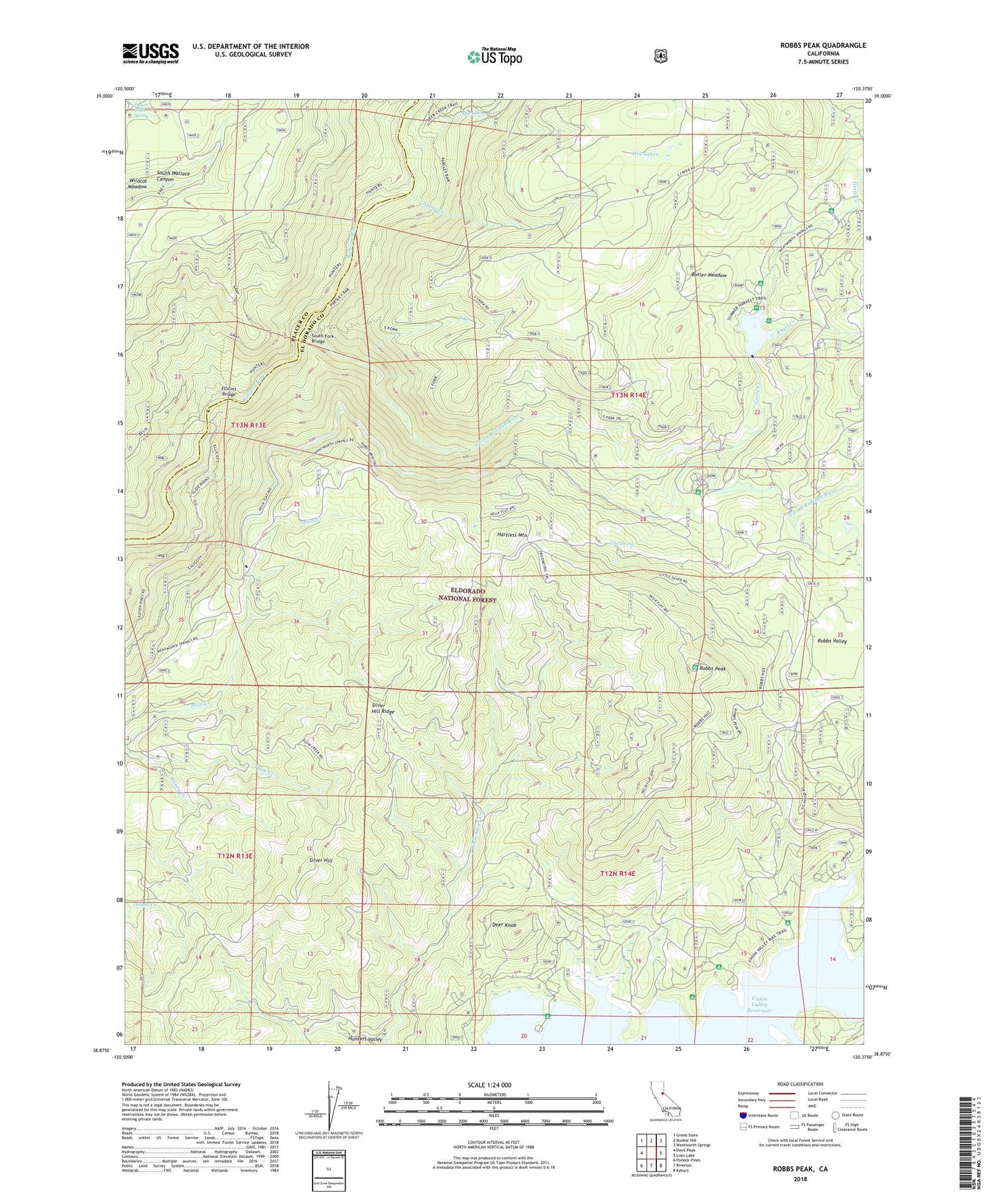
Robbs Peak California US Topo Map
Couldn't load pickup availability
Also explore the Robbs Peak Forest Service Topo of this same quad for updated USFS data
2021 topographic map quadrangle Robbs Peak in the state of California. Scale: 1:24000. Based on the newly updated USGS 7.5' US Topo map series, this map is in the following counties: El Dorado, Placer. The map contains contour data, water features, and other items you are used to seeing on USGS maps, but also has updated roads and other features. This is the next generation of topographic maps. Printed on high-quality waterproof paper with UV fade-resistant inks.
Quads adjacent to this one:
West: Devil Peak
Northwest: Greek Store
North: Bunker Hill
Northeast: Wentworth Springs
East: Loon Lake
Southeast: Kyburz
South: Riverton
Southwest: Pollock Pines
This map covers the same area as the classic USGS quad with code o38120h4.
Contains the following named places: Angel Creek, Bobs Cabin Trail, Butler Meadow, Cold Spring, Deer Creek, Deer Knob, Desert Cold Spring, Ditch Camp, Dry Lakes, Dry Lakes Trail, Ellicott Bridge, Ellicott Trail, Gerle 1009-005 Dam, Gerle Creek, Gerle Creek Campground, Gerle Creek Divide Reservoir, Grey Trail, Hales Crossing, Hartless Guard Station, Hartless Mountain, Honey Creek, Hunsucker Trail, Hunters Valley, Robbs Peak, Robbs Peak 1009-006 Dam, Robbs Peak Powerhouse, Robbs Valley, Rocky Basin Creek, Silver Hill, Silver Hill Ridge, Slide Point Trail, South Creek, South Fork Bridge, South Fork Camp Ground, South Fork Rubicon River, South Fork Trail, Stony Creek, Tells Creek, Uncle Toms Cabin, Wench Creek Campground, Yellow Jacket Campground