MyTopo
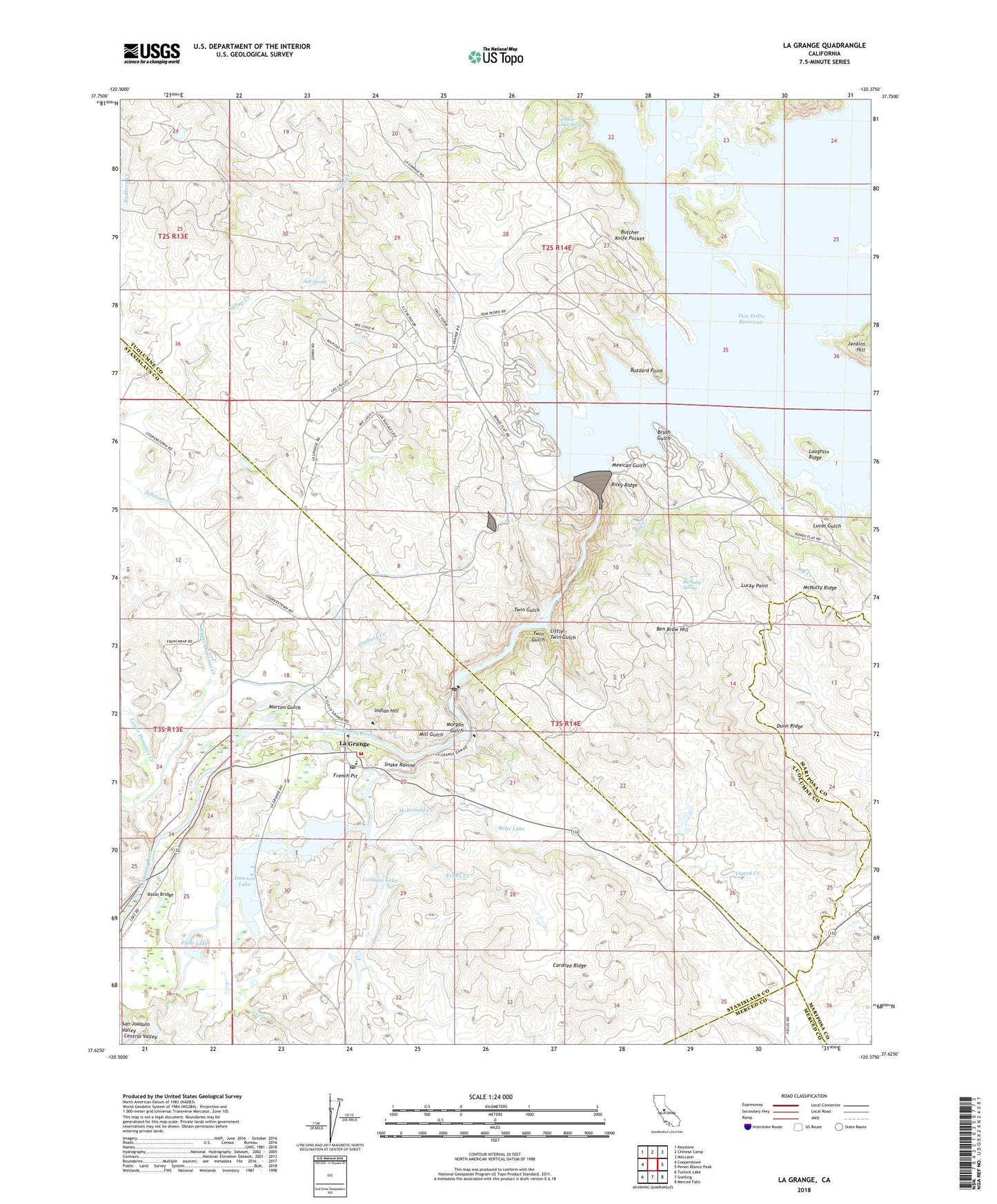
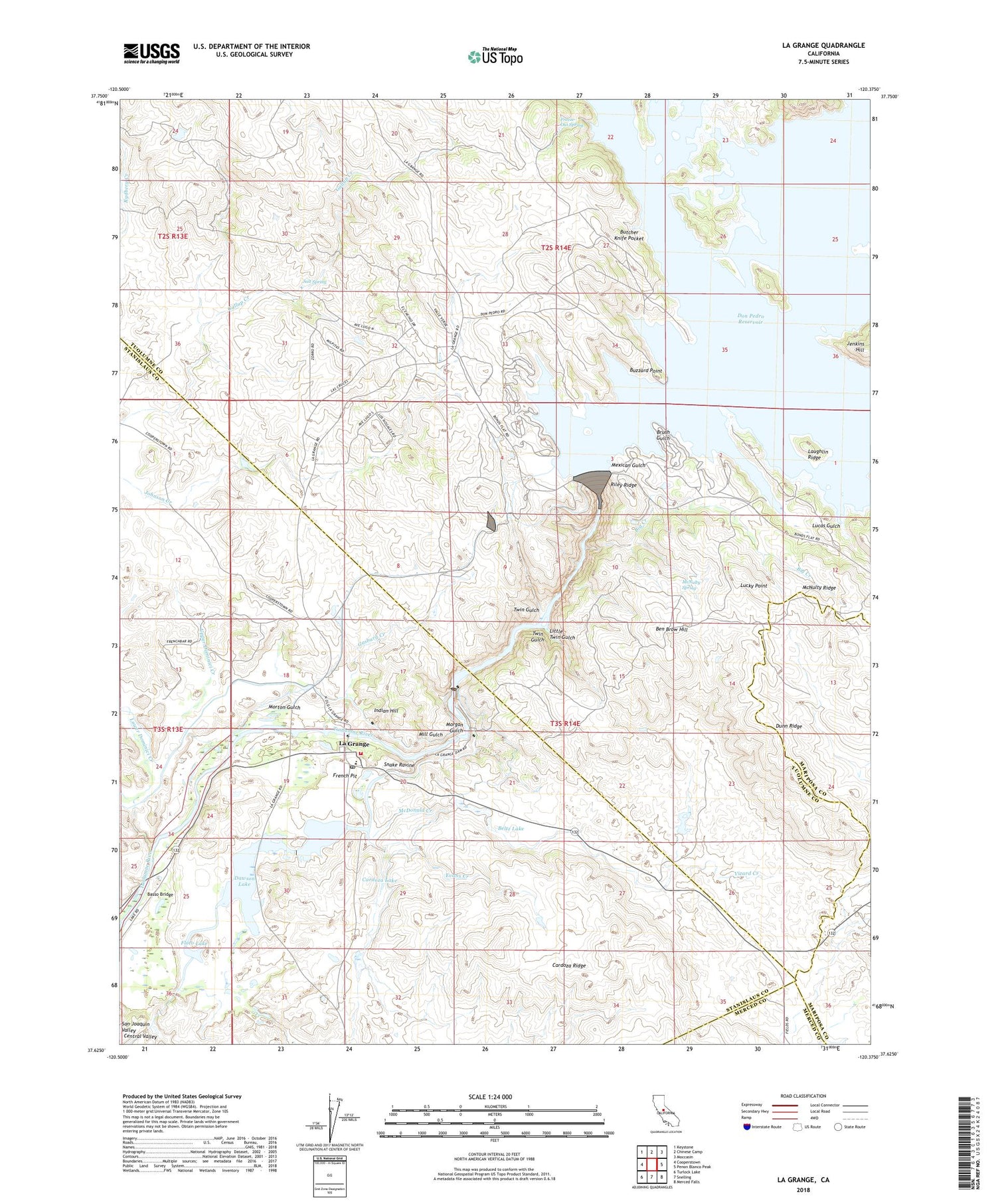
La Grange California US Topo Map
Couldn't load pickup availability
2021 topographic map quadrangle La Grange in the state of California. Scale: 1:24000. Based on the newly updated USGS 7.5' US Topo map series, this map is in the following counties: Tuolumne, Stanislaus, Mariposa, Merced. The map contains contour data, water features, and other items you are used to seeing on USGS maps, but also has updated roads and other features. This is the next generation of topographic maps. Printed on high-quality waterproof paper with UV fade-resistant inks.
Quads adjacent to this one:
West: Cooperstown
Northwest: Keystone
North: Chinese Camp
Northeast: Moccasin
East: Penon Blanco Peak
Southeast: Merced Falls
South: Snelling
Southwest: Turlock Lake
This map covers the same area as the classic USGS quad with code o37120f4.
Contains the following named places: Basso Bridge, Beltz Lake, Ben Brow Hill, Big Creek, Big Island, Brush Gulch, Butcher Knife Pocket, Buzzard Point, Cardoza Lake, Cardoza Ridge, Corner School, Dawson Lake, Dawson Lake 68-004 Dam, Don Pedro Camp, Don Pedro Dam, Don Pedro Reservoir, Dunn Creek, Dunn Ridge, Eagle Island, Evans Creek, Floto Lake, Fortynine Mine, Frank Young Gulch, Freeze-Out Spring, French Bar Cemetery, French Pit, Gasburg Creek, Gillman Gulch, Goodwin Creek, Indian Hill, Jenkins Hill, La Grange, La Grange Cemetery, La Grange Census Designated Place, La Grange Dam, La Grange Elementary School, La Grange Pit, La Grange Post Office, La Grange Regional Park, La Grange Reservoir, Laughlin Ridge, Little Twin Gulch, Lone Gulch, Lower Dominici Creek, Lucas Gulch, Lucky Point, McDonald Creek, McNulty Ridge, McNulty Spring, Mexican Gulch, Mill Gulch, Mitchell Mine, Morgan Gulch, Morton Gulch, New Don Pedro Dam, Oak Hill Mine, Old La Grange Schoolhouse, Riley Ridge, Saint Louis Catholic Church, Saint Louis Catholic Mission Cemetery, Salt Spring, Salt Spring Creek, Snake Ravine, Stanislaus Consolidated Fire Protection District Station 35, Twin Gulch, Upper Dominici Creek, Vizard Creek, ZIP Code: 95329