MyTopo
Chinese Camp California US Topo Map
Couldn't load pickup availability
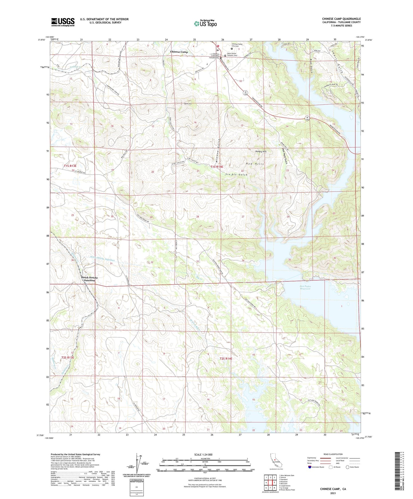
2021 topographic map quadrangle Chinese Camp in the state of California. Scale: 1:24000. Based on the newly updated USGS 7.5' US Topo map series, this map is in the following counties: Tuolumne. The map contains contour data, water features, and other items you are used to seeing on USGS maps, but also has updated roads and other features. This is the next generation of topographic maps. Printed on high-quality waterproof paper with UV fade-resistant inks.
Quads adjacent to this one:
West: Keystone
Northwest: New Melones Dam
North: Sonora
Northeast: Standard
East: Moccasin
Southeast: Penon Blanco Peak
South: La Grange
Southwest: Cooperstown
This map covers the same area as the classic USGS quad with code o37120g4.
Contains the following named places: Big Creek, Blue Gulch, Brown Adit, Chinese Camp, Chinese Camp Census Designated Place, Chinese Camp City Cemetery, Chinese Camp Elementary School, Chinese Camp Odd Fellows Cemetery, Chinese Camp Post Office, Crimea House, Eagle-Shawmut Mine, Hetch Hetchy Junction, Hungry Hill, Mammoth Mine, Minnow Gulch, Orcutt Mine, Poor Mans Gulch, Quigley Creek, Red Hills, Red Mountain Bar Siphon, Republican Mine, Saint Xavier Catholic Cemetery, Six-bit Gulch, Smarts Gulch, Tarantula Mine, Taylor Hill, Tuolumne County Fire Department Station 61 Chinese Camp, West Fork Big Creek, Woods Creek, ZIP Code: 95327