MyTopo
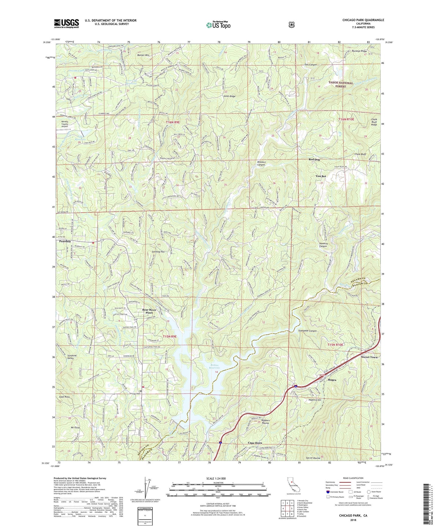
Chicago Park California US Topo Map
Couldn't load pickup availability
Also explore the Chicago Park Forest Service Topo of this same quad for updated USFS data
2022 topographic map quadrangle Chicago Park in the state of California. Scale: 1:24000. Based on the newly updated USGS 7.5' US Topo map series, this map is in the following counties: Nevada, Placer. The map contains contour data, water features, and other items you are used to seeing on USGS maps, but also has updated roads and other features. This is the next generation of topographic maps. Printed on high-quality waterproof paper with UV fade-resistant inks.
Quads adjacent to this one:
West: Grass Valley
Northwest: Nevada City
North: North Bloomfield
Northeast: Washington
East: Dutch Flat
Southeast: Foresthill
South: Colfax
Southwest: Lake Combie
This map covers the same area as the classic USGS quad with code o39120b8.
Contains the following named places: Arrowhead Mine, Banner Mine, Banner Mountain, Bear River Pines, Bear River School, Brady Ranch, Buckeye Diggings, Buena Vista, Canada Hill Mine, Cape Horn, Central School, Chalk Bluff, Chicago Park, Chicago Park Ditch, Chicago Park Elementary School, Chicago Park Post Office, Clipper Creek, Coleman, D-S Canal, Gas Canyon, Goat Rock, Greenhorn Campground, Greenhorn Creek, Greenhorn Creek Pit, Greenhorn Picnic Area, Hawkins Canyon, Hayford Hill, Head Ranch, Hilltop Ranch, Hunts Hill, Jones Ridge, KJFA-FM (Grass Valley), KNCO-FM (Grass Valley), KVMR-FM (Nevada City), Lava Cap Mine, Lava Cap Reservoir, Little Clipper Creek, Little Greenhorn Creek, Little York, Little York Diggings, Loma Rica Airport 61-025 Dam, Long Ravine Campground, Magra, Missouri Canyon, Mount Olive, Nevada City Raw Water 2026 Dam, Nevada County Consolidated Fire District Station 86, Orchard Springs Campground, Peardale, Peardale - Chicago Park Fire Protection District, Peardale - Chicago Park Fire Protection District Station 257, Peninsula Campground, Pinecrest, Poore Mine, Poorman Creek, Red Dog, Red Dog You Bet Diggings, Rollins 61-021 Dam, Rollins Reservoir, Saint Paul Lutheran Cemetery, Secret Town, Sonntag Hill, South Fork Greenhorn Creek, Stampede Canyon, Steephollow Creek, Steeplehollow Crossing, Sunshine Valley, Victory Mine, You Bet, Yuba Reservoir, ZIP Code: 95945