MyTopo
Litchfield California US Topo Map
Couldn't load pickup availability
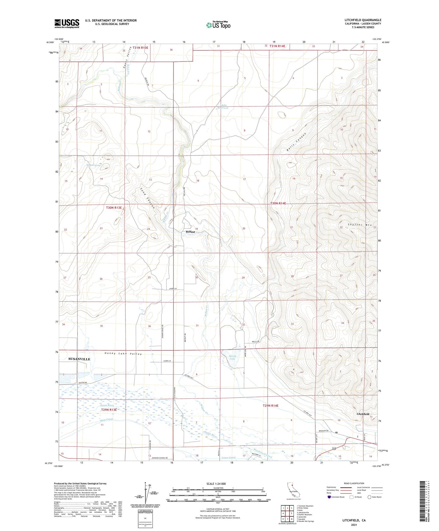
2021 topographic map quadrangle Litchfield in the state of California. Scale: 1:24000. Based on the newly updated USGS 7.5' US Topo map series, this map is in the following counties: Lassen. The map contains contour data, water features, and other items you are used to seeing on USGS maps, but also has updated roads and other features. This is the next generation of topographic maps. Printed on high-quality waterproof paper with UV fade-resistant inks.
Quads adjacent to this one:
West: Johnstonville
Northwest: Tunnison Mountain
North: Petes Valley
Northeast: Karlo
East: Shaffer Mountain
Southeast: Wendel Hot Springs
South: Standish
Southwest: Janesville
This map covers the same area as the classic USGS quad with code o40120d4.
Contains the following named places: Adobe Reservoir, Balls Canyon, Belfast, Litchfield, Litchfield Census Designated Place, Litchfield Post Office, Miller Quarry, Morgan Spring, Petes Creek, Sand Canyon, Shaffer Elementary School, The Crossing, Ward Lake 227-002 Dam, Wards Lake, Willow Creek