MyTopo
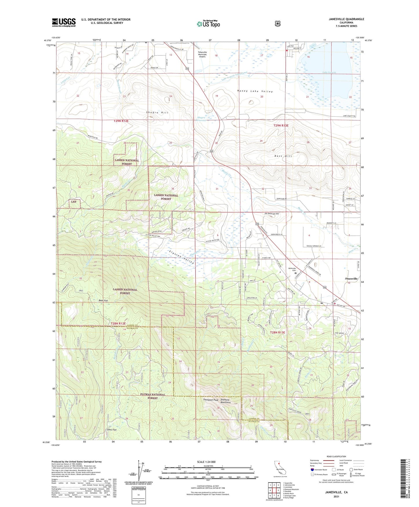
Janesville California US Topo Map
Couldn't load pickup availability
Also explore the Janesville Forest Service Topo of this same quad for updated USFS data
2021 topographic map quadrangle Janesville in the state of California. Scale: 1:24000. Based on the newly updated USGS 7.5' US Topo map series, this map is in the following counties: Lassen, Plumas. The map contains contour data, water features, and other items you are used to seeing on USGS maps, but also has updated roads and other features. This is the next generation of topographic maps. Printed on high-quality waterproof paper with UV fade-resistant inks.
Quads adjacent to this one:
West: Diamond Mountain
Northwest: Susanville
North: Johnstonville
Northeast: Litchfield
East: Standish
Southeast: Stony Ridge
South: Antelope Lake
Southwest: Kettle Rock
This map covers the same area as the classic USGS quad with code o40120c5.
Contains the following named places: Bankhead Creek, Bass Hill, Bass Hill Landfill, Bear Flat, Diamond Crest Cemetery, Diamond Mountains, Elysian Creek, Elysian Valley, Janesville, Janesville Cemetery, Janesville Census Designated Place, Janesville Elementary School, Janesville Fire Protection District, Janesville Post Office, Jim Peterson Hill, Lake Leavitt, Lake Leavitt Inlet Canal, Lowe Flat, Mallery Pit, Shugru 239 Dam, Shugru Hill, Shugru Reservoir, Southern Baptist Church of Janesville, Susan River Fire Protection District Station 2, Thompson Peak