
MyTopo
Live Oak Springs California US Topo Map
Couldn't load pickup availability
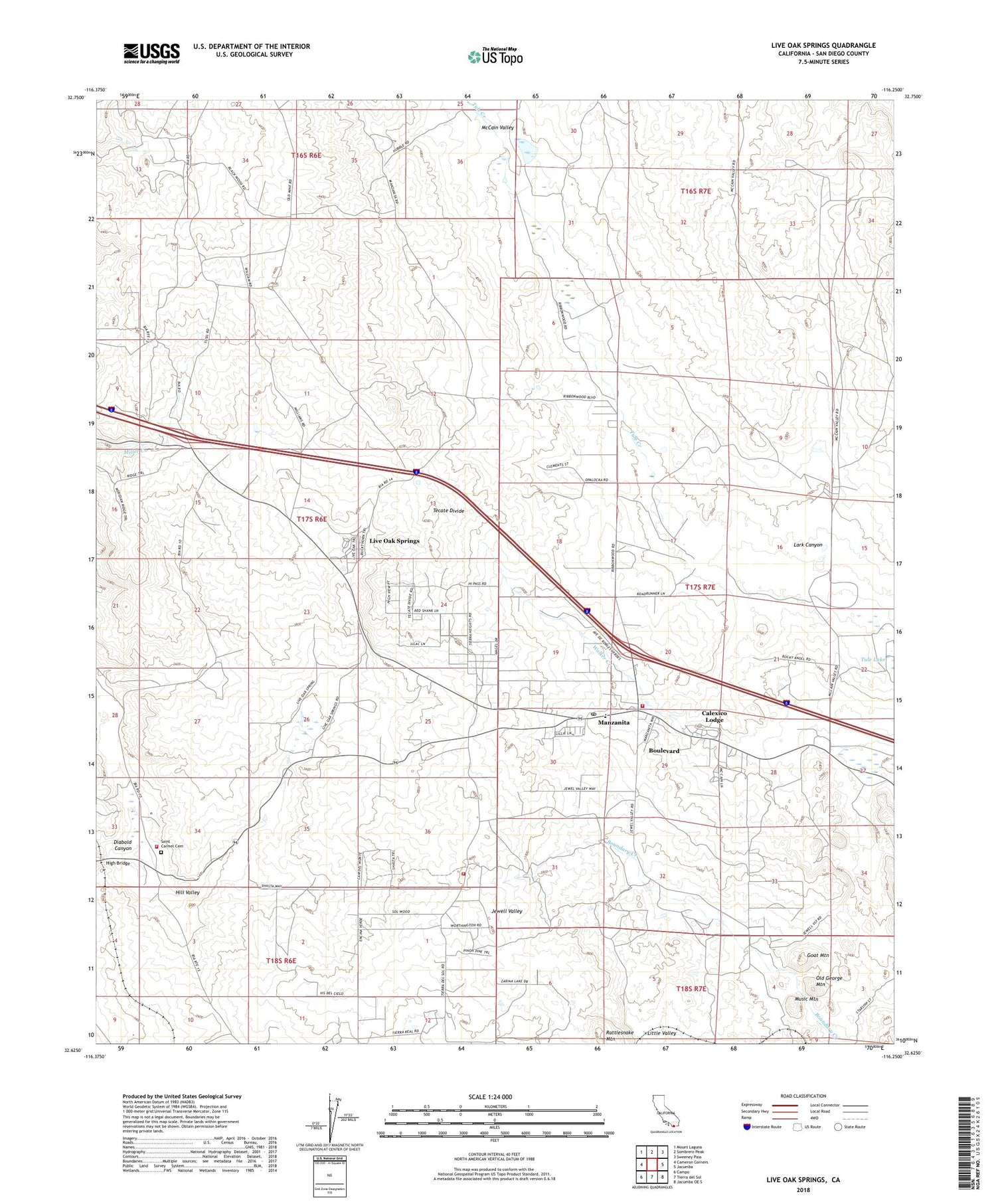
2021 topographic map quadrangle Live Oak Springs in the state of California. Scale: 1:24000. Based on the newly updated USGS 7.5' US Topo map series, this map is in the following counties: San Diego. The map contains contour data, water features, and other items you are used to seeing on USGS maps, but also has updated roads and other features. This is the next generation of topographic maps. Printed on high-quality waterproof paper with UV fade-resistant inks.
Quads adjacent to this one:
West: Cameron Corners
Northwest: Mount Laguna
North: Sombrero Peak
Northeast: Sweeney Pass
East: Jacumba
Southeast: Jacumba OE S
South: Tierra del Sol
Southwest: Campo
This map covers the same area as the classic USGS quad with code o32116f3.
Contains the following named places: Boulevard, Boulevard Census Designated Place, Boulevard Post Office, CAL FIRE White Star Fire Station, Calexico Lodge, Campo Indian Reservation, Campo Reservation Fire Protection District - Fire Station, Clover Flats Elementary School, Diabold Canyon, Goat Mountain, High Bridge, Hill Valley, Lark Canyon, Little Valley, Live Oak Springs, Manzanita, Music Mountain, Old George Mountain, Pueblo Siding, Saint Carmel Cemetery, San Diego County Fire Authority Fire Station 47, San Diego County Sheriff's Office Boulevard, Tecate Divide, Tule Creek, Walker Creek, ZIP Code: 91905


