
MyTopo
Llano Seco California US Topo Map
Couldn't load pickup availability
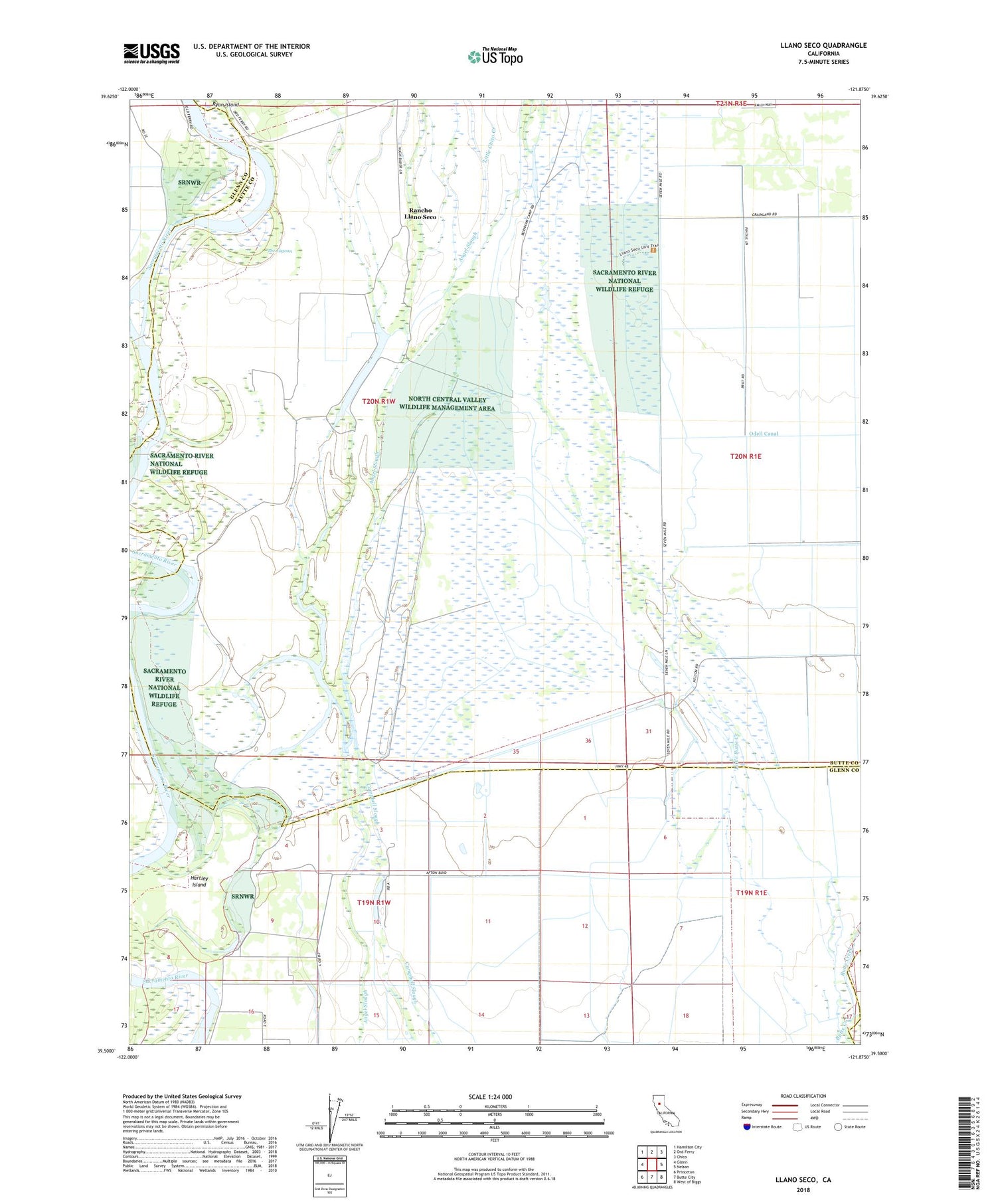
2022 topographic map quadrangle Llano Seco in the state of California. Scale: 1:24000. Based on the newly updated USGS 7.5' US Topo map series, this map is in the following counties: Butte, Glenn. The map contains contour data, water features, and other items you are used to seeing on USGS maps, but also has updated roads and other features. This is the next generation of topographic maps. Printed on high-quality waterproof paper with UV fade-resistant inks.
Quads adjacent to this one:
West: Glenn
Northwest: Hamilton City
North: Ord Ferry
Northeast: Chico
East: Nelson
Southeast: West of Biggs
South: Butte City
Southwest: Princeton
This map covers the same area as the classic USGS quad with code o39121e8.
Contains the following named places: Aguas Frias, Aguas Frias School, Dodgeland, Eddy Lake, Hartley Island, Little Butte Creek, Little Chico Creek, Llano Seco, Newhard Landing, North Central Valley Wildlife Management Area, Odell Canal, Parrott Landing, Perkins Lake, Rancho Llano Seco, The Lagoon


