MyTopo
Ord Ferry California US Topo Map
Couldn't load pickup availability
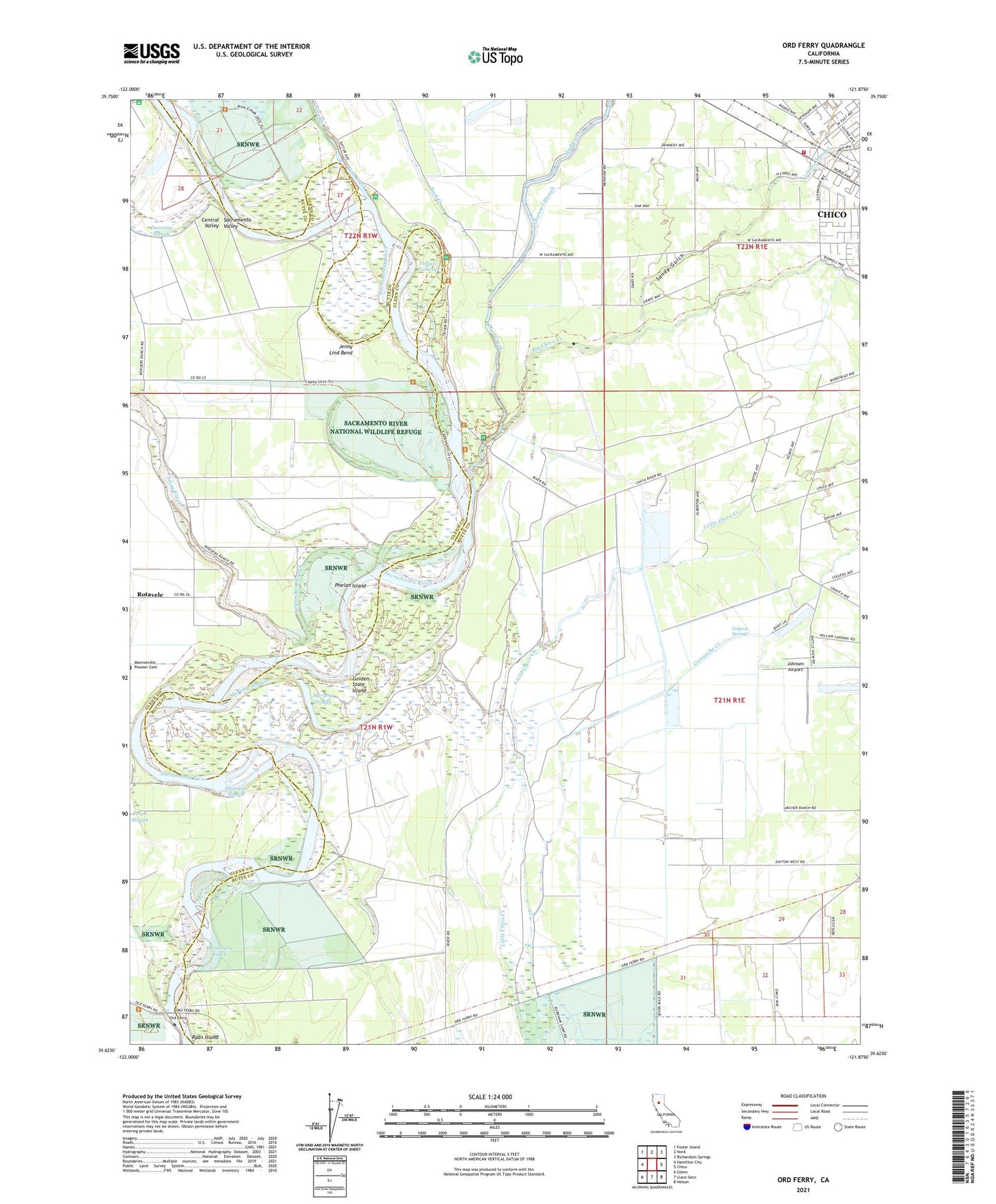
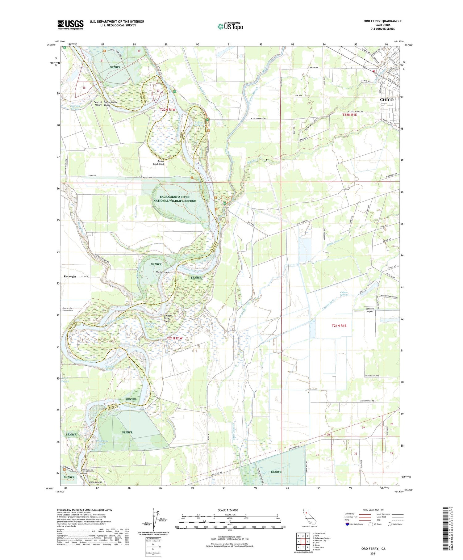
2021 topographic map quadrangle Ord Ferry in the state of California. Scale: 1:24000. Based on the newly updated USGS 7.5' US Topo map series, this map is in the following counties: Butte, Glenn. The map contains contour data, water features, and other items you are used to seeing on USGS maps, but also has updated roads and other features. This is the next generation of topographic maps. Printed on high-quality waterproof paper with UV fade-resistant inks.
Quads adjacent to this one:
West: Hamilton City
Northwest: Foster Island
North: Nord
Northeast: Richardson Springs
East: Chico
Southeast: Nelson
South: Llano Seco
Southwest: Glenn
This map covers the same area as the classic USGS quad with code o39121f8.
Contains the following named places: Bidwell School, Bidwell-Sacramento River State Park, Big Chico Creek, Big Chico Creek Day Use Area, Channel Slough, Chico Fire Department Station 6, Chico Landing, Colyear Springs, Comanche Creek, Deadmans Reach, Dubock Slough, Dunning Slough, Golden State Island, Indian Fishery, Jenny Lind Bend, Johnsen Airport, Kusal Slough, Lindo Channel, Monroeville, Mud Creek, Murphy Slough, Negro Sam Slough, Ord Ferry, Ordbend County Park, Perch Slough, Phelan Island, Pine Creek, Pine Creek Landing, Rancho De Farwell, Ryan Island, Sandy Gulch, Scottys Boat Landing, Shannon Slough, Stony Creek