
MyTopo
Hamilton City California US Topo Map
Couldn't load pickup availability
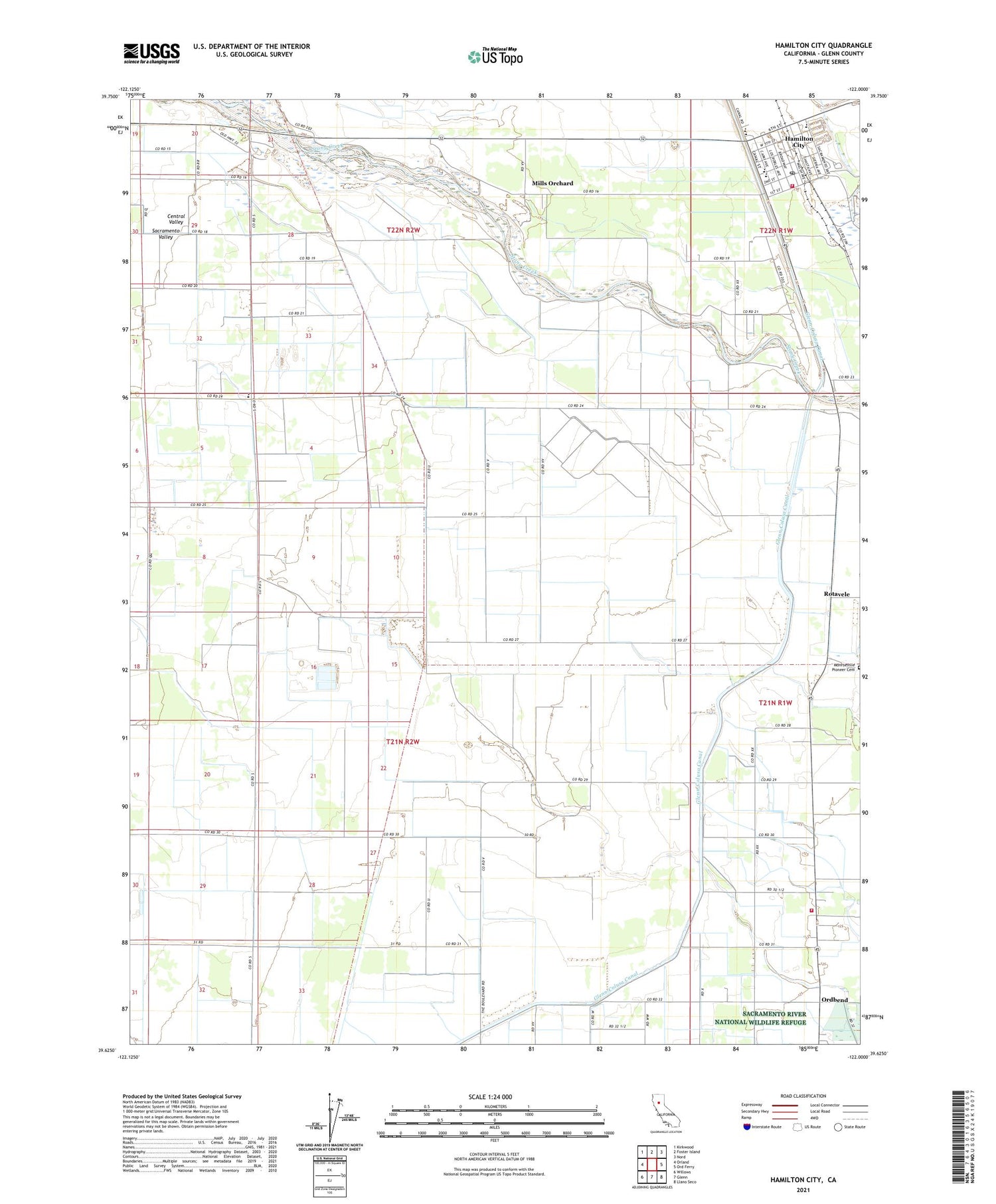
2021 topographic map quadrangle Hamilton City in the state of California. Scale: 1:24000. Based on the newly updated USGS 7.5' US Topo map series, this map is in the following counties: Glenn. The map contains contour data, water features, and other items you are used to seeing on USGS maps, but also has updated roads and other features. This is the next generation of topographic maps. Printed on high-quality waterproof paper with UV fade-resistant inks.
Quads adjacent to this one:
West: Orland
Northwest: Kirkwood
North: Foster Island
Northeast: Nord
East: Ord Ferry
Southeast: Llano Seco
South: Glenn
Southwest: Willows
This map covers the same area as the classic USGS quad with code o39122f1.
Contains the following named places: Bidwell-Sacramento River State Park, Evangelical Free Church of Hamilton City, Glenn-Colusa Canal, Hamilton City, Hamilton City Census Designated Place, Hamilton City Fire Protection District / Hamilton City Fire Department, Hamilton City Pit, Hamilton City Post Office, Hamilton Elementary School, Hamilton High School, Hamilton Pit, Ideal Mobile Home Park, Mills Orchard, Monroeville Pioneer Cemetery, Ord Fire Protection District, Ord School, Ordbend, Plaza Elementary School, Rotavele, Saint John, Stony Creek Gravel 2005 Dam, Swift Point Warehouse, ZIP Code: 95951


