MyTopo
Mathison Peak California US Topo Map
Couldn't load pickup availability
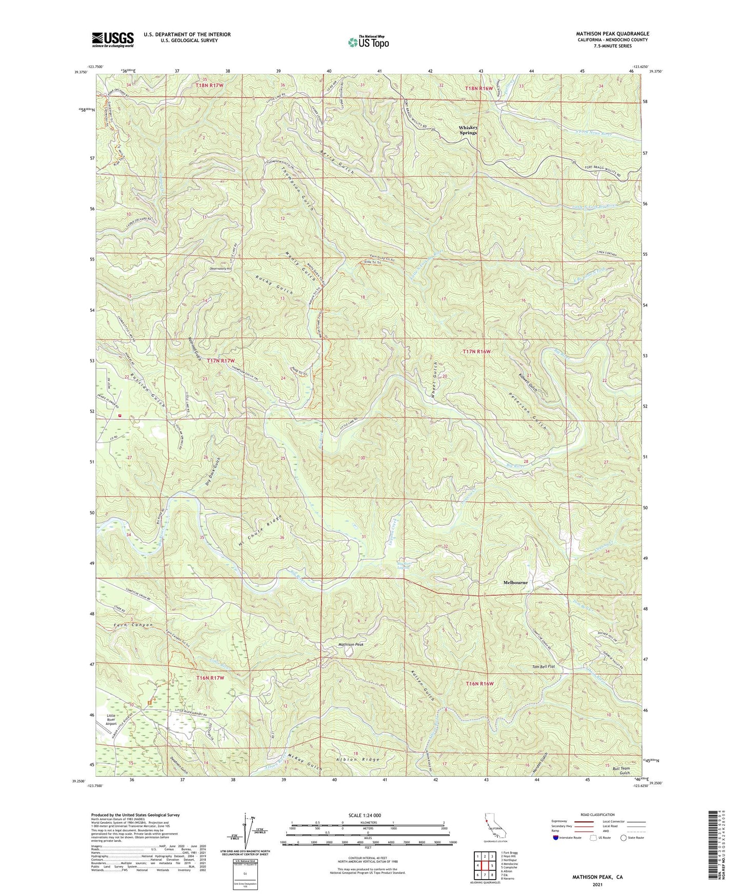
2021 topographic map quadrangle Mathison Peak in the state of California. Scale: 1:24000. Based on the newly updated USGS 7.5' US Topo map series, this map is in the following counties: Mendocino. The map contains contour data, water features, and other items you are used to seeing on USGS maps, but also has updated roads and other features. This is the next generation of topographic maps. Printed on high-quality waterproof paper with UV fade-resistant inks.
Quads adjacent to this one:
West: Mendocino
Northwest: Fort Bragg
North: Noyo Hill
Northeast: Northspur
East: Comptche
Southeast: Navarro
South: Elk
Southwest: Albion
This map covers the same area as the classic USGS quad with code o39123c6.
Contains the following named places: Berry Gulch, Big River Laguna, California Department of Forestry and Fire Protection Woodlands, Caspar Orchard, Dry Dock Gulch, East Branch Little North Fork, Edison Ranch, Hansens Curve, Hi Chute Ridge, Kaisen Gulch, Kidwell Gulch, Laguna Creek, Little North Fork Big River, MacDonalds Ranch, Manly Gulch, Mathison Peak, Mathison Peak Lookout, McKay Gulch, McKay School, Melbourne, Mendocino Lumber Company Ranch, Mendocino Volunteer Fire Department Woodland Substation, Mendocino Woodlands Outdoor Center, Mendocino Woodlands State Park, Observatory Hill, Parlin Creek, Parlin Fork Conservation Camp, Peterson Gulch, Railroad Gulch, Reep Ranch, Rocky Gulch, South Fork Albion River, Thompson Gulch, Tom Bell Creek, Tom Bell Flat, Van Damme Pygmy Forest Natural Preserve, Wheel Gulch, Whiskey Springs, Woodlands Station, ZIP Code: 95460